Ali Kosh
Coordinates: 32°33′28.13″N 47°19′29.72″E / 32.5578139°N 47.3249222°E
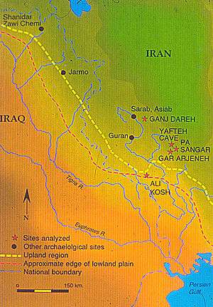 Map showing location of Ali Kosh and other locations of early herding activity | |
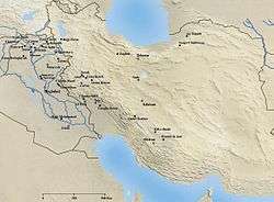 Neolithic sites in Iran | |
| Location | Ilam Province |
|---|---|
| Region | Iran |
| Diameter | 135 m |
| History | |
| Cultures | Pre-Pottery Neolithic |
| Site notes | |
| Discovered | 1960s |
| Archaeologists | |
Ali Kosh is a small Tell of the Early Neolithic period located in Ilam Province in west Iran, in the Zagros Mountains.[1] It was excavated by Frank Hole and Kent Flannery in the 1960s.[2]
The site is about 135 m in diameter.[3]
Research has found three phases of occupation of the site over an almost 2,000 period, starting from about 9,500 years ago (7500 BCE).[3] It was occupied by pre-pottery peoples.[4]
References
- ↑ Hole, Frank. "Ali Kosh". Yale Campus Press. Yale University. Retrieved 25 September 2018.
- ↑ Darvill, Timothy (2008). The Concise Oxford Dictionary of Archaeology (2nd ed.). Oxford Reference. doi:10.1093/acref/9780199534043.001.0001. ISBN 9780191727139.
- 1 2 Smith, Andrew Brown (2005). African herders: emergence of pastoral traditions. Rowman Altamira. pp. 67–68. ISBN 978-0-cite7591-0748-9 Check
|isbn=value: invalid character (help). - ↑ Langer, William L. (1972). An Encyclopedia of World History (5th ed.). Boston, MA: Houghton Mifflin Company. p. 17. ISBN 0-395-13592-3. LCCN 72186219.
Bibliography
- F. Hole and K. V. Flannery, The Prehistory of Southwestern Iran: A Preliminary Report, Proceedings of the Prehistoric Society 33, 1968
- F. Hole, K. V. Flannery, and J. A. Neely, Prehistory and Human Ecology of the Deh Luran Plain. Memòria 1, Ann Arbor, 1969.
- F. Hole, Studies in the Archeological History of the Deh Luran Plain. Memòria 9, Ann Arbor, 1977
This article is issued from
Wikipedia.
The text is licensed under Creative Commons - Attribution - Sharealike.
Additional terms may apply for the media files.