Algiers, Indiana
| Algiers, Indiana | |
|---|---|
| Unincorporated community | |
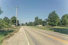 | |
 Algiers  Algiers | |
| Coordinates: 38°29′14″N 87°10′30″W / 38.48722°N 87.17500°WCoordinates: 38°29′14″N 87°10′30″W / 38.48722°N 87.17500°W | |
| Country | United States |
| State | Indiana |
| County | Pike |
| Township | Jefferson |
| Elevation[1] | 525 ft (160 m) |
| Time zone | UTC-5 (Eastern (EST)) |
| • Summer (DST) | UTC-4 (EDT) |
| ZIP code | 47567 |
| Area code(s) | 812, 930 |
| GNIS feature ID | 430075 |
Algiers is an unincorporated community in Jefferson Township, Pike County, in the U.S. state of Indiana.[2]
History
Algiers was laid out in 1868.[3] The community was named after Algiers, the capital of Algeria.[4] An old variant name of the community was called Delectible.[5]
A post office called Algiers was established in 1885, and remained in operation until it was discontinued in 1955.[6]
The town's name is part of the namesake of the Algers, Winslow and Western Railway which operates within Pike County.
Geography
Algiers is located at 38°29′14″N 87°10′30″W / 38.48722°N 87.17500°W.
References
- ↑ "US Board on Geographic Names". United States Geological Survey. October 25, 2007. Retrieved 2016-11-17.
- ↑ "Algiers, Indiana". Geographic Names Information System. United States Geological Survey. Retrieved 2017-02-06.
- ↑ Goodspeed Brothers. History of Pike and Dubois Counties, Indiana. p. 355.
- ↑ Baker, Ronald L. (October 1995). From Needmore to Prosperity: Hoosier Place Names in Folklore and History. Indiana University Press. p. 48. ISBN 978-0-253-32866-3.
...apparently for the city in North Africa...
- ↑ "USGS detail on Algiers - Variant Citation". Retrieved 2017-02-06.
- ↑ "Pike County". Jim Forte Postal History. Retrieved 5 October 2015.
Municipalities and communities of Pike County, Indiana, United States | ||
|---|---|---|
| City | ||
| Towns | ||
| Townships | ||
| CDP | ||
| Other unincorporated communities |
| |
| Footnotes | ‡This populated place also has portions in an adjacent county or counties | |
This article is issued from
Wikipedia.
The text is licensed under Creative Commons - Attribution - Sharealike.
Additional terms may apply for the media files.