Qamishli District
| Qamishli District منطقة القامشلي | |
|---|---|
| District | |
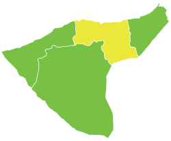 Location of Qamishli District within al-Hasakah Governorate | |
 Qamishli District Location in Syria | |
| Coordinates (Qamishli): 37°03′N 41°13′E / 37.05°N 41.22°E | |
| Country |
|
| Governorate | al-Hasakah |
| Seat | Qamishli |
| Subdistricts | 4 nawāḥī |
| Area | |
| • Total | 4,043.54 km2 (1,561.22 sq mi) |
| Population (2004)[1] | 425,580 |
| Geocode | SY0802 |
Qamishli District (Arabic: منطقة القامشلي, translit. manṭiqat al-Qāmišlī, Kurdish: Devera Qamişlo) is a district of al-Hasakah Governorate in northeastern Syria. The Administrative centre is the city of Qamishli. At the 2004 census, the district had a population of 425,580.[1]
Subdistricts
The district of Qamishli is divided into four subdistricts or nawāḥī (population as of 2004[1]):
| PCode | Name | Area | Population | Villages | Seat |
|---|---|---|---|---|---|
| SY080200 | Qamishli Subdistrict | 637,27 km² | 232,095 | 92 | Qamishli |
| SY080201 | Tell Hamis Subdistrict | 1,498.73 km² | 71,699 | 129 | Tell Hamis |
| SY080202 | Amuda Subdistrict | 1,034.86 km² | 56,101 | 103 | Amuda |
| SY080203 | al-Qahtaniyah Subdistrict | 872,67 km² | 65,685 | 103 | al-Qahtaniyah |
References
- 1 2 3 "General Census of Population and Housing 2004" (PDF) (in Arabic). Syrian Central Bureau of Statistics. Retrieved 15 October 2015. Also available in English: "2004 Census Data". UN OCHA. Retrieved 15 October 2015.
This article is issued from
Wikipedia.
The text is licensed under Creative Commons - Attribution - Sharealike.
Additional terms may apply for the media files.