Akkar District
| Akkar قضاء عكار | |
|---|---|
| District | |
.jpg) Coastline | |
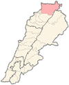 Location in Lebanon | |
| Coordinates (Halba): 34°33′02″N 036°04′41″E / 34.55056°N 36.07806°ECoordinates: 34°33′02″N 036°04′41″E / 34.55056°N 36.07806°E | |
| Country |
|
| Governorate | Akkar |
| Area[1] | |
| • Total | 788 km2 (304 sq mi) |
| Population | |
| • Estimate (June 2015)[1] | 389,899 |
| Time zone | UTC+2 (EET) |
| • Summer (DST) | UTC+3 (EEST) |
Akkar District (Arabic: قضاء عكار) is the only district in Akkar Governorate, Lebanon. It is coextensive with the governorate and covers an area of 788 km2 (304 sq mi). The UNHCR estimated the population of the district to be 389,899 in 2015, including 106,935 registered refugees of the Syrian Civil War and 19,404 Palestinian refugees.[1] The capital is at Halba.
The district is characterized by the presence of a relatively large coastal plain, with high mountains to the east. The largest cities in Akkar are Halba, Bire Akkar and Al-Qoubaiyat.
Akkar has many important Roman and Arabic archaeological sites. One of the most famous archaeological sites and the birthplace of the Roman emperor Severus Alexander (d.235) is the Tell of Arqa near the town of Miniara. Several prehistoric sites were found in the Akkar plain foothills that were suggested to have been used by the Heavy Neolithic Qaraoun culture at the dawn of the Neolithic Revolution.[2][3]
Akkar can be divided into 7 parts: Qaitea (القيطع), Jouma (الجومة), Dreib (الدريب), Jabal Akroum (جبل أكروم), Wadi Khaled (وادي خالد), Cheft (الشفت) and As-sahel (السهل)[4].
Demographics
The majority of the residents in the Akkar District is composed by a majority of Sunni Muslims, followed by a large minority of Greek Orthodox Christians. Maronites are the second largest Christian denomination, and have typically resided around the city of Al-Qoubaiyat. Melkite Christians are also present in small numbers in the region.
This region is also home to the largest population of Alawites in Lebanon.
Turkish people form a majority in Kouachra and Aydamun.
References
- 1 2 3 "Akkar Governorate Profile". UNHCR. June 2015. Retrieved 19 February 2017.
- ↑ L. Copeland; P. Wescombe (1966). Inventory of Stone-Age Sites in Lebanon: North, South and East-Central Lebanon, pp. 20-21. Impr. Catholique. Retrieved 3 March 2011.
- ↑ Wetzel, R. & Haller, J., Le Quarternaire de la région de Tripoli. Notes et Mémoires de la Délégation Générale de France au Liban. Section Géologique, No. 4. Beirut, 1945.
- ↑ "Akkar" (PDF).