Akhalkalaki
| Akhalkalaki ახალქალაქი | |
|---|---|
 | |
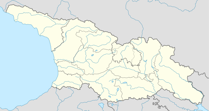 Akhalkalaki Location of Akhalkalaki in Georgia  Akhalkalaki Akhalkalaki (Samtskhe-Javakheti) | |
| Coordinates: 41°24′20″N 43°29′10″E / 41.40556°N 43.48611°E | |
| Country |
|
| Mkhare | Samtskhe-Javakheti |
| Elevation | 1,707 m (5,600 ft) |
| Population (2014)[1] | |
| • Total | 8,295 |
| Time zone | UTC+4 (Georgian Time) |
| • Summer (DST) | UTC+5 |
| Website | Official |
Akhalkalaki (Georgian: ახალქალაქი [ɑxɑlkʰɑlɑkʰi], for New City (from Georgian [ɑxɑli] meaning "new" and [kʰɑlɑkʰi] meaning "city" or "town"); Armenian: Ախալքալաք; Turkish: Ahılkelek) is a town in Georgia's southern region of Samtskhe–Javakheti. Akhalkalaki lies on the edge of the Javakheti Plateau. The city is located about 30 kilometres (19 mi) from the border with Turkey. In 2002 over 90 percent of the city's population were ethnic Armenians. The city was passed from Ottomans to Russians after Russo-Turkish War (1828–1829). On January 4, 1900, an earthquake destroyed much of the town and killed 1,000 people in the area.[2] As of the 2014 census the town had a population of 8,295.[1]
History
Akhalkalaki was founded in 1064. In 1066 the city was destroyed during the Seljuq invasions of the Kingdom of Georgia.[3] Akhalkalaki had alternated between Georgian and Armenian rule until it passed to the Georgian Bagratids in the 11th century.[4] In 11th century Akhalkalaki became political and economical centre of Javakheti. In the 16th century the city came under the rule of the Ottoman Empire and became a sanjak centre in Çıldır Eyaleti. Under the Ottoman rule, the town was known as "Ahılkelek". The city was passed from the Ottomans to the Russians after the Russo-Turkish War in 1828–1829.
Population
The population was mainly Georgian but had been converted to Islam by 1829.[4] After Russian takeover most of the native Muslims left the area for the Ottoman Empire and in their place Christian Armenian refugees from Erzurum and Bayazid settled here.[4] Since then the city and the region of Javakheti has been largely populated by Armenians.
| Year | Armenians | Georgians | Russians | Total | |||
|---|---|---|---|---|---|---|---|
| 1886 | 4,083 | 94.9% | 51 | 1.2% | 57 | 1.3% | 4,303 |
| 1897[6] | 4,136 | 76% | 129 | 2.4% | 479 | 8.8% | 5,440 |
| 1926[7] | 3,185 | 90.9% | 197 | 5.7% | 61 | 1.8% | 3,475 |
| 1959[8] | 6,522 | 74.1% | 433 | 4.9% | 1,424 | 16.2% | 8,804 |
| 1989[9] | - | - | - | - | - | - | 15,572 |
| 2014[10] | - | - | - | - | - | - | 8,295 |
Transport

The crossroads village meets from south the streets from the border to Armenia and Turkey, from north to Borjomi–Gori and east-west from Batumi to Tiflis south of the Lesser Caucasus.
A 160 km long railway line was constructed between 1982 and 1986 in three parts. The junction from the line Tiflis–Jerewan is in Marabda.
In April 2005, an agreement was signed to build a new railway connecting Turkey with Georgia and Azerbaijan, passing nearby Akhalkalaki. This would bypass an existing line through Gyumri in Armenia which has been closed by Turkey, blockading Armenia, for political reasons since the 1990s.[11] The railway became operational on October 30, 2017.[12] It is here where the break-of-gauge is.[13]
In compound with the military base was constructed an airport. With military dismantling it was closed.
Bases
The city was a home to the Soviet-era 147th Motor Rifle Division (part of the 9th Army of the Transcaucasian Military District) up until the early 1990s. After the fall of the Soviet Union the Division became the Russian 62nd Military Base. It was officially transferred, according to the Sochi agreement, to Georgia on June 27, 2007.[14]
Notable people
- Derenik Demirchian, Armenian writer
- Jivani, Armenian bard
- Harutyun Khachatryan, Armenian film director
- Ruben Ter-Minasian, Defense Minister of the First Republic of Armenia
- Hamo Ohanjanyan, the third Prime Minister of the First Republic of Armenia
- Ahmed bey Pepinov, Azerbaijani statesman
See also
References
- 1 2 "Population Census 2014". www.geostat.ge. National Statistics Office of Georgia. November 2014. Retrieved 2 June 2016.
- ↑ The Annual Register of World Events, 1900 (Longmans, Green, and Co., 1901) p461
- ↑ Suny, Ronald Grigor (1994), The Making of the Georgian Nation: 2nd edition. Indiana University Press, p. 34
- 1 2 3 Richard G. Hovannisian (1971). The Republic of Armenia: The first year, 1918-1919. University of California Press. p. 70. ISBN 978-0-520-01805-1.
- ↑ "население грузии". Retrieved October 8, 2016.
- ↑ "АХАЛКАЛАКСКИЙ УЕЗД (1897 г.)". Retrieved October 8, 2016.
- ↑ "Ахалкалакский уезд 1926". www.ethno-kavkaz.narod.ru. Retrieved 21 April 2018.
- ↑ "Ахалкалакский район 1959". www.ethno-kavkaz.narod.ru. Retrieved 21 April 2018.
- ↑ "Archived copy". Archived from the original on 2012-02-04. Retrieved 2013-05-16.
- ↑ http://census.ge/files/results/english/1_Number%20of%20population%20by%20administrative-territorial%20units%20and%20sex.xls
- ↑ Railway Gazette International February 2009, p54
- ↑ "Baku-Tbilisi-Kars (BTK) railway track becomes operational to carry Chinese goods to Europe". dnd.com.pk. 30 October 2017. Retrieved 27 February 2018.
- ↑ Ltd, DVV Media International. "Stadler signs Baku – Tbilisi – Kars sleeping car contract". railwaygazette.com. Retrieved 21 April 2018.
- ↑ Russia Transfers Akhalkalaki Military Base to Georgia. Civil Georgia. June 27, 2007. Accessed on June 29, 2007.
External links
| Wikimedia Commons has media related to Akhalkalaki. |
Coordinates: 41°24′20″N 43°29′10″E / 41.40556°N 43.48611°E
| Autonomous Republic of Abkhazia |   | |
|---|---|---|
| Autonomous Republic of Adjara | ||
| Guria |
| |
| Imereti | ||
| Kakheti | ||
| Mtskheta-Mtianeti | ||
| Samegrelo-Zemo Svaneti | ||
| Samtskhe-Javakheti |
| |
| Racha-Lechkhumi and Kvemo Svaneti |
| |
| Kvemo Kartli | ||
| Shida Kartli | ||
| Cities with local government | ||
| Capital city | ||