Ajekar
| Ajekar | |
|---|---|
| Village | |
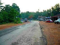 Karnataka SH1 towards Karkala at Ajekar | |
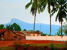
 Ajekar Location of Ajekar in Karnataka, India | |
| Coordinates: 13°19′12″N 74°59′59″E / 13.3200755°N 74.99977579°E | |
| Country |
|
| State | Karnataka |
| Region | Tulunadu |
| District | Udupi |
| Taluka | Karkala |
| Government | |
| • Type | Gram panchayat |
| Elevation | 75 m (246 ft) |
| Population (2011) | |
| • Total | 7,172[1] |
| Languages | |
| • Official | Tulu, Konkani, Kannada, Malayalam, Beary |
| Time zone | UTC+5:30 (IST) |
| PIN | 574101 |
| Telephone code | 08258 |
Ajekar is a small village at the foot of Valikunja in Karkal Taluk of Udupi district, India. It is situated about 40 km from Udupi and about 65 km north-east of Mangalore. Ajekar is also called Marne Grama, which is governed by Grama Panchayat. It is also called Ajekaru in the Kannada language. Kemanj(je)a was one of the oldest names of this village. Ajekar has a mixed population of around 7172 [3,397 male and 3,775 female] (Census 2011), Hindus, Christians, Muslims and Jains.
Etymology
There is a legend which says that its name is directly derived from the sage Aja. It is said that the sage made his tapasu near this place. The concrete location is unknown to this day. There are other modern legends like Ajjana Karu, which is most likely not correct. Karu is an old Kannada word for land.