Ahmedgarh
| Ahmedgarh Dhaliwal | |
|---|---|
| city | |
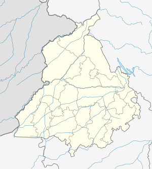
 Ahmedgarh Location in Punjab, India | |
| Coordinates: 30°40′41″N 75°49′37″E / 30.678°N 75.827°ECoordinates: 30°40′41″N 75°49′37″E / 30.678°N 75.827°E | |
| Country |
|
| State | Punjab |
| District | Sangrur |
| Area | |
| • Total | 6 km2 (2 sq mi) |
| Population (2015) | |
| • Total | 40,000 |
| • Density | 6,700/km2 (17,000/sq mi) |
| Languages | |
| • Official | Punjabi |
| Time zone | UTC+5:30 (IST) |
| Telephone code | 01675 |
| Vehicle registration | PB 28/13 |
Ahmedgarh is a city and a municipal council in Sangrur district in the Indian state of Punjab. Ahmedgarh (earlier Bhadurgarh) is given the status of Tehsil in November 2016,[1] which was earlier a sub-tehsil of Malerkotla tehsil. Later, in 1905, an exchange between the Nawab of Malerkotlata, Ahmed Ali Khan, and the Dhurkot family a bit of land was given to the Nawab to establish the town's first railway station hence the name of the town was changed to Ahmedgarh after his highness. It lies about 18 km north of Malerkotla on the Sangrur-Ludhiana road. It is 50 km from Sangrur, the district headquarters, 26 km from Ludhiana and 98 km from Chandigarh. It is a railway station on the Ludhiana-Jakhal railway line.
Ahmedgarh is an example of pre-independence town planning. It was planned as a market town on the model of Lyallpur (Faisalabad) in Pakistan. The planning consisted of a cross-axis of two main avenues along which auctioning, vending and storage of agricultural and agriculture related goods took place. The four quadrants thus formed constituted the residential quarters for the people. The town was enclosed by a 'Fasil', a brick arched wall with only four manned entry points for security. Further, each of the four 'mohallas' are accessed via one of the two gated structures from the main avenues. At the intersection of the two avenues was a public well, which has lately been covered. This is the Gandhi chowk today. The plots abutting the market avenues were 16 feet wide and ranging from 150 to 240 feet in length. All of them had to comply with a fixed design for the facade, which was in the form of three mughal arches, thus forming a regimented colonnade on both sides of the avenues. Sardar Bhadur Singh Dhaliwal's descendants presently reside in Ahmedgharh.
At a later stage, the avenues were split into two with shops being constructed along the median, hence forming the 8 streets intersecting at Gandhi Chowk. Presently, the wide avenues have been encroached upon from both sides, and only a few buildings retain the arched facade, often found behind several rooms from the entrance to the building.
Ahmedgarh even today is an important agricultural market. The main crops brought to this market are paddy, wheat and cotton. Being close to two industrial towns of Malerkotla and Ludhiana, a number of small-scale industries are being set up in and around this town too. The city is also famous for agricultural implements such as diggers, ploughs and sickles.
Ahmedgarh has now emerged as one of the dry ports of India. Ahmedgarh is famous for its 8 Street Gandhi Chowk, Grain Market and Main Bazaar near Railway Station.
Demographics
As of the 2001 India census,[2] Ahmedgarh had a population of 28,007. Males constitute 53% of the population and females 47%. Ahmedgarh has an average literacy rate of 70%, higher than the national average of 59.5%; with 56% of the males and 44% of females literate. 11% of the population is under 6 years of age. . www.census2011.co.in/data/town/800269-ahmedgarh-punjab.html . The Ahmedgarh Municipal Council has population of 31,302 of which 16,468 are males while 14,834 are females as per report released by Census India 2011. Population of Children with age of 0-6 is 3492 which is 11.16% of total population of Ahmedgarh (M Cl). In Ahmedgarh Municipal Council, Female Sex Ratio is of 901 against state average of 895. Moreover, Child Sex Ratio in Ahmedgarh is around 841 compared to Punjab state average of 846. Literacy rate of Ahmedgarh city is 83.16% higher than state average of 75.84%. In Ahmedgarh, male literacy is around 87.18% while female literacy rate is 78.74%. ........ Population- 31,302 Hindu- 55.89% Muslim- 13.31% Christian- 0.27% Sikh- 29.62% Buddhist- 0.00% Jain- 0.87% OthersNot- 0.00% Stated- 0.04% ,. Facebook page -> . https://m.facebook.com/profile.php?id=161442377338152
References
- ↑ Tehsils and Sub-Tehsils in Punjab
- ↑ "Census of India 2001: Data from the 2001 Census, including cities, villages and towns (Provisional)". Census Commission of India. Archived from the original on 2004-06-16. Retrieved 2008-11-01.