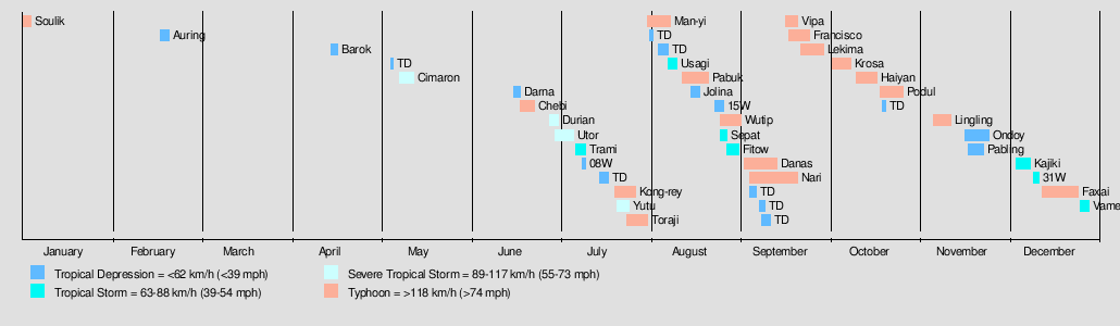
2001 Pacific typhoon season
| 2001 Pacific typhoon season | |
|---|---|
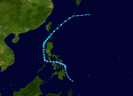
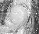
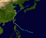
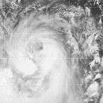
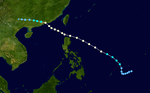
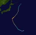
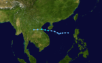
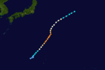
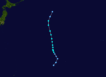
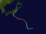
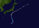
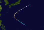
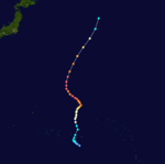
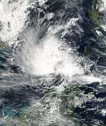
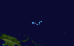
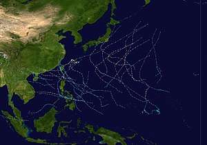 Season summary map | |
| Seasonal boundaries | |
| First system formed | February 17, 2001 |
| Last system dissipated | December 29, 2001 |
| Strongest storm | |
| Name | Faxai |
| • Maximum winds |
195 km/h (120 mph) (10-minute sustained) |
| • Lowest pressure | 915 hPa (mbar) |
| Seasonal statistics | |
| Total depressions | 45 |
| Total storms | 26 |
| Typhoons | 16 |
| Super typhoons | 3 (unofficial) |
| Total fatalities | 1,287 total |
| Total damage | $2.3 billion (2001 USD) |
| Related articles | |
The 2001 Pacific typhoon season has no official bounds; it ran year-round in 2001, but most tropical cyclones tend to form in the northwestern Pacific Ocean between May and November.[1] These dates conventionally delimit the period of each year when most tropical cyclones form in the northwestern Pacific Ocean.
The scope of this article is limited to the Pacific Ocean, north of the equator and west of the international date line. Storms that form east of the date line and north of the equator are called hurricanes; see 2001 Pacific hurricane season. Tropical Storms formed in the entire west pacific basin are assigned a name by the Tokyo Typhoon Center. Tropical depressions in this basin have the "W" suffix added to their number. Tropical depressions that enter or form in the Philippine area of responsibility are assigned a name by the Philippine Atmospheric, Geophysical and Astronomical Services Administration or PAGASA. This can often result in the same storm having two names.
Systems
In storm information below, wind-speed advisories differ from the Joint Typhoon Warning Center (JTWC) to the JMA as the JTWC uses the United States criteria of 1-minute mean to designate maximum sustained winds, while the JMA uses the 10-minute mean wind criterion to designate tropical cyclone maximum sustained gusts. This difference generally results in JTWC maximum winds appearing higher than the maximum winds described by the JMA for the same cyclone.
Tropical Depression 01W (Auring)
| Tropical depression (PAGASA) | |
| Tropical depression (SSHWS) | |
  | |
| Duration | February 17 – February 20 |
|---|---|
| Peak intensity | 55 km/h (35 mph) (10-min) 1004 hPa (mbar) |
In the middle of February, a tropical depression moved across the Philippines.
Tropical Depression 02W (Barok)
| Tropical depression (PAGASA) | |
| Tropical depression (SSHWS) | |
  | |
| Duration | April 16 – April 18 |
|---|---|
| Peak intensity | 45 km/h (30 mph) (10-min) 1004 hPa (mbar) |
From April 17 through April 21, a tropical depression persisted to the east of the Philippines.
Severe Tropical Storm Cimaron (Crising)
| Severe tropical storm (JMA) | |
| Tropical storm (SSHWS) | |
  | |
| Duration | May 9 – May 14 |
|---|---|
| Peak intensity | 95 km/h (60 mph) (10-min) 985 hPa (mbar) |
Tropical Storm Cimaron developed on May 9 and moved northward through the Philippines, dissipating on May 14.
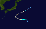
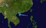
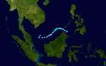
Tropical Depression Darna
| Tropical depression (PAGASA) | |
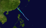
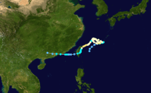
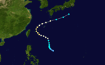
 _2001_track.png) | |
| Duration | June 17 – June 19 |
|---|---|
| Peak intensity | 55 km/h (35 mph) (10-min) 1000 hPa (mbar) |
A tropical disturbance formed northeast of the Philippines on June 15. It was classified as a Tropical Depression, receiving the name Darna on June 17. Pressure dropped to 4 millibars, but it failed to reach minimal tropical storm strength. Darna moved north on June 18 and dissipated to a low on June 19. No casualties were reported and damages were unknown.
Typhoon Chebi (Emong)
| Typhoon (JMA) | |
| Category 3 typhoon (SSHWS) | |
  | |
| Duration | June 19 – June 24 |
|---|---|
| Peak intensity | 120 km/h (75 mph) (10-min) 965 hPa (mbar) |
Tropical Depression 04W formed on June 19 near Palau where it moved westward and strengthened into Tropical Storm Chebi six hours later. Chebi then moved generally west-northwest and then to the northwest as the tropical storm passed north of the Philippines on June 21 and entered the Luzon Strait on June 23 as a Category 1 typhoon. Later on the 23rd Chebi reached a peak intensity of 85 knots (160 km/h, 100 mph) as the center of the storm was 75 miles (121 km) south of Taiwan. A trough forced Chebi west and northwest where it made landfall near Fuzhou City, China. Chebi then weakened and accelerated to the north then northeast, passing southeast of Shanghai before exiting back out to sea. The JMA and other weather centers stopped issuing advisories when the remnants of Chebi dissipated in the eastern Pacific on June 30.
Chebi killed 82 people, mostly in China, and left $422 million (2001 USD), $457 million (2005 USD). Chebi's heavy rains and strong winds left nine people dead, 28 missing and $13 million (2001 USD) in damage in the Philippines. Four of the nine were from a Belizian freighter that sank during the storm.[2] The Penghu Islands, which took the brunt of the typhoon, suffered considerable damage as 102 fishing boats sank and ten thousand people were left without power. The storm also crippled ground and air traffic.[3] A rain laden typhoon, Chebi produced 100 millimeters of rain across Guangdong.[4] About 73 people were killed in China, most of them in the southeastern province of Fujian.[5] The storm also destroyed several thousand acres of crops, resulting in economic losses. In Ningde, about 321,400 houses were destroyed by the typhoon.[6] About 22 people were killed in Hangzhou when a landslide burst through a construction wall.[7]
Severe Tropical Storm Durian
| Severe tropical storm (JMA) | |
| Category 1 typhoon (SSHWS) | |
  | |
| Duration | June 29 – July 2 |
|---|---|
| Peak intensity | 110 km/h (70 mph) (10-min) 970 hPa (mbar) |
78 casualties and $446 million (2001 USD) in damage can be attributed to Typhoon Durian hitting southern China on July 1 as an 85 mph (137 km/h) typhoon. The name Durian was submitted by Thailand and refers to a Southeast Asian fruit of the same name.
Severe Tropical Storm Utor (Feria)
| Severe tropical storm (JMA) | |
| Category 1 typhoon (SSHWS) | |
  | |
| Duration | July 1 – July 7 |
|---|---|
| Peak intensity | 110 km/h (70 mph) (10-min) 960 hPa (mbar) |
Severe Tropical Storm Utor, which developed on June 30 east of the Philippines, brushed northern Luzon on the 4th as a 90 mph (140 km/h) typhoon. It continued west-northwestward to hit southeastern China on the 6th. Utor, while not a very strong storm, brought heavy rain amounting to $297.2 million (2001 USD) in damage, as well as causing 197 fatalities.
Tropical Storm Trami (Gorio)
| Tropical storm (JMA) | |
| Tropical storm (SSHWS) | |
  | |
| Duration | July 8 – July 11 |
|---|---|
| Peak intensity | 75 km/h (45 mph) (10-min) 994 hPa (mbar) |
Forming east of the Philippines, Trami moved northwestward through its life and dissipated on July 11 over southeastern China.
Tropical Depression 08W
| Tropical depression (SSHWS) | |
  | |
| Duration | July 10 – July 11 |
|---|---|
| Peak intensity | 45 km/h (30 mph) (1-min) 1002 hPa (mbar) |
Tropical Depression 08W was a short-lived system that remained far away from land in mid-July.
Tropical Depression
| Tropical depression (JMA) | |
 | |
| Duration | July 16 – July 19 |
|---|---|
| Peak intensity | 55 km/h (35 mph) (10-min) 1004 hPa (mbar) |
Another short-lived tropical depression persisted from July 16 through July 19.
Typhoon Kong-rey
| Typhoon (JMA) | |
| Category 2 typhoon (SSHWS) | |
  | |
| Duration | July 21 – July 28 |
|---|---|
| Peak intensity | 130 km/h (80 mph) (10-min) 955 hPa (mbar) |
Kong-rey developed south of Japan, initially moved to the west but recurved to the northeast, dissipating on July 28.
Severe Tropical Storm Yutu (Huaning)
| Severe tropical storm (JMA) | |
| Category 2 typhoon (SSHWS) | |
  | |
| Duration | July 22 – July 26 |
|---|---|
| Peak intensity | 100 km/h (65 mph) (10-min) 975 hPa (mbar) |
Yutu made landfall to the west of Hong Kong and dissipated on July 26.
Typhoon Toraji (Isang)
| Typhoon (JMA) | |
| Category 3 typhoon (SSHWS) | |
  | |
| Duration | July 25 – August 1 |
|---|---|
| Peak intensity | 140 km/h (85 mph) (10-min) 960 hPa (mbar) |
On July 29, 115 mph (185 km/h) Typhoon Toraji hit eastern Taiwan and continued westward to make landfall on southeast China on the July 30.
Torrential rainfall produced by the storm triggered flash flooding and landslides across Taiwan, killing 200 people and leaving NT$7.7 billion ($245 million USD) in damage.[8][9] At least 30 people were killed in a village located in Nantou County which was completely buried by mud and rocks. In the wake of the storm, Taiwan's Premier, Chang Chun-hsiung criticized the excessive development of Taiwan and lack of heedance of possible negative effects for the significant loss of life from Toraji. He also initiated a reforestation project to avoid future disasters of a similar scale.[10]
Typhoon Man-yi
| Typhoon (JMA) | |
| Category 4 typhoon (SSHWS) | |
  | |
| Duration | August 1 – August 9 |
|---|---|
| Peak intensity | 150 km/h (90 mph) (10-min) 955 hPa (mbar) |
Man-yi became a strong typhoon, remaining away from land before dissipating on August 9 east of Japan.
Tropical Storm Usagi
| Tropical storm (JMA) | |
| Tropical storm (SSHWS) | |
  | |
| Duration | August 8 – August 11 |
|---|---|
| Peak intensity | 65 km/h (40 mph) (10-min) 992 hPa (mbar) |
45 mph (72 km/h) Tropical Storm Usagi, which formed in the South China Sea on August 8, hit northern Vietnam on the 10th.
Typhoon Pabuk
| Typhoon (JMA) | |
| Category 2 typhoon (SSHWS) | |
  | |
| Duration | August 13 – August 22 |
|---|---|
| Peak intensity | 130 km/h (80 mph) (10-min) 960 hPa (mbar) |
Throughout Japan, the storm resulted in six fatalities and injured another 32, nine of which were severe. Damage from Pabuk amounted to 619.166 million yen ($7.1 million USD).
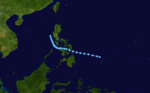
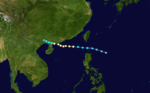
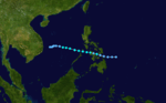
Tropical Depression Jolina
| Tropical depression (PAGASA) | |
 _2001_track.png) | |
| Duration | August 16 – August 19 |
|---|---|
| Peak intensity | 55 km/h (35 mph) (10-min) 998 hPa (mbar) |
Three circulations developed in a monsoon trough in the South China Sea in mid-August. The third formed into a tropical depression which remained stalled west of Luzon between August 16 and 19. It was last seen as an exposed surface circulation virtually where it formed on August 21.[11]
Tropical Depression 15W
| Tropical depression (JMA) | |
| Tropical depression (SSHWS) | |
  | |
| Duration | August 24 – August 28 |
|---|---|
| Peak intensity | 55 km/h (35 mph) (10-min) 1000 hPa (mbar) |
Short-lived tropical depression that did not affect land.
Typhoon Wutip
| Typhoon (JMA) | |
| Category 4 super typhoon (SSHWS) | |
  | |
| Duration | August 26 – September 2 |
|---|---|
| Peak intensity | 165 km/h (105 mph) (10-min) 930 hPa (mbar) |
Moving northeastward for its entire duration, Wutip became a moderate typhoon before dissipating on September 2.
Tropical Storm Sepat
| Tropical storm (JMA) | |
| Tropical storm (SSHWS) | |
  | |
| Duration | August 26 – August 30 |
|---|---|
| Peak intensity | 85 km/h (50 mph) (10-min) 990 hPa (mbar) |
An area of thunderstorms formed late on the 19th about 100 miles (160 km) south of Pohnpei. By the 22nd it was south-southeast of Guam, still attempting to organize while it moved east-northeast. Moving disjointedly northward, by the 27th it developed into a tropical depression 250 miles (400 km) northwest of Wake Island, and by early the next day it had attained tropical storm strength. Continuing northward, it reached it maximum intensity of 45 kts/50 mph before losing organization on the 28th. Accelerating as it recurved well northwest of Midway Island, it became a nontropical low late on the 31st as it approached the International Dateline to the south of the Aleutians.[11]
Tropical Storm Fitow
| Tropical storm (JMA) | |
| Tropical storm (SSHWS) | |
  | |
| Duration | August 28 – September 1 |
|---|---|
| Peak intensity | 65 km/h (40 mph) (10-min) 990 hPa (mbar) |
Initially an area of thunderstorms formed west of Luzon late on August 26, possibly due to the remains of former Tropical Depression Jolina. Late on August 28 it formed into a tropical depression about 300 miles (480 km) south-southwest of Hong Kong. It moved west-northwest over northeastern Hainan late on August 29, before becoming a tropical storm 24 hours later. Early on August 31, the tropical storm began to drift north towards China. That evening, it struck Dongxing before weakening back into a tropical depression on September 1 and dissipating the following day. Excessive rains fell in mainland China, with locations in Changjiang county measuring up to 831.1 mm in the 3 day period ending late on August 31. Total economic losses in Hainan were near 1.367 billion yuan ($201.7 million USD). In all, 3680 houses were nearly destroyed, four died, and 3.5 million people were impacted by the weak tropical storm.[11]
Typhoon Danas
| Typhoon (JMA) | |
| Category 3 typhoon (SSHWS) | |
  | |
| Duration | September 3 – September 14 |
|---|---|
| Peak intensity | 155 km/h (100 mph) (10-min) 945 hPa (mbar) |
A tropical depression formed on September 3. It was then later designated as 19W by the JTWC and named as Danas by the JMA on September 4. It intensified into a Category 2 typhoon as it created a small eye on September 7. On September 8, Danas became a Category 3 typhoon as it moved northwest towards Japan by Typhoon Nari. It then dissipated on September 11.
On September 10, Danas spawned a tornado near the city of Ochiai, just outside Tokyo. Along its track, the tornado damaged roofs, downed trees and injured one person. Following an assessment of the damage, the Tokyo District Meteorological Observatory ranked it as an F1 on the Fujita scale. According to reliable records, this was the eleventh tornado to touch down in the Kanto region.[12] Throughout Japan, Danas was responsible for eight fatalities and injured 48. Damage from the storm amounted to 1.1 billion yen ($12.8 million USD).
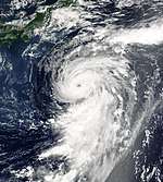
Typhoon Nari (Kiko)
| Typhoon (JMA) | |
| Category 3 typhoon (SSHWS) | |
  | |
| Duration | September 5 – September 21 |
|---|---|
| Peak intensity | 140 km/h (85 mph) (10-min) 960 hPa (mbar) |
On September 5, a tropical depression developed northeast of Taiwan. Weak currents, which were prevalent throughout its lifetime, caused it to drift to the northeast where it became a tropical storm on the 6th. Nari stalled near Okinawa, and became a typhoon on the 7th. Over the next 5 days, Nari executed a triple loop over open waters, reaching a peak of 115 mph (185 km/h) winds before weakening to a tropical storm on the 14th. It restrengthened to a typhoon, and as it continued southwestward, Nari reached 100 mph (160 km/h) winds before hitting northeastern Taiwan on the 16th. The storm drifted across the island, emerging into the South China Sea on the 18th as a tropical depression. It continued westward, and finally made landfall east of Hong Kong as a 65 mph (105 km/h) tropical storm on the 20th. Nari caused 92 casualties[13] and up to 50 inches (1,300 mm) of rain led to torrential flooding.
Typhoon Vipa
| Typhoon (JMA) | |
| Category 1 typhoon (SSHWS) | |
  | |
| Duration | September 17 – September 21 |
|---|---|
| Peak intensity | 120 km/h (75 mph) (10-min) 975 hPa (mbar) |
The JMA classified a small tropical depression on September 16. It rapidly was upgraded to Tropical Depression 21W by the JTWC as it headed towards warm waters. Early on September 17, it became a tropical storm naming it Vipa. The cluster of thunderstorms increased to Vipa as it became a minimal typhoon on September 19. It impacted Japan later that day, bringing strong winds and minimal damage. Typhoon Vipa underwent an extratropical transition on September 21, and fully dissipated southeast of Kamchatka Peninsula on September 23.
The name Vipa was changed to the correct spelling Wipha in 2002.[14]
Typhoon Francisco
| Typhoon (JMA) | |
| Category 3 typhoon (SSHWS) | |
  | |
| Duration | September 18 – September 25 |
|---|---|
| Peak intensity | 155 km/h (100 mph) (10-min) 945 hPa (mbar) |
Tropical Depression 22W formed in open waters on September 18. It rapidly intensified to a tropical storm, being named as Francisco on September 20. It became a typhoon on September 21 as it moved north. On September 22, it reached peak intensity as a strong typhoon. Typhoon Francisco became extratropical on September 25 and dissipated on September 26.
Typhoon Lekima (Labuyo)
| Typhoon (JMA) | |
| Category 2 typhoon (SSHWS) | |
  | |
| Duration | September 22 – September 30 |
|---|---|
| Peak intensity | 130 km/h (80 mph) (10-min) 965 hPa (mbar) |
A cluster of thunderstorms formed and rapidly became Tropical Depression Labuyo by the PAGASA and 23W by the JTWC on September 22. Convection increased which made Labuyo go on favorable conditions of becoming a Tropical Storm. It became Tropical Storm Lekima on September 24, as it was reported that 1 died. It rapidly became a typhoon and reached peak intensity as a Category 2 on September 27. A total of 2 had died in Taiwan due to strong winds and high waves. Due with land interaction, it was rapidly downgraded to a severe tropical storm and finally dissipated over China on September 30. Damages from this storm was unknown.
Typhoon Krosa
| Typhoon (JMA) | |
| Category 3 typhoon (SSHWS) | |
  | |
| Duration | October 3 – October 9 |
|---|---|
| Peak intensity | 150 km/h (90 mph) (10-min) 950 hPa (mbar) |
Typhoon Krosa was a fast-paced storm that peaked as a Category 3 typhoon. It formed on October 3 and was first classified as a tropical depression by the JMA. Later that day, it was designated 24W by the JTWC. It rapidly intensified to a tropical storm, naming it Krosa on October 4. Krosa then entered warm waters and deep convection later that day as it rapidly became a typhoon. On October 6, it reached peak intensity as a Category 3 storm and weakened to a Category 2 later that day. On October 7, Krosa entered cool waters as it rapidly weakened to a tropical storm. It dissipated on October 9 as it was absorbed by a trough of low-pressure. Krosa did not cause any damage or casualties, but it did affect the Micronesian Islands.
Typhoon Haiyan (Maring)
| Typhoon (JMA) | |
| Category 2 typhoon (SSHWS) | |
  | |
| Duration | October 11 – October 18 |
|---|---|
| Peak intensity | 130 km/h (80 mph) (10-min) 960 hPa (mbar) |
Tropical Depression 25W formed over the Philippine Sea on October 11. The PAGASA named it as Maring 3 hours later. Maring steadily moved northwards due to an intensifying high-pressure area moving southwestwards, as the JTWC upgraded it to a tropical storm on October 13. In the same time, Maring became Tropical Storm Haiyan. The next day, the three agencies, upgraded it to a typhoon. Typhoon Haiyan reached peak intensity as a category 2 on October 15, without furthering intensifying to a category 3. As the high-pressure moved westwards, Haiyan rapidly weakened to a minimal typhoon and moved westwards too, affecting Taiwan. Haiyan finally dissipated on October 18.
Throughout Japan and the Ryukyu Islands, two people were killed by the typhoon and another was injured. Damage from the storm amounted to 296.024 million yen ($3.4 million USD).
Typhoon Podul
| Typhoon (JMA) | |
| Category 5 super typhoon (SSHWS) | |
  | |
| Duration | October 19 – October 27 |
|---|---|
| Peak intensity | 185 km/h (115 mph) (10-min) 925 hPa (mbar) |
Typhoon Podul became a super typhoon according to the JTWC, attaining strong winds but remaining away from land.
Typhoon Lingling (Nanang)
| Typhoon (JMA) | |
| Category 4 typhoon (SSHWS) | |
  | |
| Duration | November 6 – November 12 |
|---|---|
| Peak intensity | 155 km/h (100 mph) (10-min) 940 hPa (mbar) |
A tropical depression formed in the Philippine Sea on November 5. It moved westward, hitting the Philippines on the 6th. The depression strengthened over the archipelago, becoming a tropical storm on the 7th. Lingling continued to intensify, reaching a peak of 135 mph (217 km/h) winds on the 10th in the South China Sea. The next day, the typhoon hit central Vietnam as a 110 mph (180 km/h) typhoon, and dissipated on the 12th. Lingling, like most typhoons, brought torrential rains and flooding, resulting in 171 deaths in the Philippines (with 118 missing) and 18 deaths in Vietnam.
Tropical Depression 28W (Ondoy)
| Tropical depression (PAGASA) | |
| Tropical storm (SSHWS) | |
  | |
| Duration | November 17 – November 25 |
|---|---|
| Peak intensity | 55 km/h (35 mph) (10-min) 996 hPa (mbar) |
A tropical depression moved towards the Philippines in the middle of November before turning to the northeast, dissipating on November 25.
Tropical Depression 29W (Pabling)
| Tropical depression (PAGASA) | |
| Tropical storm (SSHWS) | |
  | |
| Duration | November 18 – November 24 |
|---|---|
| Peak intensity | 55 km/h (35 mph) (10-min) 1004 hPa (mbar) |
A tropical wave formed west of Mindanao, Philippines on November 11. It started to move south southwestwards towards the southern part of the South China Sea. Due to the coriolis effect, it became a tropical disturbance on November 16. Still moving eastwards, the storm intensified into a depression by the JMA, two days later. Due to the strong pull from Tropical Storm 28W, it gathered more strength becoming Tropical Depression 29W, moving northwestwards and affecting Borneo. Late on November 20, 29W became a tropical storm. The next day, it moved westward, due to the dissipating 28W and entered the PAG, giving the name Pabling. It finally dissipated on November 24. This is the first storm to move in an eastward direction near the equator, since Tropical Storm Greg in 1996.
Tropical Storm Kajiki (Quedan)
| Tropical storm (JMA) | |
| Tropical storm (SSHWS) | |
  | |
| Duration | December 4 – December 9 |
|---|---|
| Peak intensity | 65 km/h (40 mph) (10-min) 996 hPa (mbar) |
In early December, a tropical storm moved across the Philippines.
Tropical Storm 31W
| Tropical storm (SSHWS) | |
  | |
| Duration | December 10 – December 12 |
|---|---|
| Peak intensity | 65 km/h (40 mph) (1-min) 997 hPa (mbar) |
Initially classified by JTWC as the precursor of Faxai, but later found to be a separate system.
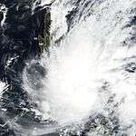
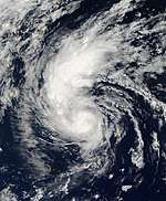
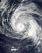
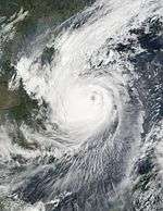
Typhoon Faxai
| Typhoon (JMA) | |
| Category 5 super typhoon (SSHWS) | |
  | |
| Duration | December 13 – December 25 |
|---|---|
| Peak intensity | 195 km/h (120 mph) (10-min) 915 hPa (mbar) |
On December 13, a tropical depression formed in the open waters of the West Pacific. It drifted for 5 days, slowly organizing into a tropical storm on the 15th. As Faxai moved more quickly to the northwest, its wind speeds increased, becoming a typhoon on the 20th and rapidly intensifying to a peak of 180 mph (290 km/h) on the 23rd. Cooler waters and upper level shear weakened it until it became extratropical on the 25th. Faxai, the strongest storm of the year, was one of the most intense December typhoons ever recorded. Fortunately, it never approached land.
Initially Faxai was classified as part of Tropical Depression 31W, but post-analysis considers the early part of Faxai's life a separate storm. As such, Faxai was classified as 33W in post-analysis.
Two people were killed as a result of the storm and damage across several islands amounted to roughly $1 million.
Tropical Storm Vamei
| Tropical storm (JMA) | |
| Category 1 typhoon (SSHWS) | |
  | |
| Duration | December 26 – December 29 (Exited basin) |
|---|---|
| Peak intensity | 85 km/h (50 mph) (10-min) 1006 hPa (mbar) |
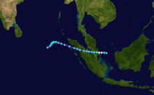
Tropical Depression 32W formed 200 nautical miles (370 km) east of Singapore at 1200 UTC (2000 SGT) on December 26. It is extremely unusual to see tropical development this close to the equator. The initial position of 1.4° N means this storm formed only 85 nautical miles (157 km) north of the equator. On December 27 it was upgraded to Tropical Storm Vamei, and shortly thereafter it made landfall in Malaysia. Emerging into the Indian Ocean on December 29 as a Tropical Depression, it briefly re-strengthened before dissipating on January 1. The name Vamei was retired in 2004 and replaced with Peipah because of the unique formation and track of this storm.
Storm names
Within the North-western Pacific Ocean, both the Japan Meteorological Agency (JMA) and the Philippine Atmospheric, Geophysical and Astronomical Services Administration assign names to tropical cyclones that develop in the Western Pacific, which can result in a tropical cyclone having two names.[15] The Japan Meteorological Agency's RSMC Tokyo — Typhoon Center assigns international names to tropical cyclones on behalf of the World Meteorological Organization's Typhoon Committee, should they be judged to have 10-minute sustained windspeeds of 65 km/h, (40 mph).[16] While the Philippine Atmospheric, Geophysical and Astronomical Services Administration assigns names to tropical cyclones which move into or form as a tropical depression in their area of responsibility located between 135°E and 115°E and between 5°N-25°N even if the cyclone has had an international name assigned to it.[15] The names of significant tropical cyclones are retired, by both PAGASA and the Typhoon Committee.[16] Should the list of names for the Philippine region be exhausted then names will be taken from an auxiliary list of which the first ten are published each season. Unused names are marked in gray.
International names
During the season 26 named tropical cyclones developed in the Western Pacific and were named by the Japan Meteorological Agency, when it was determined that they had become tropical storms. These names were contributed to a list of a 140 names submitted by the fourteen members nations and territories of the ESCAP/WMO Typhoon Committee.
| Cimaron | Chebi | Durian | Utor | Trami | Kong-rey | Yutu | Toraji | Man-yi | Usagi | Pabuk | Wutip | Sepat |
| Fitow | Danas | Nari | Vipa | Francisco | Lekima | Krosa | Haiyan | Podul | Lingling | Kajiki | Faxai | Vamei |
This is the only time that the name "Vipa" was used. Its spelling was corrected to "Wipha" in 2002.[14]
Philippines
| Auring | Barok | Crising | Darna | Emong |
| Feria | Gorio | Huaning | Isang | Jolina |
| Kiko | Labuyo | Maring | Nanang | Ondoy |
| Pabling | Quedan | Roleta (unused) | Sibak (unused) | Talahib (unused) |
| Ubbeng (unused) | Vinta (unused) | Wilma (unused) | Yaning (unused) | Zuma (unused) |
| Auxiliary list | ||||
|---|---|---|---|---|
| Alamid (unused) | Bruno (unused) | Conching (unused) | Dolor (unused) | Ernie (unused) |
| Florante (unused) | Gerardo (unused) | Hernan (unused) | Isko (unused) | Jerome (unused) |
The Philippine Atmospheric, Geophysical and Astronomical Services Administration uses its own naming scheme for tropical cyclones in their area of responsibility. PAGASA assigns names to tropical depressions that form within their area of responsibility and any tropical cyclone that might move into their area of responsibility. Should the list of names for a given year prove to be insufficient, names are taken from an auxiliary list, the first 10 of which are published each year before the season starts. Starting in 2001, new sets of names are implemented.The names not retired from this list will be used again in the 2005 season. Names that were not assigned are marked in gray.
Retirement
The name Vamei was retired by the ESCAP/WMO Typhoon Committee. The name Peipah was chosen to replace Vamei. The name "Nanang" was retired by PAGASA and was replaced by Nando for 2005.
Season effects
This table lists all the storms that developed in the western Pacific Ocean to the west of the International Date Line during the 2001 season. It includes their intensity, duration, name, landfalls, deaths, and damages. All damage figures are in 2001 USD. Damages and deaths from a storm include when the storm was a precursor wave or extratropical low.
| Name | Dates active | Peak classification | Sustained wind speeds |
Pressure | Areas affected | Damage (USD) |
Deaths | Refs |
|---|---|---|---|---|---|---|---|---|
| 01W (Auring) | February 17 – 20 | Tropical depression | 55 km/h (35 mph) | 1004 hPa (29.65 inHg) | Philippines | Unknown | 15 | |
| 02W (Barok) | April 16 – 18 | Tropical depression | 45 km/h (30 mph) | 1004 hPa (29.65 inHg) | None | None | None | |
| TD | May 6 – 7 | Tropical depression | Not specified | 1004 hPa (29.65 inHg) | Philippines | None | None | |
| Cimaron (Crising) | May 9 – 14 | Severe tropical storm | 95 km/h (60 mph) | 985 hPa (29.09 inHg) | Philippines, Japan | $555 thousand | None | |
| Darna | June 17 – 19 | Tropical depression | 55 km/h (35 mph) | 1000 hPa (29.53 inHg) | Philippines, Taiwan | Unknown | None | |
| Chebi (Emong) | June 19 – 24 | Typhoon | 120 km/h (75 mph) | 965 hPa (28.5 inHg) | China, Taiwan | $471 million | 108 | |
| Durian | June 29 – July 2 | Severe tropical storm | 95 km/h (60 mph) | 970 hPa (28.64 inHg) | China, Vietnam | $422 million | 110 | |
| Utor (Feria) | July 1 – July 7 | Severe tropical storm | 110 km/h (70 mph) | 960 hPa (28.35 inHg) | Philippines, China | $332 million | 197 | |
| Trami (Gorio) | July 8 – 11 | Tropical storm | 75 km/h (45 mph) | 994 hPa (29.35 inHg) | Philippines, Taiwan, China | Unknown | 3 | |
| 08W | July 10 – 11 | Tropical depression | 45 km/h (30 mph) | 1002 hPa (29.59 inHg) | None | None | None | |
| TD | July 16 – 19 | Tropical depression | Not specified | 1004 hPa (29.65 inHg) | None | Unknown | None | |
| Kong-rey | July 21 – 28 | Typhoon | 130 km/h (80 mph) | 955 hPa (28.2 inHg) | None | None | None | |
| Yutu (Huaning) | July 22 – 26 | Severe tropical storm | 100 km/h (65 mph) | 975 hPa (28.79 inHg) | Philippines, Vietnam, China | $75.5 million | None | |
| Toraji (Isang) | July 25 – August 1 | Typhoon | 140 km/h (85 mph) | 960 hPa (28.35 inHg) | Philippines, Taiwan, China | $245 million | 200 | |
| Man-yi | August 1 – 9 | Typhoon | 150 km/h (90 mph) | 955 hPa (28.2 inHg) | Mariana Islands | $50 thousand | None | |
| TD | August 2 – 3 | Tropical depression | Not specified | 1004 hPa (29.65 inHg) | Taiwan, Ryukyu Islands | None | None | |
| TD | August 5 – 8 | Tropical depression | Not specified | 1000 hPa (29.53 inHg) | East China, Korea | None | None | |
| Usagi | August 8 – 11 | Tropical storm | 65 km/h (45 mph) | 992 hPa (29.29 inHg) | China, Vietnam, Laos, Thailand | $3.2 million | 3 | |
| Pabuk | August 13 – 22 | Typhoon | 130 km/h (80 mph) | 960 hPa (28.35 inHg) | Mariana Islands, Japan | $7.1 million | 6 | |
| Jolina | August 16 – 19 | Tropical depression | 55 km/h (35 mph) | 998 hPa (29.47 inHg) | Philippines | $9.1 million | 41 | |
| TD | August 22 – 24 | Tropical depression | Not specified | 1000 hPa (29.53 inHg) | None | None | None | |
| TD | August 22 – 23 | Tropical depression | Not specified | 1002 hPa (29.59 inHg) | None | None | None | |
| 15W | August 24 – 28 | Tropical depression | 55 km/h (35 mph) | 1000 hPa (29.53 inHg) | None | None | None | |
| Wutip | August 26 – September 2 | Typhoon | 165 km/h (105 mph) | 930 hPa (27.46 inHg) | None | None | None | |
| Sepat | August 26 – 30 | Tropical storm | 85 km/h (50 mph) | 990 hPa (29.24 inHg) | None | None | None | |
| Fitow | August 28 – September 1 | Tropical storm | 85 km/h (50 mph) | 990 hPa (29.24 inHg) | China | $202 million | 4 | |
| Danas | September 3 – 14 | Typhoon | 155 km/h (100 mph) | 945 hPa (27.91 inHg) | Japan | $12.8 million | 9 | |
| Nari (Kiko) | September 5 – 21 | Typhoon | 140 km/h (85 mph) | 960 hPa (28.35 inHg) | Japan, Taiwan, China | $443 million | 104 | |
| TD | September 5 – 7 | Tropical depression | Not specified | 1002 hPa (29.59 inHg) | South China | None | None | |
| TD | September 8 – 10 | Tropical depression | Not specified | 1000 hPa (29.53 inHg) | Taiwan, Ryukyu Islands | None | None | |
| TD | September 9 – 12 | Tropical depression | Not specified | 1000 hPa (29.53 inHg) | South China, Vietnam | None | None | |
| Vipa | September 17 – 21 | Typhoon | 120 km/h (75 mph) | 975 hPa (28.79 inHg) | Japan | None | None | |
| Francisco | September 18 – 25 | Typhoon | 155 km/h (100 mph) | 945 hPa (27.91 inHg) | None | None | None | |
| Lekima (Labuyo) | September 22 – 30 | Typhoon | 130 km/h (80 mph) | 965 hPa (28.5 inHg) | Philippines, Taiwan, China | Unknown | 2 | |
| Krosa | October 3 – 9 | Typhoon | 150 km/h (90 mph) | 950 hPa (28.05 inHg) | Mariana Islands | None | None | |
| Haiyan (Maring) | October 11 – 18 | Typhoon | 130 km/h (80 mph) | 960 hPa (28.35 inHg) | Taiwan, Japan | $3.4 million | 2 | |
| Podul | October 19 – 27 | Typhoon | 185 km/h (115 mph) | 925 hPa (27.32 inHg) | Caroline Islands | None | None | |
| TD | October 20 – 21 | Tropical depression | Not specified | 1002 hPa (29.59 inHg) | Vietnam | None | None | |
| Lingling (Nanang) | November 6 – 12 | Typhoon | 155 km/h (100 mph) | 940 hPa (27.76 inHg) | Philippines, Vietnam, Cambodia | $70.3 million | 379 | |
| 28W (Ondoy) | November 17 – 25 | Tropical depression | 55 km/h (35 mph) | 996 hPa (29.41 inHg) | Caroline Islands, Mariana Islands, Philippines | None | None | |
| 29W (Pabling) | November 18 – 23 | Tropical depression | 55 km/h (35 mph) | 1004 hPa (29.65 inHg) | Philippines, Malaysia, Brunei, Indonesia | None | None | |
| Kajiki (Quedan) | December 4 – 9 | Tropical storm | 65 km/h (40 mph) | 996 hPa (29.41 inHg) | Philippines, Vietnam | Minimal | None | |
| 31W | December 10 – 12 | Tropical storm | 65 km/h (40 mph) | 997 hPa (29.44 inHg) | Caroline Islands | None | None | |
| Faxai | December 13 – 25 | Typhoon | 195 km/h (120 mph) | 915 hPa (27.02 inHg) | Caroline Islands, Mariana Islands, Philippines | $1 million | 2 | |
| Vamei | December 26 – 29 | Tropical Storm | 85 km/h (50 mph) | 1006 hPa (29.71 inHg) | Singapore, Malaysia, Indonesia | $3.6 million | 5 | |
| Season aggregates | ||||||||
| 45 systems | February 17 – December 29 | 195 km/h (120 mph) | 915 hPa (27.02 inHg) | $2.3 billion | 1287 | |||
See also
- List of Pacific typhoon seasons
- 2001 Pacific hurricane season
- 2001 Atlantic hurricane season
- 2001 North Indian Ocean cyclone season
- South-West Indian Ocean cyclone seasons: 2000-01, 2001-02
- Australian region cyclone seasons: 2000-01, 2001-02
- South Pacific cyclone seasons: 2000-01, 2001-02
References
- ↑ "Archived copy". Archived from the original on 2010-12-20. Retrieved 2006-08-26.
- ↑ http://72.14.207.104/search?q=cache:B1Z3B7KbI6kJ:www.japantoday.com/gidx/news37918.html+Typhoon+Chebi+,+Taiwan&hl=en&gl=us&ct=clnk&cd=4
- ↑ Five Killed, 28 Missing in Taiwan
- ↑ Typhoon Chebi Brings Rainstorm for Guangdong
- ↑ http://72.14.207.104/search?q=cache:9R6lRuW8kScJ:www.japantoday.com/gidx/news37987.html+Typhoon+Chebi+,+Taiwan&hl=en&gl=us&ct=clnk&cd=3
- ↑ Typhoon Chebi Savages Fujian, At Least 79 Killed
- ↑ https://web.archive.org/web/20010913040430/http://english.pravda.ru/world/2001/06/27/8836.html
- ↑ Staff Writer (August 4, 2005). "Typhoon strengthens near Taiwan". CNN. Retrieved April 22, 2010.
- ↑ C.-Y. Chen, W.-C. Lee & F.-C. Yu (May 16, 2006). "Debris flow hazards and emergency response in Taiwan". ProQuest. Retrieved April 22, 2010.
- ↑ Staff Writer (August 3, 2001). "Chang slams over-farming". The China Post. Retrieved April 22, 2010.
- 1 2 3 http://www.typhoon2000.ph/garyp_mgtcs/aug01.txt
- ↑ "Tokyo District Damage Report: Tornado" (in Japanese). National Institute of Informatics. 2001. Retrieved July 16, 2010.
- ↑ Precipitation Processes Associated With the Landfalling Typhoon Nari (2001). Retrieved on 2007-02-25.
- 1 2 "Typhoon Committee Operational Manual Meteorological Component" (PDF). World Meteorological Organization. p. 36. Archived (PDF) from the original on 26 September 2007. Retrieved 2007-09-16.
- 1 2 Padgett, Gary. "Monthly Tropical Cyclone summary December 1999". Australian Severe Weather. Archived from the original on August 28, 2012. Retrieved August 28, 2012.
- 1 2 the Typhoon Committee (February 21, 2012). "Typhoon Committee Operational Manual 2012" (PDF). World Meteorological Organization. pp. 37–38. Archived (PDF) from the original on August 28, 2012.
External links
| Wikimedia Commons has media related to 2001 Pacific typhoon season. |
- Satellite movie of 2001 Pacific typhoon season
- Japan Meteorological Agency
- China Meteorological Agency
- National Weather Service Guam
- Hong Kong Observatory
- Macau Meteorological Geophysical Services
- Korea Meteorological Agency
- Philippine Atmospheric, Geophysical and Astronomical Services Administration
- Taiwan Central Weather Bureau
- Joint Typhoon Warning Center