1983 North Indian Ocean cyclone season
| 1983 North Indian Ocean cyclone season | |
|---|---|
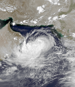
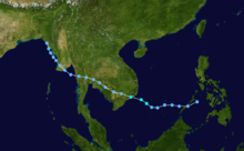
 Season summary map | |
| Seasonal boundaries | |
| First system formed | August 8, 1983 |
| Last system dissipated | November 9, 1983 |
| Seasonal statistics | |
| Total fatalities | Unknown |
| Total damage | Unknown |
| Related articles | |
The 1983 North Indian Ocean cyclone season was part of the annual cycle of tropical cyclone formation. The season has no official bounds but cyclones tend to form between April and December. These dates conventionally delimit the period of each year when most tropical cyclones form in the northern Indian Ocean. There are two main seas in the North Indian Ocean—the Bay of Bengal to the east of the Indian subcontinent and the Arabian Sea to the west of India. The official Regional Specialized Meteorological Centre in this basin is the India Meteorological Department (IMD), while the Joint Typhoon Warning Center (JTWC) releases unofficial advisories. An average of five tropical cyclones form in the North Indian Ocean every season with peaks in May and November.[1] Cyclones occurring between the meridians 45°E and 100°E are included in the season by the IMD.[2]
Systems
Tropical Storm Aurora (1A)
| Tropical storm (SSHWS) | |
  | |
| Duration | August 9 – August 10 |
|---|---|
| Peak intensity | 85 km/h (50 mph) (1-min) 985 hPa (mbar) |
On August 9 a tropical depression developed in the northwest Arabian Sea. It tracked westward, becoming a tropical storm later that day. Aurora reached a peak of 50 mph winds before hitting eastern Oman on the 10th, where it dissipated shortly thereafter. The system was unofficially named as Aurora by the JTWC. [3]
On Masirah Island, the storm dropped 46 mm (1.8 in) of rainfall.[4]
Tropical Storm Two (2B)
| Tropical storm (SSHWS) | |
  | |
| Duration | October 1 – October 4 |
|---|---|
| Peak intensity | 95 km/h (60 mph) (1-min) 990 hPa (mbar) |
Tropical Storm Two, which began its life on October 1 in the central Bay of Bengal, hit northeastern India on the 3rd as a 60 mph tropical storm, dissipating the next day.
Tropical Depression Kim (16W)
| Tropical depression (SSHWS) | |
  | |
| Duration | October 18 (entered basin) – October 20 |
|---|---|
| Peak intensity | 55 km/h (35 mph) (1-min) 994 hPa (mbar) |
The remnants of Western Pacific Tropical Storm Kim redeveloped in the northeastern Bay of Bengal near Myanmar. It paralleled the coastline, hit western Myanmar, and dissipated on the 20th.
Tropical Storm Three (3B)
| Tropical storm (SSHWS) | |
  | |
| Duration | November 5 – November 9 |
|---|---|
| Peak intensity | 100 km/h (65 mph) (1-min) 980 hPa (mbar) |
65 mph Tropical Storm Three, which developed on November 5 in the central Bay of Bengal, hit southeastern Bangladesh on the 9th. The storm quickly dissipated without causing any reported damage.
See also
- List of North Indian Ocean cyclone seasons
- 1983 Atlantic hurricane season
- 1983 Pacific hurricane season
- 1983 Pacific typhoon season
- Australian cyclone seasons: 1982–83, 1983–84
- South Pacific cyclone seasons: 1982–83, 1983–84
- South-West Indian Ocean cyclone seasons: 1982–83, 1983–84
References
- ↑ "Frequently Asked Questions: What is the annual frequency of Cyclones over the Indian Seas? What is its intra-annual variation?". Indian Meteorological Department. 2012. Archived from the original on May 21, 2015. Retrieved June 8, 2012.
- ↑ "Bulletins Issued by Regional Specialized Meteorological Centre (RSMC) – Tropical Cyclones, New Delhi" (PDF). India Meteorological Department. May 25, 2009. Retrieved July 16, 2012.
- ↑ https://www.usno.navy.mil/NOOC/nmfc-ph/RSS/jtwc/atcr/1983atcr.pdf
- ↑ https://books.google.com/books?id=uc_tCAAAQBAJ&pg=PA17&lpg=PA17&dq=1996+oman+cyclone&source=bl&ots=mX3bSvGdql&sig=nCCHeVO2QZr3PtQFYEtgV1kH6CY&hl=en&sa=X&ved=0CC0Q6AEwA2oVChMI3JC5lLyOyQIVCOwmCh1EwgLP#v=onepage&q=1996%20oman%20cyclone&f=false