Zonsverduistering van 30 juni 1973
De totale zonsverduistering van 30 juni 1973 trok veel over land en zee en was achtereenvolgens te zien op of in deze 16 (ei)landen : Brazilië, Guyana, Suriname, Santo Antão, São Vicente, Mauritanië, Mali, Algerije, Niger, Tsjaad, Soedan, Democratische Republiek Congo, Zuid-Soedan, Oeganda, Kenia en Somalië.[1][2]
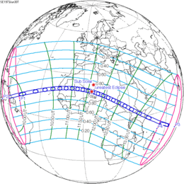
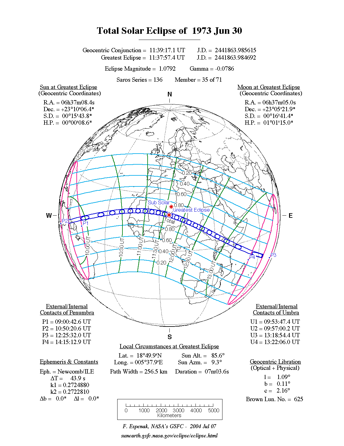
De zonsverduistering was te zien tussen de blauwe lijnen.
Lengte
Maximum
Het punt met maximale totaliteit lag in Niger vlakbij Assamakka en duurde 7m03,5s.
Limieten
| Fenomeen | Code | Tijdstip UTC |
|---|---|---|
| Eerste contact bijschaduw | P1 | 09:00:42.6 |
| Eerste contact kernschaduw | U1 | 09:53:47.4 |
| Kernschaduw compleet vanaf | U2 | 09:57:00.2 |
| Bijschaduw compleet vanaf | P2 | 10:50:20.6 |
| Maximum eclips | GE | 11:37:57.4 |
| Bijschaduw compleet t/m | P3 | 12:25:32.0 |
| Kernschaduw compleet t/m | U3 | 13:18:54.4 |
| Laatste contact kernschaduw | U4 | 13:22:06.0 |
| Laatste contact bijschaduw | P4 | 14:15:12.9 |
Zie ook
Externe links
- NASA Google map van deze verduistering
- NASA overzicht van alle verduisteringen
Bronnen, noten en/of referenties
|
This article is issued from
Wikipedia.
The text is licensed under Creative
Commons - Attribution - Sharealike.
Additional terms may apply for the media files.