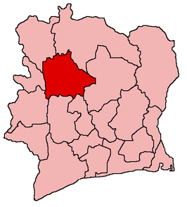
Worodougou
Worodougou is een bestuurlijke regio in het noordwesten van het West-Afrikaanse land Ivoorkust. De laatste census van 1988 telde 244.843 inwoners. De schatting van 2007 wees op ruim 450.000 inwoners. De regio heeft een oppervlakte van bijna 22.000 vierkante kilometer en heeft Séguéla als hoofdplaats.
Regio in Ivoorkust | |||
 | |||
| Coördinaten | 8°30'NB, 6°20'WL | ||
| Algemeen | |||
| Oppervlakte | 21.900 km² | ||
| Inwoners (2007) | 456.708 (21 inw./km²) | ||
| Hoofdstad | Séguéla | ||
| |||
Grenzen
Worodougou ligt te midden van zeven andere Ivoriaanse regio's:
- Denguélé in het noordwesten.
- Savanes in het noordoosten.
- Vallée du Bandama in het oosten.
- Marahoué in het zuidoosten.
- Haut-Sassandra in het zuiden.
- Dix-Huit Montagnes in het zuidwesten.
- Bafing in het westen.
Departementen
De regio is verder opgedeeld in twee departementen [1]:
- Mankono
- Séguéla
| Bronnen, noten en/of referenties |
| Regio's van Ivoorkust | |
|---|---|
|
Agnéby · Bafing · Bas-Sassandra · Denguélé · Dix-Huit Montagnes · Fromager · Haut-Sassandra · Lacs · Lagunes · Marahoué · Moyen-Cavally · Moyen-Comoé · N'zi-Comoé · Savanes · Sud-Bandama · Sud-Comoé · Vallée du Bandama · Worodougou · Zanzan |
This article is issued from
Wikipedia.
The text is licensed under Creative
Commons - Attribution - Sharealike.
Additional terms may apply for the media files.