West Hanningfield
West Hanningfield is een civil parish in het bestuurlijke gebied Chelmsford, in het Engelse graafschap Essex.
Geplaatst op: 3-8-2010 |
Dit artikel is een beginnetje over landen & volken. U wordt uitgenodigd om op bewerken te klikken om uw kennis aan dit artikel toe te voegen. |
| Civil parish in Engeland | |||
 | |||
| Situering | |||
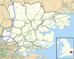
| Regio | East of England | ||
| Graafschap | Essex | ||
| District | Chelmsford | ||
| Coördinaten | 51° 40' NB, 0° 30' OL | ||
| Algemeen | |||
| Oppervlakte | 11,2570 km² | ||
| Inwoners (2011) | 975 (87 inw./km²) | ||
| Overig | |||
| Postcode(s) | CM2 8 | ||
| Netnummer(s) | 01277 (and 01245) | ||
| Grid code | TQ727997 | ||
| Post town | CHELMSFORD | ||
| ONS-code | E04003975 | ||
| Foto's | |||
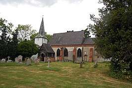 | |||
| Parochiekerk van St. Mary en St. Edward | |||
| |||
This article is issued from
Wikipedia.
The text is licensed under Creative
Commons - Attribution - Sharealike.
Additional terms may apply for the media files.