Washington (West Sussex)
Washington is een civil parish in het bestuurlijke gebied Horsham, in het Engelse graafschap West Sussex met 1867 inwoners.
| Zie de categorie Washington, West Sussex van Wikimedia Commons voor mediabestanden over dit onderwerp. |
Albourne · Aldingbourne · Aldwick · Amberley · Angmering · Ansty and Staplefield · Appledram · Ardingly · Arundel · Ashington · Ashurst Wood · Ashurst · Balcombe · Barlavington · Barnham · Bepton · Bersted · Bignor · Billingshurst · Birdham · Bognor Regis · Bolney · Bosham · Boxgrove · Bramber · Broadbridge Heath · Burgess Hill · Burpham · Bury · Chichester · Chidham and Hambrook · Clapham · Climping · Cocking · Coldwaltham · Colgate · Compton · Coombes · Cowfold · Cuckfield · Donnington · Duncton · Earnley · Eartham · Easebourne · East Dean · East Grinstead · East Lavington · East Preston · East Wittering · Eastergate · Ebernoe · Elsted and Treyford · Felpham · Fernhurst · Ferring · Findon · Fishbourne · Fittleworth · Ford · Fulking · Funtington · Graffham · Harting · Hassocks · Haywards Heath · Henfield · Heyshott · Horsted Keynes · Houghton · Hunston · Hurstpierpoint and Sayers Common · Itchingfield · Kingston · Kirdford · Lancing · Lavant · Linch · Linchmere · Lindfield Rural · Lindfield · Littlehampton · Lodsworth · Lower Beeding · Loxwood · Lurgashall · Lyminster and Crossbush · Madehurst · Marden · Middleton-on-Sea · Midhurst · Milland · Newtimber · North Horsham · North Mundham · Northchapel · Nuthurst · Oving · Pagham · Parham · Patching · Petworth · Plaistow · Poling · Poynings · Pulborough · Pyecombe · Rogate · Rudgwick · Rusper · Rustington · Selsey · Shermanbury · Shipley · Sidlesham · Singleton · Slaugham · Slindon · Slinfold · Sompting · South Stoke · Southbourne · Southwater · Stedham with Iping · Steyning · Stopham · Storrington and Sullington · Stoughton · Sutton · Tangmere · Thakeham · Tillington · Trotton with Chithurst · Turners Hill · Twineham · Upper Beeding · Upwaltham · Walberton · Warnham · Warningcamp · Washington · West Chiltington · West Dean · West Grinstead · West Hoathly · West Itchenor · West Lavington · West Thorney · West Wittering · Westbourne · Westhampnett · Wisborough Green · Wiston · Woodmancote · Woolbeding with Redford · Worth · Yapton
Geplaatst op: 18-8-2010 |
Dit artikel is een beginnetje over landen & volken. U wordt uitgenodigd om op bewerken te klikken om uw kennis aan dit artikel toe te voegen. |
| Civil parish in Engeland | |||
 | |||
| Situering | |||
| Regio | South East England | ||
| Graafschap | West Sussex | ||
| District | Horsham | ||
| Coördinaten | 50° 54' NB, 0° 24' WL | ||
| Algemeen | |||
| Oppervlakte | 12,7667 km² | ||
| Inwoners (2011) | 1867 (146 inw./km²) | ||
| Overig | |||
| Postcode(s) | RH20 | ||
| Netnummer(s) | 01903 | ||
| Grid code | TQ121127 | ||
| Post town | PULBOROUGH | ||
| ONS-code | E04009973 | ||
| Foto's | |||
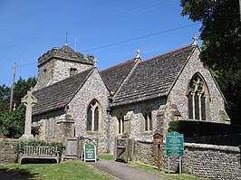 | |||
| H.-Mariakerk. | |||
| |||