Topola
Topola (Servisch: Топола) is een gemeente in het Servische district Šumadija. Topola telt 25.292 inwoners (2002). De oppervlakte bedraagt 356 km², de bevolkingsdichtheid is 71 inwoners per km².
Gemeente in Servië | |||
 | |||
Situering | |||
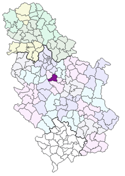
| Land | Servië | ||
| District | Šumadija | ||
| Regio | Centraal-Servië | ||
| Coördinaten | 44°15'9"NB, 20°40'34"OL | ||
Algemeen | |||
| Oppervlakte | 356 km² | ||
| Inwoners (2002) | 25,292 | ||
Overig | |||
| Postcode(s) | 34310 | ||
| Netnummer(s) | 034 | ||
| Kenteken | KG | ||
| Website | topola.com | ||
| |||
Bij de volkstelling van 2002 bestond de gemeente Topola uit de volgende plaatsen (inwonertal tussen haakjes):
- Belosavci (1182)
- Blaznava (591)
- Božurnja (672)
- Donja Šatornja (800)
- Donja Trešnjevica (304)
- Donja Trnava (921)
- Gornja Šatornja (558)
- Gornja Trnava (1736)
- Gorovič (319)
- Guriševci (153)
- Jarmenovci (563)
- Jelenac (375)
- Junkovac (945)
- Kloka (1146)
- Krćevac (775)
- Lipovac (558)
- Manojlovci (144)
- Maskar (236)
- Natalinci (834)
- Ovsište (630)
- Pavlovac (70)
- Plaskovac (559)
- Rajkovac (189)
- Šume (595)
- Svetlić (417)
- Topola (5422)
- Topola (1363)
- Vinča (1176)
- Vojkovci (278)
- Žabare (1016)
- Zagorica (765).
This article is issued from
Wikipedia.
The text is licensed under Creative
Commons - Attribution - Sharealike.
Additional terms may apply for the media files.