Thurnham (Kent)
Thurnham is een civil parish in het bestuurlijke gebied Maidstone, in het Engelse graafschap Kent met 1207 inwoners.
 Thurnham Friars
 Kerk van St. Mary the Virgin
| Bronnen, noten en/of referenties
|
Geplaatst op: 3-8-2010 |
Dit artikel is een beginnetje over landen & volken. U wordt uitgenodigd om op bewerken te klikken om uw kennis aan dit artikel toe te voegen. |
| Civil parish in Engeland | |||
 | |||
| Situering | |||
| Regio | South East England | ||
| Graafschap | Kent | ||
| District | Maidstone | ||
| Coördinaten | 51° 17' NB, 0° 35' OL | ||
| Algemeen | |||
| Oppervlakte | 12,8449 km² | ||
| Inwoners (2011) | 1207 (94 inw./km²) | ||
| Overig | |||
| Postcode(s) | ME14 | ||
| Netnummer(s) | 01622 | ||
| Grid code | TQ805579 | ||
| Post town | MAIDSTONE | ||
| ONS-code | E04004974 | ||
| Foto's | |||
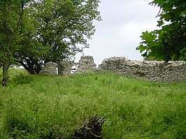 | |||
| Thurnham Castle, ook Godard's Castle. | |||
| |||
This article is issued from
Wikipedia.
The text is licensed under Creative
Commons - Attribution - Sharealike.
Additional terms may apply for the media files.