Stretton (Rutland)
Stretton is een civil parish in het bestuurlijke gebied Rutland, in het Engelse graafschap Rutland met 1260 inwoners.
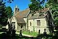 Kerk van Stretton
Geplaatst op: 16-8-2010 |
Dit artikel is een beginnetje over landen & volken. U wordt uitgenodigd om op bewerken te klikken om uw kennis aan dit artikel toe te voegen. |
| Civil parish in Engeland | |||
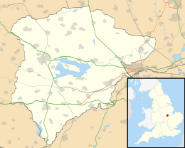 | |||
| Situering | |||
| Regio | East Midlands | ||
| Graafschap | Rutland | ||
| District | Rutland | ||
| Coördinaten | 52° 44' NB, 0° 36' WL | ||
| Algemeen | |||
| Oppervlakte | 13,5701 km² | ||
| Inwoners (2011) | 1260 (93 inw./km²) | ||
| Overig | |||
| Postcode(s) | LE15 | ||
| Netnummer(s) | 01572 | ||
| Grid code | SK948160 | ||
| Post town | OAKHAM | ||
| ONS-code | E04000670 | ||
| Foto's | |||
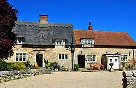 | |||
| Pub "Jackson Stops" | |||
| |||
This article is issued from
Wikipedia.
The text is licensed under Creative
Commons - Attribution - Sharealike.
Additional terms may apply for the media files.