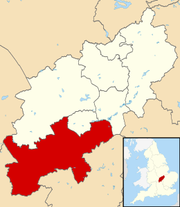
South Northamptonshire
South Northamptonshire is een Engels district in het shire-graafschap (non-metropolitan county OF county) Northamptonshire en telt 93.000 inwoners. De oppervlakte bedraagt 634 km².
| Niet-metropolitaans district in Engeland | |||
 | |||
| Situering | |||
| Land | Engeland | ||
| County | Northamptonshire | ||
| Regio | East Midlands | ||
| Coördinaten | 52°6'NB, 1°6'WL | ||
| Algemeen | |||
| Oppervlakte | 634,0232[1] km² | ||
| Inwoners (2018[2]) | 92515 (146 inw./km²) | ||
| ONS-code | E07000155 | ||
| |||
Van de bevolking is 13,8% ouder dan 65 jaar. De werkloosheid bedraagt 1,8% van de beroepsbevolking (cijfers volkstelling 2001).
Civil parishes in district South Northamptonshire
Abthorpe, Adstone, Alderton, Ashton, Aston le Walls, Aynho, Blakesley, Blisworth, Boddington, Brackley, Bradden, Brafield on the Green, Bugbrooke, Castle Ashby, Chacombe, Chipping Warden and Edgcote, Cogenhoe and Whiston, Cold Higham, Cosgrove, Courteenhall, Croughton, Culworth, Deanshanger, Denton, Easton Neston, Evenley, Eydon, Farthinghoe, Gayton, Grafton Regis, Grange Park, Greatworth, Greens Norton, Hackleton, Harpole, Hartwell, Helmdon, Hinton-in-the-Hedges, Kings Sutton, Kislingbury, Litchborough, Little Houghton, Maidford, Marston St Lawrence, Middleton Cheney, Milton Malsor, Moreton Pinkney, Nether Heyford, Newbottle, Old Stratford, Overthorpe, Pattishall, Paulerspury, Potterspury, Quinton, Radstone, Roade, Rothersthorpe, Shutlanger, Silverstone, Slapton, Stoke Bruerne, Sulgrave, Syresham, Thenford, Thorpe Mandeville, Tiffield, Towcester, Upper Heyford, Wappenham, Warkworth, Weston and Weedon, Whitfield, Whittlebury, Wicken, Woodend, Yardley Gobion, Yardley Hastings.
Bronnen, noten en/of referenties
|