Puerto Plata (provincie)
Puerto Plata is een provincie van de Dominicaanse Republiek. Ze heeft 329.000 inwoners en is 1800 km² groot.
Provincie in de Dominicaanse Republiek | |||
| |||
 | |||
| Situering | |||
| Macroregio[1] | Norte | ||
| Regio (Nr) | Cibao Norte (I) | ||
| Coördinaten | 19° 45′ NB, 70° 45′ WL | ||
| Algemeen | |||
| Oppervlakte | 1805,63[2] km² | ||
| Inwoners (2016) | 329.482[3] (182 inw./km²) | ||
| Hoofdstad | Puerto Plata | ||
| ONE-code | 18 | ||
| ISO 3166-2 | DO-18 | ||
Foto's | |||
 | |||
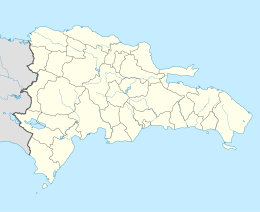
| Inplanting van de provincie (blauw) in het land | |||
| |||

Gemeenten

- Puerto Plata, de provinciehoofdstad
- Altamira
- Guananico
- Imbert
- Los Hidalgos
- Luperón
- Sosúa
- Villa Isabela
- Villa Montellano
| Bronnen, noten en/of referenties |
| Zie de categorie Puerto Plata Province van Wikimedia Commons voor mediabestanden over dit onderwerp. |
| Provincies van de Dominicaanse Republiek | |
|---|---|
|
Azua · Baoruco · Barahona · Dajabón · Duarte · Elías Piña · El Seibo · Espaillat · Hato Mayor · Hermanas Mirabal · Independencia · La Altagracia · La Romana · La Vega · María Trinidad Sánchez · Monseñor Nouel · Monte Cristi · Monte Plata · Pedernales · Peravia · Puerto Plata · Samaná · Sánchez Ramírez · San Cristóbal · San José de Ocoa · San Juan · San Pedro de Macorís · Santiago · Santiago Rodríguez · Santo Domingo · Valverde | |
This article is issued from
Wikipedia.
The text is licensed under Creative
Commons - Attribution - Sharealike.
Additional terms may apply for the media files.