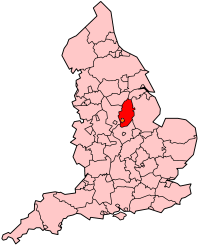
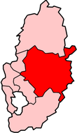
Newark and Sherwood
Newark and Sherwood is een Engels district in het shire-graafschap (non-metropolitan county OF county) Nottinghamshire en telt 122.000 inwoners. De oppervlakte bedraagt 651 km².
| Niet-metropolitaans district in Engeland | |||
  | |||
| Situering | |||
| Land | Engeland | ||
| County | Nottinghamshire | ||
| Regio | East Midlands | ||
| Coördinaten | 53°6'NB, 0°57'WL | ||
| Algemeen | |||
| Oppervlakte | 651,3406[1] km² | ||
| Inwoners (2018[2]) | 121566 (187 inw./km²) | ||
| ONS-code | E07000175 | ||
| |||
Van de bevolking is 17,3% ouder dan 65 jaar. De werkloosheid bedraagt 3,1% van de beroepsbevolking (cijfers volkstelling 2001).
Plaatsen in district Newark and Sherwood
Civil parishes in district Newark and Sherwood
Alverton, Averham, Balderton, Barnby in the Willows, Bathley, Besthorpe, Bilsthorpe, Bleasby, Blidworth, Bulcote, Carlton-on-Trent, Caunton, Caythorpe, Clipstone, Coddington, Collingham, Cotham, Cromwell, Eakring, East Stoke, Edingley, Edwinstowe, Egmanton, Elston, Epperstone, Farndon, Farnsfield, Fernwood, Fiskerton cum Morton, Girton, Gonalston, Grassthorpe, Gunthorpe, Halam, Halloughton, Harby, Hawton, Hockerton, Holme, Hoveringham, Kelham, Kersall, Kilvington, Kings Clipstone, Kirklington, Kirton, Kneesall, Langford, Laxton and Moorhouse, Lindhurst, Lowdham, Maplebeck, Meering, Newark, North Clifton, North Muskham, Norwell, Ollerton and Boughton, Ompton, Ossington, Oxton, Perlethorpe cum Budby, Rainworth, Rolleston, Rufford, South Clifton, South Muskham, South Scarle, Southwell, Spalford, Staunton, Staythorpe, Sutton-on-Trent, Syerston, Thorney, Thorpe, Thurgarton, Upton, Walesby, Wellow, Weston, Wigsley, Winkburn, Winthorpe.
Bronnen, noten en/of referenties
|