Montcuit
Montcuit is een gemeente in het Franse departement Manche (regio Normandië) en telt 195 inwoners (2004). De plaats maakt deel uit van het arrondissement Coutances.
Gemeente in Frankrijk | |||
 | |||
| Situering | |||
| Regio | Normandië | ||
| Departement | Manche (50) | ||
| Arrondissement | Coutances | ||
| Kanton | Saint-Sauveur-Lendelin | ||
| Coördinaten | 49° 7′ NB, 1° 20′ WL | ||
| Algemeen | |||
| Oppervlakte | 4,9 km² | ||
| Inwoners (1 jan. 2011) | 197 (40,2 inw./km²) | ||
| Hoogte | 40 - 142 m | ||
| Overig | |||
| Postcode | 50490 | ||
| INSEE-code | 50340 | ||
Foto's | |||
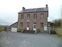 | |||
| Gemeentehuis | |||
| |||
Geografie
De oppervlakte van Montcuit bedraagt 4,9 km², de bevolkingsdichtheid is 39,8 inwoners per km².
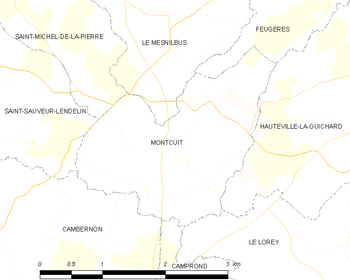
De onderstaande kaart toont de ligging van Montcuit met de belangrijkste infrastructuur en aangrenzende gemeenten.
 |
Demografie
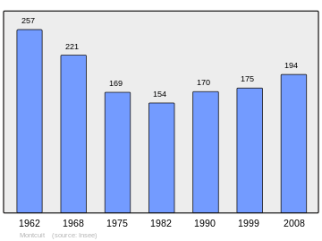
Onderstaande figuur toont het verloop van het inwonertal (bron: INSEE-tellingen).
 Grafiek inwonertal gemeente |
This article is issued from
Wikipedia.
The text is licensed under Creative
Commons - Attribution - Sharealike.
Additional terms may apply for the media files.