Madibeng
Madibeng (officieel Local Municipality of Madibeng) is een gemeente in het Zuid-Afrikaanse district Bojanala. Madibeng ligt in de provincie Noordwest en telt 477.381 inwoners[1].
Gemeente in Zuid-Afrika | |||
 | |||
.svg.png) | |||
| Situering | |||
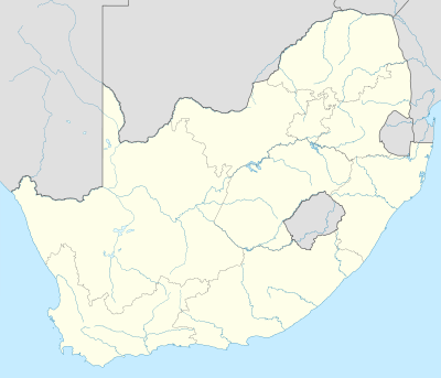
| Provincie | Noordwest | ||
| District | Bojanala | ||
| Coördinaten | 25° 38′ ZB, 27° 47′ OL | ||
| Algemeen | |||
| Oppervlakte | 3839 km² | ||
| Inwoners (2011) | 477.381 (124 inw./km²) | ||
| Etniciteit[1] | 89% Zwart 1% Kleurling 1% Indisch of Aziatisch 9% Blank | ||
| Talen[1] | 9% Afrikaans 4% Engels 2% Zuid-Ndebele 5% Xhosa 5% Zoeloe 8% Noord-Sotho 6% Zuid-Sotho 43% Tswana 1% Swazi 2% Venda 11% Tsonga | ||
| Burgemeester | Mpho Magongwa | ||
| Website | madibengweb.co.za/ | ||
| |||
Hoofdplaatsen
Het nationaal instituut voor de statistiek, Stats SA, deelt sinds de census 2011 deze gemeente in in 48 zogenaamde hoofdplaatsen (main place)[1]:
Ana AH • Baikagedi • Bapong • Brits • Buffelsdoorn • Bushveld View • Dipompong • Fafung • Ga-Moti • Ga-Rantlapane • Ga-Rasai • Ga-Tshefoqe • Ga-Tsogwe • Hartbeespoort • Hebron • Jericho • Kgabalatsane • Klipgat • Kwarriekraal • Legonyane • Lerulaneng • Letlhabile • Letlhakaneng • Maboloka • Madibeng NU • Madidi • Madinyane • Majakaneng • Makgabetlwane • Mankgekgetha • Mmakau • Mmakaunyane • Modderspruit • Moiletswane • Mooinooi • Mothutlung • Ntsopilo • Oukasie • Rabokala • Ramogaodi • Rankotia • Rietfontein • Rooival • Segwaelane • Sephai • Shakung • Sonop • Wonderkoppies.
Zie ook
Yes Media, The Local Government Handbook – South Africa, Madibeng.
| Bronnen, noten en/of referenties |
Geplaatst op: 12-07-2008 |
Dit artikel is een beginnetje over landen & volken. U wordt uitgenodigd om op bewerken te klikken om uw kennis aan dit artikel toe te voegen. |