Huanta (provincie)
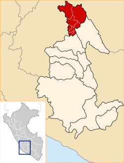
Huanta is een provincie in de regio Ayacucho in Peru.
| Provincie van Peru | |||
| |||
 | |||
| Coördinaten | 12°56'23"ZB, 74°14'51"WL | ||
| Algemeen | |||
| Oppervlakte | 3.886,03 km² | ||
| Inwoners (2015) | 108.553 (28 inw./km²) | ||
| Hoofdplaats | Huanta | ||
| Hoogte | 2642[1] m | ||
| Regio | Ayacucho | ||
| Politiek | |||
| Burgemeester | Renol Silbio Pichardo Ramos (2019-2022) | ||
| Overig | |||
| Tijdzone | UTC−5 | ||
| Ubigeo | 0504 | ||
| Website | www.munihuanta.gob.pe | ||
| |||


Geschiedenis
Aardrijkskunde
De provincie heeft een oppervlakte van 3.879 km² en telt 108.553 inwoners (2015). De hoofdplaats van de provincie is het district Huanta; dit district vormt eveneens de stad (ciudad) Huanta[2].
Bestuurlijke indeling
De provincie Huanta is verdeeld in twaalf districten, UBIGEO tussen haakjes:
- (050402) Ayahuanco
- (050409) Canayre
- (050412) Chaca
- (050403) Huamanguilla
- (050401) Huanta, hoofdplaats van de provincie en deel van de stad (ciudad) Huanta
- (050404) Iguain
- (050408) Llochegua
- (050405) Luricocha
- (050411) Pucacolpa
- (050406) Santillana
- (050407) Sivia
- (050410) Uchuraccay
| Bronnen, noten en/of referenties |
|
Cangallo · Huamanga · Huanca Sancos · Huanta · La Mar · Lucanas · Parinacochas · Páucar del Sara Sara · Sucre · Víctor Fajardo · Vilcas Huamán |
This article is issued from
Wikipedia.
The text is licensed under Creative
Commons - Attribution - Sharealike.
Additional terms may apply for the media files.