Formoso do Araguaia
Formoso do Araguaia is een gemeente in de Braziliaanse deelstaat Tocantins gelegen aan de Araguaia. De gemeente telt 18.719 inwoners (schatting 2009).
Gemeente in Brazilië | |||
| |||
 | |||
| Situering | |||
| Regio | Noord | ||
| Staat | Tocantins | ||
| Mesoregio | Ocidental do Tocantins | ||
| Microregio | Rio Formoso | ||
| Coördinaten | 11° 48′ ZB, 49° 32′ WL | ||
| Algemeen | |||
| Oppervlakte | 13.423,256 km² | ||
| Inwoners (2009) | 18.719 (1,5 inw./km²) | ||
| Hoogte | 240 m | ||
| Gemeentenummer | 1708205 | ||
| Politiek | |||
| Burgemeester | Pedro Rezende | ||
| Gesticht | 1 oktober 1963 | ||
| Overig | |||
| Tijdzone | UTC−3 | ||
| HDI | 0,71 | ||
| Website | Gemeente Formoso | ||
Detailkaart | |||
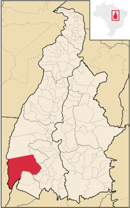 | |||
| Locatie van Formoso do Araguaia in de staat Tocantins | |||
| |||

De gemeente grenst aan Lagoa da Confusão, Dueré, Cariri do Tocantins, Figueirópolis, Sandolândia, São Miguel do Araguaia (GO), Cocalinho (MT), Novo Santo Antônio (MT) en São Félix do Araguaia (MT)
Galerij
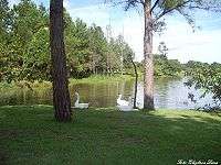 Park van Formoso
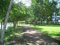
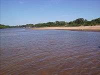 Rio Javaés
| Bronnen, noten en/of referenties |
This article is issued from
Wikipedia.
The text is licensed under Creative
Commons - Attribution - Sharealike.
Additional terms may apply for the media files.