Dunster
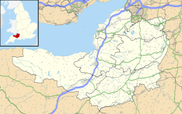
Dunster is een civil parish in het Britse graafschap Somerset. Dunster ligt in het Nationaal park Exmoor.
| Civil parish in Engeland | |||
 | |||
| Situering | |||
| Regio | South West England | ||
| Graafschap | Somerset | ||
| District | Somerset West and Taunton | ||
| Coördinaten | 51° 11' NB, 3° 27' WL | ||
| Algemeen | |||
| Oppervlakte | 8,7390 km² | ||
| Inwoners (2011) | 817 (93 inw./km²) | ||
| Overig | |||
| Postcode(s) | TA24 | ||
| Netnummer(s) | 01643 | ||
| Grid code | SS990436 | ||
| Post town | MINEHEAD | ||
| ONS-code | E04008835 | ||
| Foto's | |||
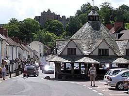 | |||
| Vooraan de overdekte garenmarkt, achteraan het kasteel | |||
| |||
Bezienswaardig is het kasteel.
| Bronnen, noten en/of referenties
|
| Zie de categorie Dunster van Wikimedia Commons voor mediabestanden over dit onderwerp. |
This article is issued from
Wikipedia.
The text is licensed under Creative
Commons - Attribution - Sharealike.
Additional terms may apply for the media files.