Dannhauser
Dannhauser (officieel Dannhauser Local Municipality) is een gemeente in het Zuid-Afrikaanse district Amajuba. Dannhauser ligt in de provincie KwaZoeloe-Natal en telt 102.161 inwoners[1].
Gemeente in Zuid-Afrika | |||
 | |||
.svg.png) | |||
| Situering | |||
| Provincie | KwaZoeloe-Natal | ||
| District | Amajuba | ||
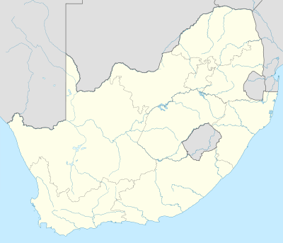
| Coördinaten | 28° 1′ ZB, 30° 3′ OL | ||
| Algemeen | |||
| Oppervlakte | 1516 km² | ||
| Inwoners (2011) | 102.161 (67 inw./km²) | ||
| Etniciteit[1] | 97% Zwart 1% Indisch of Aziatisch 1% Blank | ||
| Talen[1] | 1% Afrikaans 2% Engels 1% Zuid-Ndebele 94% Zoeloe 1% Zuid-Sotho | ||
| Burgemeester | Jabu Phakathi | ||
| Website | dannhauser.gov.za | ||
| |||
Hoofdplaatsen
Het nationaal instituut voor de statistiek, Stats SA, deelt sinds de census 2011 deze gemeente in in 58 zogenaamde hoofdplaatsen (main place)[1]:
Annieville • Anville • Bright Home • Chelmsford • Chester • Clifton • Cloneen • Cork • Curragh • Dannhauser • Dannhauser NU • Doornkop • Dorset • Eastbourne • Emafusini • Fairbreeze • Flint • Fulathela Sorth • Geduld • Greenock • Grootgeluk • Hattingspruit • Hilltop • Inverness • Jokis • Kempshoek • Kilegethe • Kliprand • Lekkerwater • Mafahlawane • Martha • Mbanane • Mielibult • Milford • Moltloung • Mtendeka • Mullingar • Naas • Nellie • Nellie Valler • Nguqunguqu • Nyanyadu • Path Farm • Phillip • Poona • Rocky Spruit • Rutland • Skombaren • Spookmill • Springbok Laagte • Springlake • Striijbank • Surrey • Twhatgwha • Uitkyk • Verdriet • Wilts • Zondo.
Zie ook
Yes Media, The Local Government Handbook – South Africa, Dannhauser.
| Bronnen, noten en/of referenties |