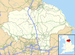
Coxwold
Coxwold is een civil parish in het bestuurlijke gebied Hambleton, in het Engelse graafschap North Yorkshire.
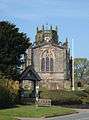 Kerk van St Michael
Geplaatst op: 4-8-2010 |
Dit artikel is een beginnetje over landen & volken. U wordt uitgenodigd om op bewerken te klikken om uw kennis aan dit artikel toe te voegen. |
| Civil parish in Engeland | |||
 | |||
| Situering | |||
| Regio | Yorkshire and the Humber | ||
| Graafschap | North Yorkshire | ||
| District | Hambleton | ||
| Coördinaten | 54° 11' NB, 1° 11' WL | ||
| Algemeen | |||
| Oppervlakte | 17,7386 km² | ||
| Inwoners (2011) | 259 (15 inw./km²) | ||
| Overig | |||
| Postcode(s) | YO61 | ||
| Grid code | SE534771 | ||
| Post town | YORK | ||
| ONS-code | E04007157 | ||
| Foto's | |||
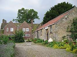 | |||
| Shandy Hall | |||
| |||
This article is issued from
Wikipedia.
The text is licensed under Creative
Commons - Attribution - Sharealike.
Additional terms may apply for the media files.