Chiclayo (provincie)
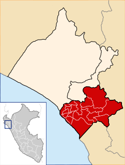
Chiclayo is een van de drie provincies in de regio Lambayeque in Peru. De provincie heeft een oppervlakte van 3.288 km² en heeft 857.405 inwoners (2015). De hoofdplaats van de provincie is het district Chiclayo, waar opgravingen verricht werden; zes van de twintig districten vormen de steden (ciudades) Chiclayo, Monsefu en Tuman[2].
| Provincie van Peru | |||
 | |||
| Coördinaten | 6°45'50"ZB, 79°50'15"WL | ||
| Algemeen | |||
| Oppervlakte | 3.288,07 km² | ||
| Inwoners (2015) | 857.405 (261 inw./km²) | ||
| Hoofdplaats | Chiclayo | ||
| Hoogte | 34[1] m | ||
| Regio | Lambayeque | ||
| Politiek | |||
| Burgemeester | Marcos Antonio Gasco Arrobas (2019-2022) | ||
| Overig | |||
| Tijdzone | UTC−5 | ||
| Ubigeo | 1401 | ||
| |||
De provincie grenst in het noorden aan de provincies Lambayeque en Ferreñafe, in het oosten aan de regio Cajamarca, in het zuiden aan de regio La Libertad en in het westen aan de Grote Oceaan.
Bestuurlijke indeling
De provincie Chiclayo is onderverdeeld in twintig districten, UBIGEO tussen haakjes:
- (140116) Cayalti
- (140101) Chiclayo, hoofdplaats van de provincie en deel van de stad (ciudad) Chiclayo
- (140102) Chongoyape
- (140103) Etén
- (140104) Etén Puerto
- (140105) José Leonardo Ortíz, deel van de stad (ciudad) Chiclayo
- (140106) La Victoria,deel van de stad (ciudad) Chiclayo
- (140107) Lagunas
- (140108) Monsefú, vormt de stad (ciudad) Monsefú
- (140109) Nueva Arica
- (140110) Oyotún
- (140117) Patapo
- (140111) Picsi
- (140112) Pimentel, deel van de stad (ciudad) Chiclayo
- (140118) Pomalca
- (140119) Pucalá
- (140113) Reque
- (140115) Saña
- (140114) Santa Rosa
- (140120) Tumán, vormt de stad (ciudad) Tuman
| Bronnen, noten en/of referenties |
This article is issued from
Wikipedia.
The text is licensed under Creative
Commons - Attribution - Sharealike.
Additional terms may apply for the media files.