Chesterfield (Engeland)
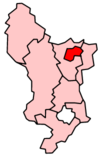
Chesterfield is een marktplaats en een lokaal district in het shire-graafschap (non-metropolitan county OF county) Derbyshire. Het ligt ten zuiden van Sheffield waar de rivieren Rother en Hipper samenvloeien en heeft een inwoneraantal van ongeveer 105.000. De locatie is 53°34′N 1°25′W. Een andere plaats in district Chesterfield is Staveley.
| Niet-metropolitaans district in Engeland | |||
  | |||
| Situering | |||
| Land | Engeland | ||
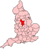
| County | Derbyshire | ||
| Regio | East Midlands | ||
| Coördinaten | 53°14'9"NB, 1°25'39"WL | ||
| Algemeen | |||
| Oppervlakte | 66,0352[1] km² | ||
| Inwoners (2018[2]) | 104628 (1584 inw./km²) | ||
| ONS-code | E07000034 | ||
| Foto's | |||
.jpg) | |||
| De kromme gedraaide kerktoren van Chesterfield | |||
| |||
Civil parishes in district Chesterfield
Geschiedenis
Chesterfield heeft in 1204 zijn marktrechten gekregen van koning Jan zonder Land. Chesterfield is sterk gegroeid door de aanleg van de Chesterfieldlijn - een onderdeel van de spoorweg van Derby naar Leeds waarvan de aanleg in 1837 begon. Tijdens de aanleg werden kolen gevonden en werden er hoogovens in Chesterfield gebouwd.
In de jaren-1980 werden de steenkoolmijnen door de regering-Thatcher gesloten.
Kerktoren
Chesterfield is bekend geworden vanwege zijn "kromme kerktoren" van de Heilige Maria en Alle Heiligenkerk. De kromme toren is door de jaren heen 1,60 meter uit het lood geraakt en is bovendien krom geworden. De meningen over de reden variëren van een slechte kwaliteit hout, tot een verhaal waarin de toren zo verbaasd geweest zou zijn toen er een maagd trouwde in de kerk, dat hij het van dichtbij wilde bekijken.
Sport
Chesterfield FC is de betaaldvoetbalclub van de stad en speelt haar wedstrijden in het Proact Stadium.
Geboren
- Fred Davis (1913-1998), snookerspeler
- John Hurt (1940-2017), acteur
- Jason Statham (1967), acteur
- Claire Price (1972), actrice
- Matthew Lowton (1989), voetballer
Bronnen, noten en/of referenties
|
Unitary authority: Derby
Districten: Amber Valley · Bolsover · Chesterfield · Derbyshire Dales · Erewash · High Peak · North East Derbyshire · South Derbyshire
Lijst van plaatsen in het graafschap Derbyshire
Civil parishes in het ceremoniële graafschap Derbyshire:
Abney and Abney Grange
· Aldercar and Langley Mill
· Alderwasley
· Aldwark
· Alfreton
· Alkmonton
· Ash
· Ashbourne
· Ashford in the Water
· Ashleyhay
· Ashover
· Aston-on-Trent
· Aston
· Atlow
· Ault Hucknall
· Bakewell
· Ballidon
· Bamford
· Barlborough
· Barlow
· Barrow upon Trent
· Barton Blount
· Baslow and Bubnell
· Bearwardcote
· Beeley
· Belper
· Biggin by Hulland
· Birchover
· Blackwell
· Blackwell in the Peak
· Bonsall
· Boylestone
· Brackenfield
· Bradbourne
· Bradley
· Bradwell
· Brailsford
· Brampton
· Brassington
· Breadsall
· Breaston
· Bretby
· Brimington
· Brough and Shatton
· Brushfield
· Burnaston
· Calke
· Callow
· Calow
· Calver
· Carsington
· Castle Gresley
· Castleton
· Catton
· Cauldwell
· Chapel-en-le-Frith
· Charlesworth
· Chatsworth
· Chelmorton
· Chinley, Buxworth and Brownside
· Chisworth
· Church Broughton
· Clay Cross
· Clifton and Compton
· Clowne
· Codnor
· Coton in the Elms
· Crich
· Cromford
· Cubley
· Curbar
· Dalbury Lees
· Dale Abbey
· Darley Dale
· Denby
· Derwent
· Dethick, Lea and Holloway
· Doveridge
· Drakelow
· Draycott and Church Wilne
· Dronfield
· Duffield
· Eaton and Alsop
· Eckington
· Edale
· Edensor
· Edlaston and Wyaston
· Egginton
· Elmton with Creswell
· Elton
· Elvaston
· Etwall
· Eyam
· Fenny Bentley
· Findern
· Flagg
· Foolow
· Foremark
· Foston and Scropton
· Froggatt
· Glapwell
· Grassmoor, Hasland and Winswick
· Gratton
· Great Hucklow
· Great Longstone
· Green Fairfield
· Grindleford
· Grindlow
· Harthill
· Hartington Middle Quarter
· Hartington Nether Quarter
· Hartington Town Quarter
· Hartington Upper Quarter
· Hartshorne
· Hassop
· Hathersage
· Hatton
· Hayfield
· Hazelwood
· Hazlebadge
· Heanor and Loscoe
· Heath and Holmewood
· Highlow
· Hilton
· Hognaston
· Holbrook
· Hollington
· Holmesfield
· Holymoorside and Walton
· Hoon
· Hope
· Hope Woodlands
· Hopton
· Hopwell
· Horsley
· Horsley Woodhouse
· Hulland
· Hulland Ward
· Hungry Bentley
· Ible
· Idridgehay and Alton
· Ingleby
· Ironville
· Ivonbrook Grange
· Kedleston
· Kilburn
· Killamarsh
· King Sterndale
· Kirk Ireton
· Kirk Langley
· Kniveton
· Lea Hall
· Linton
· Little Eaton
· Little Hucklow
· Little Longstone
· Litton
· Longford
· Lullington
· Mackworth
· Mapleton
· Mapperley
· Marston Montgomery
· Marston on Dove
· Matlock Bath
· Matlock Town
· Melbourne
· Mercaston
· Middleton
· Middleton and Smerrill
· Monyash
· Morley
· Morton
· Nether Haddon
· Netherseal
· New Mills
· Newton Grange
· Newton Solney
· Norbury and Roston
· North Wingfield
· Northwood and Tinkersley
· Ockbrook and Borrowash
· Offcote and Underwood
· Offerton
· Old Bolsover
· Osleston and Thurvaston
· Osmaston
· Outseats
· Over Haddon
· Overseal
· Parwich
· Peak Forest
· Pentrich
· Pilsley
· Pilsley
· Pinxton
· Pleasley
· Quarndon
· Radbourne
· Ravensdale Park
· Repton
· Ripley
· Risley
· Rodsley
· Rosliston
· Rowland
· Rowsley
· Sandiacre
· Sawley
· Scarcliffe
· Shardlow and Great Wilne
· Sheldon
· Shipley
· Shirebrook
· Shirland and Higham
· Shirley
· Shottle and Postern
· Smalley
· Smisby
· Snelston
· Somercotes
· Somersal Herbert
· South Darley
· South Normanton
· South Wingfield
· Stanley and Stanley Common
· Stanton
· Stanton by Bridge
· Stanton By Dale
· Staveley
· Stenson Fields
· Stoney Middleton
· Stretton
· Sudbury
· Sutton-cum-Duckmanton
· Sutton on the Hill
· Swanwick
· Swarkestone
· Taddington
· Tansley
· Temple Normanton
· Thornhill
· Thorpe
· Tibshelf
· Ticknall
· Tideswell
· Tintwistle
· Tissington
· Trusley
· Tupton
· Turnditch
· Twyford and Stenson
· Unstone
· Walton-upon-Trent
· Wardlow
· Wessington
· West Hallam
· Weston-on-Trent
· Weston Underwood
· Whaley Bridge
· Wheston
· Whitwell
· Willington
· Windley
· Wingerworth
· Winster
· Wirksworth
· Woodville
· Wormhill
· Yeaveley
· Yeldersley
· Youlgreave
| Zie de categorie Chesterfield van Wikimedia Commons voor mediabestanden over dit onderwerp. |