Calhoun County (South Carolina)
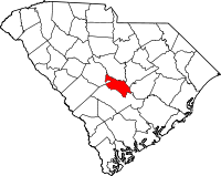
Calhoun County is een van de 46 county's in de Amerikaanse staat South Carolina. Het wordt gerekend tot de Midlands van deze staat.
| County in de Verenigde Staten | |||
 | |||
| Situering | |||
| Staat | South Carolina | ||
| Coördinaten | 33°40'12"NB, 80°46'48"WL | ||
| Algemeen | |||
| Oppervlakte | 1.016 km² | ||
| - land | 985 km² | ||
| - water | 31 km² | ||
| Inwoners (2000) | 15.185 (15 inw./km²) | ||
| Overig | |||
| Zetel | Saint Matthews | ||
| FIPS-code | 45017 | ||
| Opgericht | 1908 | ||
| Foto's | |||
 Bevolkingspiramide Calhoun County | |||
| Statistieken volkstelling Calhoun County | |||
| |||
De county heeft een landoppervlakte van 985 km² en telt 15.185 inwoners (volkstelling 2000). De hoofdplaats is Saint Matthews.
Cities en towns
- Cameron
- Creston
- Fort Motte
- Lone Star
- St. Matthews
- Sandy Run

Calhoun County Courthouse
This article is issued from
Wikipedia.
The text is licensed under Creative
Commons - Attribution - Sharealike.
Additional terms may apply for the media files.