Bishop's Castle
Bishop's Castle is een civil parish in het bestuurlijke gebied South Shropshire, in het Engelse graafschap Shropshire. De plaats telt 1893 inwoners.
Geplaatst op: 13-07-2007 |
Dit artikel is een beginnetje over landen & volken. U wordt uitgenodigd om op bewerken te klikken om uw kennis aan dit artikel toe te voegen. |
| Civil parish in Engeland | |||
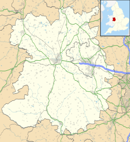 | |||
| Situering | |||
| Regio | West Midlands | ||
| Graafschap | Shropshire | ||
| District | South Shropshire | ||
| Coördinaten | 52° 30' NB, 2° 60' WL | ||
| Algemeen | |||
| Oppervlakte | 7,5534 km² | ||
| Inwoners (2011) | 1893 (251 inw./km²) | ||
| Overig | |||
| Postcode(s) | SY9 | ||
| Netnummer(s) | 01588 | ||
| Grid code | SO323887 | ||
| Post town | BISHOPS CASTLE | ||
| ONS-code | E04011223 | ||
| |||
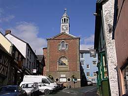
Dorpshuis
This article is issued from
Wikipedia.
The text is licensed under Creative
Commons - Attribution - Sharealike.
Additional terms may apply for the media files.