Benson (Oxfordshire)
Benson is een civil parish in het bestuurlijke gebied South Oxfordshire, in het Engelse graafschap Oxfordshire met 4754 inwoners.
| Civil parish in Engeland | |||
 | |||
| Situering | |||
| Regio | South East England | ||
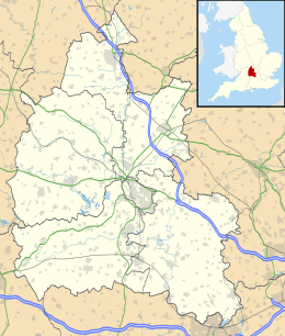
| Graafschap | Oxfordshire | ||
| District | South Oxfordshire | ||
| Coördinaten | 51° 37' NB, 1° 7' WL | ||
| Algemeen | |||
| Oppervlakte | 9,8377 km² | ||
| Inwoners (2011) | 4754 (483 inw./km²) | ||
| Overig | |||
| Postcode(s) | OX10 | ||
| Netnummer(s) | 01491 | ||
| Grid code | SU6191 | ||
| Post town | WALLINGFORD | ||
| ONS-code | E04008105 | ||
| Foto's | |||
 | |||
| Het oorlogsmonument. | |||
| |||
Het militair vliegveld RAF Benson ligt zuidoostelijk van de woonkern van Benson.
Geplaatst op: 16-8-2010 |
Dit artikel is een beginnetje over landen & volken. U wordt uitgenodigd om op bewerken te klikken om uw kennis aan dit artikel toe te voegen. |
This article is issued from
Wikipedia.
The text is licensed under Creative
Commons - Attribution - Sharealike.
Additional terms may apply for the media files.