Surrey, British Columbia
Surrey is a city in the province of British Columbia, Canada, located south of the Fraser River and north of the Canada–United States border. It is a member municipality of the Metro Vancouver regional district and metropolitan area. Mainly a suburban city, Surrey is the province's second-largest by population after Vancouver and the third-largest by area after Abbotsford and Prince George.
Surrey | |
|---|---|
City | |
| City of Surrey | |
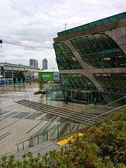
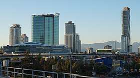   .jpg)  From top, left to right: Whalley City Centre, Crescent Beach, Holland Park, Surrey City Hall, Newton Town Centre | |
 Flag  Coat of arms | |
| Nickname(s): City of Parks | |
| Motto(s): "The future lives here" | |
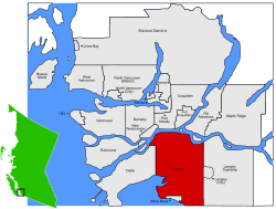 Location of Surrey | |
| Coordinates: 49°11′24″N 122°50′56″W | |
| Country | Canada |
| Province | British Columbia |
| Regional district | Metro Vancouver |
| Incorporation | 1879 (municipality status) |
| 1993 (city status) | |
| Government | |
| • Mayor | Doug McCallum |
| • City Council | |
| • MLAs | List of MLAs
|
| • MPs | List of MPs
|
| • School trustees | List of trustees
|
| Area | |
| • Total | 316.41 km2 (122.17 sq mi) |
| Highest elevation | 134 m (440 ft) |
| Lowest elevation | 0 m (0 ft) |
| Population (2016)[4] | |
| • Total | 517,887 |
| • Rank | 12th |
| • Density | 1,636.8/km2 (4,239/sq mi) |
| Demonym(s) | Surreyite[5] |
| Time zone | UTC-08 (PST) |
| • Summer (DST) | UTC-07 (PDT) |
| Forward sortation area | V3R–V3X, V3Z–V4A, V4N–V4P |
| Area code(s) | 604, 778, 236 |
| Highways | |
| Website | surrey |
The seven neighbourhoods, or town centres, that the City of Surrey comprises are Fleetwood, Whalley, City Centre, Guildford, Newton, Cloverdale, and South Surrey.[6]
History
Surrey was incorporated in 1879, and encompasses land formerly occupied by a number of Halqemeylem-speaking aboriginal groups. When Englishman H.J. Brewer looked across the Fraser River from New Westminster and saw a land reminiscent of his native County of Surrey in England, the settlement of Surrey was placed on the map. The area then comprised forests of douglas fir, fir, red cedar, hemlock, blackberry bushes, and cranberry bogs. A portion of present-day Whalley (named after Harry Whalley, who owned and operated a gas bar at the bend in King George Blvd, (formerly King George Highway) at 108 Avenue, "Whalley's Corner") was used as a burial ground by the Kwantlen (or Qw'ontl'en) Nation.
Settlers arrived first in Cloverdale and parts of South Surrey, mostly to farm, fish, harvest oysters, or set up small stores. Once the Pattullo Bridge was erected in 1937, the way was open for Surrey to expand. In the post-war 1950s, North Surrey's neighbourhoods filled with single family homes and Surrey (not yet a city) became a bedroom community, absorbing commuters who worked in Burnaby or Vancouver.
In the 1980s and 1990s, Surrey witnessed unprecedented growth, as people from different parts of Canada and the world, particularly Asia, began to make the municipality their home. Surrey is projected to surpass the city of Vancouver as the most populous city in BC by 2020 - 2030.[7]
Government and politics
Surrey is governed by an eight-member city council. The current mayor of Surrey is Doug McCallum, who took office on November 5, 2018.[8] The last elections were held in October 2018. Current City Councillors are: Linda Annis, Doug Elford, Laurie Guerra, Brenda Locke. Jack Singh Hundial, Mandeep Nagra, and Steven Pettigrew.[9]
In the 2017 provincial election, the BC NDP doubled their previously held three elected MLAs to six, while the number of MLAs for the BC Liberals dropped from five to three.
In 1997, Gurmant Grewal became the first visible minority elected in Surrey. In 2004, when his wife, Nina was elected to parliament, they became the first married couple to serve Canadian parliament concurrently. Following the 2015 federal election, the Liberal Party of Canada won three of Surrey's four seats in the House of Commons of Canada. Conservative MP Dianne Watts resigned her South Surrey-White Rock seat in 2017 to compete for the leadership of the BC Liberal Party. In the subsequent 2017 by-election, the Liberal candidate Gordie Hogg defeated former Conservative MP and federal cabinet minister Kerry-Lynne Findlay.
Demographics
| Population history | ||
|---|---|---|
| Year | Pop. | ±% |
| 1921 | 5,814 | — |
| 1931 | 8,388 | +44.3% |
| 1941 | 14,840 | +76.9% |
| 1951 | 33,670 | +126.9% |
| 1956 | 49,366 | +46.6% |
| 1961 | 70,838 | +43.5% |
| 1966 | 81,826 | +15.5% |
| 1971 | 98,601 | +20.5% |
| 1976 | 116,497 | +18.1% |
| 1981 | 147,138 | +26.3% |
| 1986 | 181,447 | +23.3% |
| 1991 | 245,173 | +35.1% |
| 1996 | 304,477 | +24.2% |
| 2001 | 347,825 | +14.2% |
| 2006 | 394,976 | +13.6% |
| 2011 | 468,251 | +18.6% |
| 2016 | 517,887 | +10.6% |
| Source: Statistics Canada [10][10][11][11][12][13][14] | ||
In 2016 the population was recorded at 517,887, an increase of 10.6% from 2011.[16] This made it the 12th largest city in Canada, while also being the fifth largest city in Western Canada (after Calgary, Edmonton, Winnipeg and Vancouver). Surrey forms an integral part of Metro Vancouver as it is the second largest city in the region, albeit while also serving as the secondary economic core of the metropolitan area. When combined with the City of Vancouver, both cities account for nearly 50% of the region's population. In recent years, a rapidly expanding urban core in Downtown Surrey, located in Whalley has transformed the area into the secondary downtown core in Metro Vancouver.[17][18]
Within the City of Surrey itself feature many neighbourhoods including City Centre, Whalley, Newton, Guildford, Fleetwood, Cloverdale and South Surrey. Each neighbourhood is unique and includes ethnically diverse populations. While Europeans and South Asians can be found in large numbers across the city, areas which house a large proportion of the former include South Surrey (72%) and Cloverdale (69%), with Newton (58%) and Whalley (51%) being home to large numbers of the latter.[19][20][21][22]
Immigration to Surrey has drastically increased since the 1980s; this has created a more ethnically and linguistically diverse city. 52% do not speak English as their first language, while slightly over 30% of the city's inhabitants are of South Asian heritage. Beginning in the 1990s, an influx of South Asians began moving to the city from neighbouring Vancouver due to rising housing costs and rapidly increasing rent costs for businesses.[23] The outflow of these residents combined with increased immigration from the Indian Subcontinent therefore established in Surrey one of the largest concentrations of South Asian residents in North America.[24] The vast majority of South Asians in Surrey are of Punjabi heritage, a region in northern India and Pakistan; this fact is reflected in the large Sikh, Muslim and Hindu populations of the city.
Other significant Asian groups which reside in the city include Chinese (7.7%), Filipino (6.2%) and Southeast Asian (2.5%). At only 1.9% of the total population, the Black community of Surrey is small however the city is home to the largest Black population in British Columbia; nearly 22% of the entire Black community in the province resides in Surrey.[25] Similar to most cities across Canada, a large majority (64%) of Surrey residents of European heritage can trace their roots to the British Isles.[26]
| Canada 2016 Census[27] | Population | % of Total Population | |
|---|---|---|---|
| Visible minority group Source: |
South Asian | 168,040 | 32.4% |
| Chinese | 39,890 | 7.7% | |
| Filipino | 31,865 | 6.2% | |
| Southeast Asian | 13,010 | 2.5% | |
| Black | 9,455 | 1.8% | |
| Korean | 9,285 | 1.8% | |
| Latin American | 7,065 | 1.4% | |
| Arab | 5,765 | 1.1% | |
| West Asian | 3,720 | 0.7% | |
| Japanese | 2,850 | 0.6% | |
| Other visible minority | 1,995 | 0.4% | |
| Mixed visible minority | 6,320 | 1.2% | |
| Total visible minority population | 299,245 | 57.8% | |
| Aboriginal | First Nations | 7,335 | 1.4% |
| Métis | 5,685 | 1.1% | |
| Inuit | 115 | 0% | |
| Total Aboriginal population | 13,460 | 2.6% | |
| European | 200,365 | 38.7% | |
| Total population | 517,887 | 100% | |
Religion
The 2011 National Household Survey states, "71.4% of the population in Surrey reported a religious affiliation, while 28.6% said they had no religious affiliation. For British Columbia as a whole, 55.9% of the population reported a religious affiliation, while 44.1% had no religion.
Proportionally, Surrey has more Sikhs than any other Canadian city. The top three most reported religious affiliations in Surrey were Christianity (38.2%), Irreligion (28.6%) and Sikhism (22.6%). These were also the top three most frequently reported religions in British Columbia.[28]
Languages
| Mother tongue | Population | Percentage |
|---|---|---|
| English | 247,685 | 47.82% |
| Punjabi | 106,100 | 20.48% |
| Mandarin | 22,885 | 4.42% |
| Hindi | 18,335 | 3.54% |
| Tagalog | 17,540 | 3.39% |
| Korean | 8,065 | 1.56% |
| Cantonese | 7,095 | 1.37% |
| Spanish | 6,730 | 1.29% |
| Vietnamese | 6,365 | 1.23% |
| Arabic | 4,940 | 0.95% |
Economic indicators
As of 2010, Surrey had the highest median family income of CDN$78,283, while BC provincial median was $71,660, and national's median was $74,540. The average family income was $85,765.[29] South Surrey area had the highest average household income of all six town centres in Surrey, with an average of $86,824 as of 2010. Median household income was also high at $62,960.[30] South Surrey's neighbourhood of Rosemary Heights is the richest in Surrey and throughout the Metro Vancouver area, with a median income more than twice the regional average.[31]
As of 2010, the median household income of Surrey was $67,702 (versus the national median of $76,437), where 29.4% of households in Surrey earned a household total income of $100,000 or more, which is above the national average of 25.9%.[29][29][32]
Geography
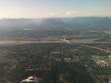
The city is characterized by low population density urban sprawl, typical of North American cities, which includes areas of residential housing, light industry and commercial centres and is prone to strip development and malls. Approximately 35 percent of the land is designated as part of the Agricultural Land Reserve. The city is mostly hills and flatland, with most of the flatland in Tynehead, Hazelmere, south of Cloverdale, and Colebrook.
Climate
The climate is typically inter-coastal Pacific-Northwest: rainy, wet winters, often with heavy rainfall lasting into early spring, with mild, sunny summers and cool autumns.
| Climate data for Surrey (1981−2010) | |||||||||||||
|---|---|---|---|---|---|---|---|---|---|---|---|---|---|
| Month | Jan | Feb | Mar | Apr | May | Jun | Jul | Aug | Sep | Oct | Nov | Dec | Year |
| Record high °C (°F) | 15.5 (59.9) |
19.4 (66.9) |
25.0 (77.0) |
29.0 (84.2) |
34.5 (94.1) |
33.3 (91.9) |
35.0 (95.0) |
34.5 (94.1) |
34.5 (94.1) |
29.0 (84.2) |
21.0 (69.8) |
16.7 (62.1) |
35.0 (95.0) |
| Average high °C (°F) | 6.7 (44.1) |
8.7 (47.7) |
11.7 (53.1) |
14.6 (58.3) |
17.9 (64.2) |
20.4 (68.7) |
23.1 (73.6) |
23.6 (74.5) |
20.9 (69.6) |
14.5 (58.1) |
8.7 (47.7) |
6.1 (43.0) |
14.7 (58.5) |
| Daily mean °C (°F) | 3.8 (38.8) |
5.1 (41.2) |
7.5 (45.5) |
10.0 (50.0) |
13.0 (55.4) |
15.6 (60.1) |
17.9 (64.2) |
18.2 (64.8) |
15.5 (59.9) |
10.4 (50.7) |
5.9 (42.6) |
3.4 (38.1) |
10.5 (50.9) |
| Average low °C (°F) | 0.9 (33.6) |
1.4 (34.5) |
3.3 (37.9) |
5.3 (41.5) |
8.0 (46.4) |
10.8 (51.4) |
12.5 (54.5) |
12.7 (54.9) |
10.0 (50.0) |
6.3 (43.3) |
3.1 (37.6) |
0.6 (33.1) |
6.2 (43.2) |
| Record low °C (°F) | −17.2 (1.0) |
−13.5 (7.7) |
−8.3 (17.1) |
−2.8 (27.0) |
−1.1 (30.0) |
2.2 (36.0) |
2.8 (37.0) |
−1.1 (30.0) |
−2.2 (28.0) |
−6.5 (20.3) |
−15.0 (5.0) |
−18.9 (−2.0) |
−18.9 (−2.0) |
| Average precipitation mm (inches) | 186.4 (7.34) |
124.8 (4.91) |
121.8 (4.80) |
109.8 (4.32) |
87.9 (3.46) |
72.1 (2.84) |
49.0 (1.93) |
42.0 (1.65) |
59.7 (2.35) |
138.5 (5.45) |
225.0 (8.86) |
182.1 (7.17) |
1,399.1 (55.08) |
| Average rainfall mm (inches) | 172.0 (6.77) |
117.4 (4.62) |
120.0 (4.72) |
109.5 (4.31) |
87.9 (3.46) |
72.1 (2.84) |
49.0 (1.93) |
42.0 (1.65) |
59.7 (2.35) |
138.1 (5.44) |
223.4 (8.80) |
169.9 (6.69) |
1,360.8 (53.57) |
| Average snowfall cm (inches) | 14.5 (5.7) |
7.4 (2.9) |
1.8 (0.7) |
0.3 (0.1) |
0.0 (0.0) |
0.0 (0.0) |
0.0 (0.0) |
0.0 (0.0) |
0.0 (0.0) |
0.4 (0.2) |
1.6 (0.6) |
12.2 (4.8) |
38.2 (15.0) |
| Average precipitation days (≥ 0.2 mm) | 19.3 | 16.0 | 17.8 | 16.2 | 14.3 | 12.7 | 8.4 | 7.4 | 8.3 | 16.3 | 22.2 | 19.4 | 178.0 |
| Average rainy days (≥ 0.2 mm) | 18.4 | 15.1 | 17.8 | 16.2 | 14.3 | 12.7 | 8.4 | 7.4 | 8.3 | 16.2 | 22.1 | 18.1 | 174.7 |
| Average snowy days (≥ 0.2 cm) | 2.2 | 1.6 | 0.55 | 0.10 | 0.0 | 0.0 | 0.0 | 0.0 | 0.0 | 0.11 | 0.56 | 2.4 | 7.4 |
| Source: Environment Canada[33] | |||||||||||||
Economy
Surrey is one of the largest industrial centres within British Columbia, with a burgeoning high technology, clean energy, advanced manufacturing, health, education, agriculture, and arts sector.[34]
Increase in filming activity in Surrey resulted in 189 productions, including 15 at the city hall plaza, in 2017.[35]
In 2018, Surrey opened a $68 million biofuel facility, the first in North America.[36]
There were six employers in Surrey in 2017 each with more than 1,000 staff across BC: Fraser Health with 25,000; School District 36 with 10,560; City of Surrey with 3,400; Coast Capital Savings with 1,738; Starline Windows Group with 1,400; Kwantlen Polytechnic University with 1,332.[37]
Universities
Two local, major post-secondary educational institutions, Simon Fraser University and Kwantlen Polytechnic University, received opportunities for expansion. In 2002, Simon Fraser University made an investment by opening a campus in Surrey, the SFU Surrey Campus, which acts a satellite campus operating as a public research university as well as providing further impetus for shaping the city. Kwantlen Polytechnic University was granted a university designation from the BC provincial government, upgrading itself from a community college to an official academic teaching institution that has become renowned in applied research.[38]
Agriculture
Farming has strongly been attached to the economic well-being of Surrey, as the city of Surrey itself fostered and cemented a robust culture of farming. Approximately a third of Surrey's land is preserved and designated as farmland that is utilized for the local production of food to cater the city's growing population as well as increasing employment opportunities via the creation of local jobs. Agriculture continues to invigorate Surrey's economy employing 3300 people or 1.6 percent of Surrey's overall labour force. Manufacturing is also a highly diversified sector where products are produced for developed and emerging industries that range from the cutting of lumber for various BC logging firms to constructing wind turbines as many Surrey-based environmental firms are capitalizing on the city's initiatives for the clean energy sector.[39][40]
Health care
The health sector makes a significant contribution to Surrey's economy. Surrey is home to almost 900 health-related businesses where major focuses in several life science sub-sectors that include infectious diseases, marine bio-science, neuroscience, oncology and regenerative medicine. Surrey Memorial Hospital is the second largest employer in the City of Surrey with an annual operating budget of $149.2 million while the health care organization, Fraser Health employs more than 4,100 people and an additional 350 active physicians at SMH.[41]
Technology
Although not as large as Vancouver's technology sector, Surrey also has an emerging tech sector with a highly anticipated incubator that will potentially act as a base to jump-start ideas into various start-up companies from local innovators, inventors, investors and entrepreneurs.
Education
Of the city's population over the age of 25, 23.7% hold a bachelor's degree or higher, slightly below the national average of 25.8% and 47.2% work in professional and managerial jobs, compared with the national average of 52.7%.[29][32]
Schools
School District 36 Surrey oversees 100 public elementary and 21 public secondary schools, making it the largest public school district in British Columbia. The Conseil scolaire francophone de la Colombie-Britannique operates one Francophone school in that city: école Gabrielle-Roy, which includes primary and secondary levels.[42]
Private schools in Surrey include Calvary Christian Academy, Holy Cross Regional High School, Pacific Academy, Regent Christian Academy, White Rock Christian Academy, Surrey Christian School, and Southridge School. There are no public middle schools in Surrey, so a typical elementary school includes kindergarten through grade 7, and secondary school starts at grade 8 and continues through grade 12. There are around 65,000 students enrolled in public and private schools.
Higher education
Surrey is home to the third campus of Simon Fraser University, which opened its doors in Surrey in 2002. SFU took over the space and programming that was initially built for TechBC, a technical university proposed for south of the Fraser River by the then-NDP led provincial government. SFU Surrey offers a number of programs, including TechOne and Explorations; first-year cohort options; and studies in Health Science, Applied Sciences, Natural Sciences, Liberal Arts, Business Administration, and Interactive Arts and Technology.
Surrey is also the home of Kwantlen Polytechnic University, a polytechnic university that opened its doors in the Newton Town Centre of Surrey in 1981 as a response to the growing need for expanded vocational training across the Fraser Valley. Since then, it has expanded to provide satellite campuses in Richmond, Langley, and a trades and technology centre in the Cloverdale Town Centre. The Surrey campus offers university transfer, career-training and academic-upgrading programs with focuses on science, business, arts, and health, including a publicly accessible wellness centre, while the Cloverdale campus offers vocational training through apprenticeships, citations, certificates, and diplomas for skilled trades and technical careers.
Surrey also has many private post-secondary institutions offering vocational training including Brighton College, Sprott Shaw College, CDI College, Western Community College, Sterling College, Stenberg College, Academy of Learning, Surrey Community College, Discovery Community College and Vancouver Career College.
Culture
Attractions
The Museum of Surrey is affiliated with CMA, CHIN, and Virtual Museum of Canada. It reopened as the Museum of Surrey on September 29, 2018, after a renovation which added 12,000 square feet (1,100 m2) to the previous 24,000-square-foot (2,200 m2) building.[43][44]
The historic Surrey Municipal Hall complex includes the Cenotaph in Heritage Square, the Surrey Museum, and Cloverdale Library. The Surrey City Centre Public Library located at Whalley/City Centre is the second largest library in terms of size in Metro Vancouver.[45][46]
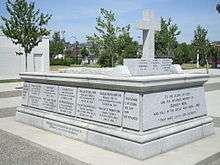
"REMEMBRANCE" by André Gauthier (sculptor) in Heritage Square, is an oversized bronze statue depicting a World War I kneeling soldier, helmet in hand, in remembrance of his fallen comrades.[47]
Events
Attracting 15,000 people every February since 2004, WinterFest is a day of live music, sporting activities, food, and fireworks, held at the Central City Plaza.
Since 1888, the town centre of Cloverdale has hosted the annual Cloverdale Rodeo and Country Fair at the Cloverdale Fairgrounds every May long weekend. The Fair is Canada's second largest rodeo, and it features 150 acres (0.61 km2) of family-oriented entertainment including agricultural/horticultural exhibits, a western tradeshow, parade, community stages, and the Pacific Northwest Firefighter Combat Challenge.
Every year on April 13, the Sikh community celebrates Vaisakhi, which often includes a nagar kirtan, or parade, and free food is often handed out. It is the largest Vaiskahi parade outside India, growing from 100,000 attendees in 2008[48] to over 500,000 in 2019.[49]
Every October since 1991, Surrey has hosted the Surrey International Writers' Conference. This event brings established writers, agents, editors and publishers from all over the world to the Comfort Inn & Suites Surrey Hotel and Sheraton Vancouver Guildford Hotel in Guildford Town Centre.
There are presently three live theatre venues in the City of Surrey in British Columbia as of January 2013: the Bell Centre for Performing Arts, the Chandos Pattison Auditorium and the Surrey Arts Centre.[50]
One of the lesser-known events in Surrey is the annual Nicomekl River Race. Every year, in early June, teams of four meet at Nicomekl Park in Langley, British Columbia to begin the race. Unlike most traditional boat races, the Nicomekl River Race requires that all boats be made by the participants. The racecourse extends from Nicomekl Park to Blackie Spit Park at Crescent Beach. The first team to reach the mouth of the river is awarded a prize of $1,000. Additional prizes are awarded to the most creative boat and costume. All proceeds go towards the BC Cancer society.
News media
In addition to news media from Vancouver, the community is served by The Surrey Now-Leader newspaper, and the Peace Arch News newspaper (for South Surrey). The city is also home to South Asian Broadcasting's ethnic radio station ReD-FM and the Asian Journal newspaper.
The first Surrey-based English-language radio station, My Surrey FM 107.7 FM, was licensed by the CRTC in 2014[51] and is now Pulse FM 107.7 reporting about South of the Fraser news. Radio India, another Indo-Canadian radio station, has its offices in Surrey.[52]
Sports
Every summer, Surrey hosts the Canada Cup International Women's Fastpitch Tournament. It began in 1993 as an international women's fastpitch developmental softball tournament to help teams prepare for the Olympics by facing top-calibre competition. The event continues to be a fan favourite with gate attendance reaching 93,000 for the nine-day tournament in 2004.
The BCHL Surrey Eagles hockey team plays at the South Surrey Arena in Surrey. The Eagles won the BCHL championship, the Fred Page Cup, in 1997, 1998, 2005 and 2013; the western championship, the Doyle Cup, in 1997 and 1998; and the national championship, the Royal Bank Cup, in 1998.
Surrey hosted the Canadian national qualifying tournament in 2006, and sends a local team to compete for a spot in the Little League World Series in Williamsport, Pennsylvania.
Surrey is also home to Canada's first kabaddi-specific stadium.[53]
Although not considered a sport, globally acclaimed dance company known as 'Brotherhood' won gold trophies at the World Hip Hop Dance Championships in 2013 and 2014 for the Varsity and adult divisions. Affiliated Dance production known as 'PraiseTEAM' had taken home the silver trophy at the world finals in 2013 as well. Both dance companies are from Surrey, BC.[54]
Cricket is also played in Surrey. There are more than 85 teams registered with British Columbia Mainland Cricket League. There are more than 20 cricket pitches across Surrey, though the only turf pitch is in West Newton.
Transportation
History
The first non-Indigenous settlement of Surrey was founded near Crescent Beach, located in South Surrey; another was founded near Bridgeview/Brownsville, located in North Surrey. Early trails and roads helped to encourage the settlement of Surrey. The first trail built by a settler was the 1861 the Kennedy Trail. James Kennedy built the trail to provide a route between New Westminster and the natural pasture land on the Mud Bay Flats next to the Serpentine River.[55] The Semiahmoo Wagon Road was built in 1873 between Brownsville opposite New Westminster and Semiahmoo (Blaine).[56] The first regular ferry service across the Fraser River started in 1882 on the steam ferry K de K with the point of departure at Brownsville.[57] The ferry landed on the Surrey side at the start of the Old Yale Road, which connected directly inland to Yale, and was a major gold rush trail.
The New Westminster Rail Bridge was opened in 1904, allowing personal vehicles to cross the Fraser River on the upper deck. The lower deck, for rail, enabled BC Electric Railway to finally construct the Interurban line, an electric suburb commuter rail route connecting Chilliwack to Vancouver. It opened for service in 1910, and ran through Kennedy, Newton, Sullivan, and Cloverdale. Currently, two of the BCER cars (1225 & 1304) are nearly finished being restored for operation on the mainline between Cloverdale and Sullivan. New car barns and museum currently under construction in Cloverdale (as of 2012)[58]
In 1937, the then two-lane Pattullo Bridge linking New Westminster and Surrey was opened.
In the early 1950s, BC Electric Railways ceased operating its interurban line, thus increasing the number of vehicles on Surrey roads. Highway 10 was built in 1953, and Highway 15 in 1957. In 1964, the provincial government completed Highway 401 and the Port Mann Bridge; that section of roadway would later be renamed Highway 1. In 1959, the George Massey Tunnel was opened, along with what is known as Highway 99. With the completion of the new Highways 1 and 99, the Fraser Highway and King George Boulevard became major arteries.
In the early 1990s, Surrey saw the return of rail transit with the SkyTrain Expo Line expansion into Surrey. The four stations added were Scott Road, Gateway, Surrey Central and King George.
Current transportation network
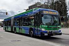
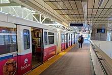
Public transit in Surrey, as with the rest of Metro Vancouver, is operated by TransLink, which provides frequent bus service throughout Surrey, and to other Metro Vancouver municipalities. Metro Vancouver's metropolitan rail system, SkyTrain, provides Surrey with an Expo Line service to Downtown Vancouver via four stations: Scott Road, Gateway, Surrey Central, and King George.
The Canadian National Railway, Canadian Pacific Railway, BNSF Railway, and Southern Railway of British Columbia have trackage running through Surrey.[59]
Vancouver International Airport is located 28 kilometres (17 mi) west of Surrey. Vancouver International Airport offers direct daily service to destinations in Canada, North America, Europe, and Asia.
Bellingham International Airport is located 32 kilometres (20 mi) south of Surrey, and offers connections to Seattle, Las Vegas, and Hawaii.
Abbotsford International Airport is located 24 kilometres (15 mi) east of Surrey, and offers daily flights to Calgary and Edmonton.
Seaport facilities are available at the Fraser River Docks.[60]
Future transportation
Funding a light rail transit (LRT) line linking both Newton and Guildford with Surrey City Centre was agreed to by both BC's provincial government and the federal government. The project was unpopular, and after electing a new mayor and council in October 2018, who had run on a platform to cancel the LRT line in favour of extending the existing SkyTrain line to Langley, made it their first order of business.[61] TransLink's Mayors' Council, who has the ultimate authority over the project, responded to this decision by indefinitely suspending work on the light rail project.[62] In July 2019, a 7-kilometre (4.3 mi) Expo Line extension from King George station to 166 Street and Fraser Highway in Fleetwood was approved and is estimated to be completed by 2025.[63][64]
Sustainable development
In 2008, Surrey city council created and adopted the Surrey Sustainability Charter:[65] a comprehensive document spanning 72 pages that takes a comprehensive look at all facets of society and creates an overarching document to guide the urban development of the city for the next 50 years. In 2011, the city council released the second update to the 2008 document indicating the progress made in the three years since the inception of the report.[66]
Problems
Being an all-inclusive plan requires an interplay of many complex and sometimes wicked problems. Trying to account for all problems is ambitious, and as the report admits, being at the municipal level reduces the funding, power and resources to implement the vision. The report acknowledges the political hurdle and notes that the city needs to influence players with more power such as the provincial or federal government in order for the vision to be successful.
Some other hurdles that have arisen since the inception of the charter include the following:
Suburban sprawl and the Gateway Program
Surrey currently faces the problem of Urban Sprawl, the phenomenon that is characterized by the low density residential, with almost no commercial or industrial zoning. This results in a heavy outflow of traffic in the morning, and inflow in the evening.
The announcement of the Gateway Program in 2005 by the British Columbia Ministry of Transportation meant a large expenditure in transportation infrastructure. Despite the oppositions by the Metro Vancouver and several mayoral councils,[67][68] the project went ahead to create the South Fraser Perimeter Road and the Port Mann Bridge, both which pass through major portions of Surrey. It has been criticized to be contradictory to not only Metro Vancouver's Sustainable Region Initiative,[69] but also Surrey's Sustainability Charter. Studies have shown that with an increase in road capacity, generated traffic increases, that is traffic that is diverted (shifted in time and route) and induced travel (increased total motor vehicle travel).[70] With the construction of the 10 lane Port Mann Bridge, the problem of suburban sprawl is exacerbated not only with the additional capacity, but RapidBus service was also cancelled despite expectations of a stop in Surrey.[71]
Transportation and land use
The Sustainability Charter hinges on a large reduction on automobile dependency requiring a well established transit infrastructure to the multiple districts of Surrey. In 2008, Gordon Campbell announced the extension of the Expo Line beyond the current terminus to as far as Langley.[72] However, financial shortfall came upon Translink shortly after, and many of the announced plans came to a halt. Plans to expand northward via the Evergreen Line came to fruition prior the vision of extending light rail out to Guildford, Newton and Langley. Trying to make ends meet, Mayor Watts attempts to impose equal tolling across the region to assist with funding transit to reduce car reliance.[73]
Protecting agricultural land reserves also play an important part in the charter of sustainability. The idea behind the agricultural land reserves is to encourage and increase the role of urban agriculture thus reducing the reliance of food transport and increasing the quality and availability of food to local people. The Charter takes the idea one step further by bringing in value adding food processing agribusiness to complete the supply chain circle.[74]
In a case study of Toronto completed by Pierre Filion, he claims that while transit and natural area conservation are successful at achieving their respective immediate objectives, they "do not modify metropolitan-wide relations between transportation and land use...in a fashion that is consistent with smart growth". Filion identifies that the largest obstacles are NIMBY reactions from the public and the limited finances from the public sector.[75]
Notable people
- Carolyn Arends, singer-songwriter and author
- Moiez Babar, electronic dance music producer and DJ
- Harry Bains, politician
- Nuvraj Bassi, professional football player
- Jagrup Brar, politician
- Jean-Luc Bilodeau, actor
- Margaret Bridgman, politician
- Lisa Brokop, singer
- Laurent Brossoit, professional hockey goaltender
- Chuck Cadman, politician
- Dona Cadman, Member of Parliament and widow of Chuck Cadman
- Gulzar Singh Cheema, physician and politician
- Jasbir Singh Cheema, politician
- Ryan D'Arcy, neuroscientist researcher
- Narima dela Cruz, politician
- Baltej Singh Dhillon, first Royal Canadian Mounted Police officer allowed to wear a turban
- Ranj Dhaliwal, author
- Sukh Dhaliwal, politician
- Brenden Dillon, professional hockey player
- Emmalyn Estrada, singer, songwriter, actress and sister of Elise Estrada
- Elise Estrada, singer, songwriter, actress and sister of Emmalyn Estrada
- Kevin Falcon, politician
- Peter Fassbender, politician
- Colin Fraser, professional ice hockey player
- Curtis Fraser, professional ice hockey player
- Gurmant Grewal, politician
- Nina Grewal, politician
- Scott Hannan, professional hockey player
- Dave Hayer, politician
- Kamal Heer, Punjabi singer
- Russ Hiebert, politician
- Jacob Hoggard, lead singer of Hedley
- Britt Irvin, actress, singer, voice-over artist
- Daniel Igali, 2000 Olympic gold medalist for freestyle wrestling
- Mark Janssens, professional hockey player
- Tristan Jarry, professional hockey goaltender
- Jujhar Khaira, professional hockey player
- Sydney Leroux, professional soccer player[76]
- Adam Loewen, first baseman/outfielder under minor-league contract for the Toronto Blue Jays
- Harbhajan Mann, Punjabi singer
- Alen Marcina, Professional soccer player and coach
- Laura Mennell, actress
- Victoria Moors, Canadian gymnast at the 2012 Summer Olympics
- Gary Nylund, professional hockey player
- Shallon Olsen, Olympic artistic gymnast
- Missy Peregrym, actress and former fashion model
- Penny Priddy, politician
- Michael Rasmussen (ice hockey) NHL player for the Detroit Red Wings
- Paul Rodgers, vocalist with Free and Bad Company
- Gordon Rice, artist
- Jasbir Sandhu, politician
- Linus Sebastian, videographer; CEO of Linus Media Group
- Geroy Simon, professional football player
- Jinny Sims, politician
- Lauren Southern, internet personality, writer, and political activist
- Kalib Starnes, professional mixed martial artist
- Heather Stilwell, politician and activist
- John Tenta, professional wrestler nicknamed "Earthquake"
- Aaron Voros, professional hockey player
- Manmohan Waris, Punjabi singer
- Nolan Watson, businessman, philanthropist, and humanitarian
- Dianne Watts, politician; first female Mayor of Surrey
Affiliated cities and municipalities
Surrey has two sister cities:
| Country | City | Date |
|---|---|---|
| Kōtō | 1989 | |
| Zhuhai | 1989 |
Surrey also has six Friendship Cities:[77]
| Country | City | Date |
|---|---|---|
| Ningbo | 1999 | |
| Dongjak | 2000 | |
| Taicang | 2004 | |
| Ludhiana | 2005 | |
| Jalandhar | 2005 | |
| Jincheng | 2006 |
See also
- List of tallest buildings in Surrey
References
- Reid, Amy (June 27, 2019). "Locke splits from Safe Surrey, slamming mayor's 'my-way-or-the-highway' approach". Surrey Now-Leader.
- Hasegawa, Regan (July 18, 2019). "Mayor's police plan 'will make Surrey less safe,' says councillor leaving party". CTV News Vancouver. Retrieved July 26, 2019.
- Zytaruk, Tom (May 31, 2019). "Councillor Steven Pettigrew parts ways with Safe Surrey Coalition". Surrey Now-Leader. Retrieved July 26, 2019.
- "Surrey, City [Census subdivision], British Columbia and British Columbia [Province]". Statistics Canada. 2016. Retrieved February 8, 2017.
- "Demonyms—From coast to coast to coast". Language Portal of Canada. Government of Canada. Retrieved March 30, 2012.
- "Surrey Communities". Retrieved February 1, 2019.
- Jill Bennett (June 18, 2013). "Surrey's population projected to surpass Vancouver's". Global News. Retrieved September 29, 2015.
- Surrey, City of. "City Council". www.surrey.ca. Retrieved November 16, 2018.
- Surrey, City of. "City Councillors". www.surrey.ca. Retrieved May 26, 2019.
- "Population Estimates". Province of British Columbia. Retrieved October 13, 2014.
- "Population and Dwelling Counts, for Canada, Provinces and Territories, and Census Divisions, 2001 and 1996 Censuses – 100% Data (British Columbia)". Statistics Canada. Retrieved October 13, 2014.
- "Population and dwelling counts, for Canada, provinces and territories, and census subdivisions (municipalities), 2006 and 2001 censuses – 100% data (British Columbia)". Statistics Canada. December 13, 2007. Retrieved October 13, 2014.
- "Population and dwelling counts, for Canada, provinces and territories, and census subdivisions (municipalities), 2011 and 2006 censuses". Statistics Canada. January 13, 2014. Retrieved October 13, 2014.
- "Census of Canada Municipalities from 1921 to 2011".
- "NHS Profile, Surrey, CY, British Columbia, 2011".
- "Surrey, City [Census subdivision], British Columbia and Greater Vancouver, Regional district [Census division], British Columbia". Statistics Canada. Retrieved October 4, 2016.
- "British Columbia's Second City".
- "The New Surrey: The city's not-so-secret weapon".
- https://www.surrey.ca/files/Neighbourhood-Profile-Newton.pdf
- https://www.surrey.ca/files/Neighbourhood-Profile-Whalley.pdf
- "Change in the air at the Punjabi Market as businesses depart for Surrey".
- "Mapping Ethnicity Part One: South Asia In Surrey".
- "Surrey, City [Census subdivision], British Columbia and Greater Vancouver, Regional district [Census division], British Columbia". Statistics Canada. Retrieved October 17, 2018.
- 2011 National Household Survey "Archived copy". Archived from the original on June 1, 2016. Retrieved November 9, 2015.CS1 maint: archived copy as title (link)
- "NHS Profile, Surrey, CY, British Columbia, 2011". StatsCan. 2011. Retrieved February 14, 2015.
- "Community Profile 2010" (PDF). Fraser Health. Retrieved February 14, 2015.
- Chad Skelton (March 1, 2012). "Rosemary Heights in Surrey is richest place in Metro Vancouver". Vancouver Sun. Retrieved February 14, 2015.
- "National Survey". StatsCan. Retrieved February 14, 2015.
- "Surrey Newton, British Columbia". Canadian Climate Normals 1981–2010. Retrieved February 17, 2015.
- "Key Sectors". City of Surrey. Retrieved February 14, 2015.
- "Another record-breaking year ensures Surrey is part of Hollywood North". CBC. Retrieved January 4, 2018.
- Brown, Janet (March 9, 2018). "North America's first bio-fuel facility opens in Surrey". Global News Radio.
- Book of Lists. Business In Vancouver. 2018. p. 76.
- "City of Surrey education" (PDF). City of Surrey. Retrieved February 14, 2015.
- "Economic Development". City of Surrey. Retrieved February 14, 2015.
- "Farming" (PDF). City of Surrey. Retrieved February 14, 2015.
- "City of Surrey Health" (PDF). City of Surrey. Retrieved February 14, 2015.
- "Carte des écoles Archived August 17, 2015, at the Wayback Machine." Conseil scolaire francophone de la Colombie-Britanique. Retrieved on January 22, 2015.
- Chan, Kenneth (April 24, 2018). "$16-million expansion of Museum of Surrey to open this fall". Daily Hive. Retrieved September 29, 2018.
- Surrey, City of. "Museum of Surrey". www.surrey.ca. Retrieved September 29, 2018.
- https://surreycitycentrelibrary.files.wordpress.com/2009/12/nov17leader-focus-on-the-future.pdf
- "Bob Prittie Metrotown - Burnaby Public Library". www.bpl.bc.ca. Retrieved February 27, 2018.
- Remembrance Archived February 15, 2013, at the Wayback Machine
- "100,000 in Vaisakhi parade". Surrey Now. Retrieved May 29, 2008.
- "Surrey's Vaisakhi parade sees more than 500,000 people, setting new attendance record". Retrieved May 16, 2019.
- Kelly Sinoski, The New Surrey: Developing six cities at once: Surrey must build and link town centres while maintaining their unique traits, Vancouver Sun, January 26, 2013, p.A12
- Cahute, Larissa (August 25, 2014). "A first for Surrey radio fans: English-language station will try to fill the good-news gap". Vancouver Desi.
- "Management" (Archive). Radio India. Retrieved on April 14, 2015. "Address: #201, 12830-80 Ave,Surrey, B.C. V3S3M6, Canada"
- "Premier Officially Opens Surrey Kabaddi Stadium" (Press release). Government of British Columbia. September 9, 2006. Retrieved January 12, 2008.
- "Canada & New Zealand win big at the 2013 World Hip Hop Dance Championship. - HIP HOP INTERNATIONAL". www.hiphopinternational.com. Retrieved February 27, 2018.
- Early Trails and Roads in the Lower Fraser Valley, W. N. Draper, British Columbia Historical Quarterly, January 1943, Vol. 7, p. 49-56.
- The Semiahmoo Trail: Myths Makers Memories by Ron Dowle, Surrey Historical Society, 1998.
- "Surrey History". Members.shaw.ca. September 11, 1993. Retrieved March 9, 2011.
- "Fraser Valley Heritage Railway Society". Fvhrs.org. Retrieved August 1, 2012.
- "COSMOS". cosmos.surrey.ca. Retrieved August 2, 2018.
- "Fraser Surrey Docks - Pacific Rim Stevedoring".
- "Surrey council passes motions to scrap LRT, start municipal police force - CBC News". Retrieved November 6, 2018.
- "Metro Vancouver mayors agree to suspend Surrey LRT, start process for SkyTrain to Langley - CBC News". Retrieved November 16, 2018.
- Chan, Kenneth (December 9, 2018). "TransLink could open new 16-km SkyTrain in Surrey by 2025". Daily Hive. Archived from the original on December 9, 2018. Retrieved March 8, 2019.
- Chan, Kenneth (July 25, 2019). "Mayors' Council approves first phase of new Surrey-Langley SkyTrain up to Fleetwood". Daily Hive. Archived from the original on July 28, 2019. Retrieved July 28, 2019.
- "Sustainability Charter: a commitment to sustainability" (PDF). City of Surrey. Retrieved February 13, 2013.
- "Sustainability Charter update 2011" (PDF). City of Surrey. Retrieved February 13, 2013.
- "Burnaby Public Consultation on Provincial Gateway Program" (PDF). City of Burnaby. Retrieved February 13, 2013.
- "Standing Committee Minutes" (PDF). City of Vancouver. Retrieved February 13, 2013.
- "Proposed twinning of the Port Mann Bridge and Highway 1 expansion" (PDF). David Suzuki Foundation. Retrieved February 13, 2013.
- Litman, Todd (September 10, 2012). "Generated Traffic and Induced Travel Implications for Transport Planning" (PDF). Victoria Transport Policy Institute. Retrieved February 11, 2013.
- "Dianne Watts angry Surrey dropped from RapidBus plans". News1130. November 23, 2012. Retrieved February 13, 2013.
- "More Skytrains for Surrey". Surrey, BC: The Leader. January 16, 2008. ProQuest 373127516.
- "A better Surrey hinges on halted transit plans". The Globe and Mail. June 15, 2012. Retrieved February 13, 2013.
- "Sustainability Charter: a commitment to sustainability" (PDF). City of Surrey. p. 20. Retrieved February 13, 2013.
- Vojnovic, edited by Igor (2013). Urban sustainability : a global perspective. East Lansing: Michigan State University Press. pp. 509–523. ISBN 9781611860559.CS1 maint: extra text: authors list (link)
- "Sydney Leroux Biography". uclabruins.com. Retrieved March 25, 2016.
- "Sister & Friendship Cities :: The City of Surrey, British Columbia". August 6, 2013. Archived from the original on August 6, 2013. Retrieved February 27, 2018.
Further reading
- Sinoski, Kelly. "The New Surrey: The city's not-so-secret weapon" (Archive). The Vancouver Sun. March 9, 2013.
External links
| Wikimedia Commons has media related to Surrey, British Columbia. |

- Official website

Places adjacent to Surrey, British Columbia | ||||||||||
|---|---|---|---|---|---|---|---|---|---|---|
| ||||||||||
| Subdivisions |
|  |
|---|---|---|
| Communities |
| |
| Metro areas and agglomerations |
| |
| Cities |
| |
| ||
Municipalities of Metro Vancouver | |
|---|---|
| Population over 500,000 | |
| Population over 100,000 | |
| Population over 50,000 |
|
| Population over 10,000 |
|
| Population under 10,000 |
|
| Unincorporated areas |
|
| |
| Authority control |
|
|---|