Kreuzberg
Kreuzberg (German pronunciation: [ˈkʁɔʏtsbɛɐ̯k] (![]()
Kreuzberg | |
|---|---|
Quarter of Berlin | |
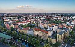 Aerial photo | |
 Coat of arms | |
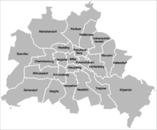
Location of Kreuzberg in Friedrichshain-Kreuzberg and Berlin 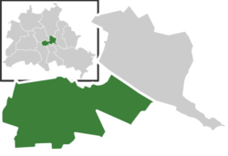 | |
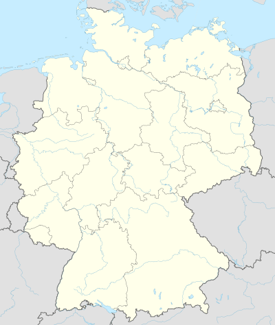 Kreuzberg 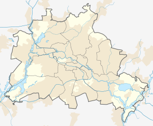 Kreuzberg | |
| Coordinates: 52°29′15″N 13°23′00″E | |
| Country | Germany |
| State | Berlin |
| City | Berlin |
| Borough | Friedrichshain-Kreuzberg |
| Founded | 1920 |
| Subdivisions | 2 zones |
| Area | |
| • Total | 10.4 km2 (4.0 sq mi) |
| Elevation | 52 m (171 ft) |
| Population (2016-06-30) | |
| • Total | 153,887 |
| • Density | 15,000/km2 (38,000/sq mi) |
| Time zone | CET/CEST (UTC+1/+2) |
| Postal codes | (nr. 0202) 10961, 10963, 10965, 10967, 10997, 10999, 10969 |
| Vehicle registration | B |
The borough is known for its very large percentage of immigrants and descendants of immigrants, many of whom are of Turkish ancestry. As of 2006, 31.6% of Kreuzberg's inhabitants did not have German citizenship.[5] While Kreuzberg thrives on its diverse culture[6] and is still an attractive area for many, the district is also characterized by high levels of unemployment and some of the lowest average incomes in Berlin.[7]
The counterculture tradition of Kreuzberg led to a plurality of votes for the Green Party, which is unique among all Berlin boroughs. The local MP Canan Bayram is the only Green politician directly elected to the federal Bundestag parliament.
Geography
Layout
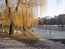
Kreuzberg is bounded by the river Spree in the east. The Landwehrkanal flows through Kreuzberg from east to west, with the Paul-Lincke-Ufer running alongside it. Other characteristics are the old U-Bahn line of the present-day U1, the Görlitzer Park in SO 36 and the Viktoriapark on the slope of the Kreuzberg hill in SW 61.
Subdivision
Kreuzberg is divided into 2 zones (Ortslagen):
- Östliches Kreuzberg (Berlin SO 36);
- Westliches Kreuzberg (Kreuzberg 61).
History
In contrast to many other areas of Berlin, which were villages before their integration into Berlin, Kreuzberg has a rather short history.[8] It was formed on 1 October 1920 by the Greater Berlin Act providing for the incorporation of suburbs and the reorganisation of Berlin into twenty boroughs. The eastern Friedrichsvorstadt, the southern Friedrichstadt, the western and southern Luisenstadt and the Tempelhofer Vorstadt were merged into the new VIth borough of Berlin, first named Hallesches Tor. On 27 September 1921 the borough assembly of Hallesches Tor decided to rename the borough after the homonymous hill.[9] Kreuzberg, literally meaning cross hill, is the point of highest elevation in the Kreuzberg locality, which is 66 m (217 ft) above sea level.[10] The hill is traditionally a place for weekend trips. It received its name from the 1821 Prussian National Monument for the Liberation Wars by Karl Friedrich Schinkel within the Viktoriapark, built in commemoration of the Napoleonic Wars. Except for its northernmost part, the quarter Friedrichstadt (established in the end of the 17th century), today's "Kreuzberg" was a very rural place until well into the 19th century.
This changed when, in the 1860s, industrialization caused Berlin to grow rapidly. This called for extensive housing – much of which was built exploiting the dire needs of the poor, with widespread land speculation. Many of Kreuzberg's buildings originate from that time.[11] They were built on the streets laid out in the Hobrecht-Plan in an area that came to be known architecturally as the Wilhelmine Ring. Far into the 20th century, Kreuzberg was the most populous of Berlin's boroughs even in absolute numbers, with more than 400,000 people, although it was and still is geographically the smallest. As a result, with more than 60,000 people per square kilometer (155,000 people per square mile), Kreuzberg had the highest population density in Berlin.
In addition to housing, Kreuzberg was also one center of Berlin's industry. The "export quarter" along Ritter Street consisted of many profitable small businesses, and the "press quarter" along Koch Street (Friedrichstadt) was the home of most of Germany's large newspapers, as well as the Ullstein, Scherl, and Mosse book publishers.[10]
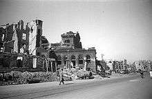
Both of these industrial quarters were almost entirely destroyed by air raids during World War II, with the bombings of a single night from 3 February 1945. In remembrance of the old tradition, the Axel Springer press company erected its German headquarters at Kochstraße again, right next to the Berlin Wall.

After World War II, Kreuzberg's housing rents were regulated by law which made investments unattractive. As a result, housing was of low quality, but cheap, which made the borough a prime target for immigrants coming to Germany (and Berlin).[12] Starting in the late 1960s, increasing numbers of students, artists, and immigrants began moving to Kreuzberg. Enclosed by the Berlin Wall on three sides, the area became famous for its alternative lifestyle and its squatters, especially the SO 36 part of Kreuzberg.[13] Starting in 1987, there have been violent riots in SO 36 on Labour day.
After the fall of the Berlin Wall, Kreuzberg suddenly found itself in the middle of the city again. The initially cheap rents and high degree of 19th century housing made some parts of the borough more attractive as a residential area for a much wider (and richer) variety of people. Today, Kreuzberg has one of the youngest populations of all European city boroughs; statistically, its population has been swapped completely twice in the last two decades.
Berlin's 2001 administrative reform combined Kreuzberg with Friedrichshain to form the new borough of Friedrichshain-Kreuzberg. Since the two areas are linked only by a single bridge over the Spree River, the Oberbaumbrücke, this combination seemed awkward to many residents. The two areas not being able to agree on a common location for the future borough's city hall, the present location in Friedrichshain was decided by flipping a five-Mark coin.
Culture
Kreuzberg has historically been home to Berlin's punk rock movement as well as other alternative subcultures in Germany.[14] The SO36 club remains a fixture on the Berlin music scene. It was originally focused on punk music and in the 1970s was often frequented by Iggy Pop and David Bowie. In those days the club rivalled New York's CBGB as one of the finest new-wave venues in the world.[15]
There has also been a significant influence stemming from African-American and hip hop culture on Kreuzberg's youth and the area has become a centre for rap and breakdance within Berlin. Though the majority of Kreuzberg's residents are of German or Turkish descent, some identify more with American or African-American culture.[16] Hip hop was largely introduced to the youth of Kreuzberg by the children of American servicemen who were stationed nearby until the reunification of Germany.[17]
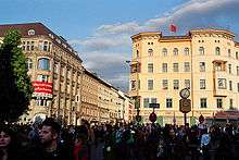
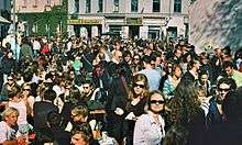
The Carnival of Cultures, a large annual festival, celebrates different cultures and heritages with colourful street parades and festivities including street entertainment, food, arts and craft stalls, music and art.[18]
Kreuzberg has long been the epicenter of LGBTQ life and arts in Berlin. Kreuzberg is home to the Schwules Museum, established in the 1980s and dedicated to preserving, exhibiting, and discovering queer history, art and culture.
Kreuzberg in popular culture

- German musician/DJ Robin Schulz's musical composition, "Prayer in C", an adaptation of a prior song of the same name by Lilly Wood & the Prick, had most of the music video filmed in Friedrichshain-Kreuzberg.
- Turkish-German filmmaker Neco Celik, who portrays the American influence over the youth culture in Kreuzberg in his first film, Alltag, notes that "Kreuzberg is a kind of biotope where different nationalities live, but the environment determines their lives, not their nationalities."
- German musician Sven Regener's first novel, Berlin Blues, and third novel, Der Kleine Bruder, are set in the district of Kreuzberg.
- "Kreuzberg" is a song by English indie rock band Bloc Party on the album A Weekend in the City, which also mentions the East Side Gallery.
- American musician Stephen Malkmus mentions taking a "locomotive to Kreuzberg" in his song "Black Book".
- Kreuzberg's bohemian way of life is reflected in the song "Find the Time" by English singer/songwriter Sam Duckworth's band Get Cape. Wear Cape. Fly on the album Searching for the Hows and Whys.
- Kreuzberg-based Turkish/German rapper Killa Hakan mentions Kreuzberg in most of his songs, most notably in his 2007 single "Kreuzberg City".
- The acclaimed documentary Pool of Princesses (Prinzessinnenbad) by Bettina Blümner focuses on the lives of three young girls from Kreuzberg.
- Canadian musician Shotgun Jimmie's 2011 album Transistor Sister contains a song titled "The King of Kreuzberg", wherein he sings about taking the train to Kreuzberg and "jump[ing] right into it".
- English post-punk band Killing Joke have a song on their first album titled "SO 36".
- Phoenix folk-punk band Andrew Jackson Jihad make a reference to Kreuzberg in the song "Kokopelli Face Tattoo" with the lyric "Kreuz is German for Williams." Vocalist Sean Bonnette claims this pokes fun at the young hipness of Kreuzberg, in that it is similar to a German version of Williamsburg, Brooklyn.
- Kreuzberg appears in Shadowrun Returns's Dragonfall expansion as Kreuzbasar, a small self-sufficient walled community in the anarchic "F-State" of Berlin.
- In the novel No Man's Land by Michael Califra (Hadrian, 2015) the story's narrator, an American expatriate named Richard, lives in the Kreuzberg district of West Berlin in the months prior to the fall of the Wall.
- Kreuzberg based Turkish/German rapper Massaka mentions Kreuzberg as a "ghetto" in his songs. He has collaborated with world superstarts such as Snoop Dogg,6ix9ine and Tyga.Massaka is a well known rapper in Turkish and German hip-hop industry.
Places and buildings of interest


- Anhalter Bahnhof (station)
- Böckler Park
- Checkpoint Charlie
- Checkpoint Charlie Museum
- Engelbecken
- Peter Fechter Memorial, one of the first fatalities of the Berlin Wall
- Federal Ministry of Economic Cooperation and Development (Germany)
- Friedrichstraße
- German Museum of Technology (Berlin)
- Gleisdreieck (Berlin U-Bahn)
- Görlitzer Bahnhof (station)
- Hermannplatz (Berlin U-Bahn)
- Hotel Excelsior
- Jerusalem's Church
- Jewish Museum Berlin
- Kochstrasse (Berlin U-Bahn)
- Kottbusser Tor (Berlin U-Bahn)
- Kreuzberg (Tempelhofer Berge)
- Landwehr Canal
- Luisenstadt Canal
- Martin-Gropius-Bau
- Mehringdamm (Berlin U-Bahn)
- Mehringplatz
- Moritzplatz (Berlin U-Bahn)
- National Monument for the Liberation Wars
- Niederkirchnerstraße
- Oberbaumbrücke (bridge over the Spree)
- Platz der Luftbrücke (Berlin U-Bahn)
- Prinzenstrasse (Berlin U-Bahn)
- Saint Thomas Church (Berlin)
- Schlesisches Tor (Berlin U-Bahn)
- Schönleinstraße (Berlin U-Bahn)
- SO36 quarter
- Tabor Church
- Topography of Terror
- U1 (Berlin Underground line)
- Viktoriapark
- Wilhelmstrasse
See also
- Berlin Friedrichshain-Kreuzberg - Prenzlauer Berg East (electoral constituency)
References
- Wosnitza, Regine (13 April 2003). "Berlin on its wild site". Time. Retrieved 21 March 2008.
- "Kreuzberg". Archived from the original on 6 February 2008.
- "Berlin's culture club - CNN.com". CNN. 30 June 2007.
- "Kreuzbergs Retter : Textarchiv : Berliner Zeitung Archiv". Archived from the original on 3 May 2009.
- "Verband Berlin-Brandenburgischer Wohnungsunternehmen e.V". Web1.bbu.de. Archived from the original on 10 February 2012. Retrieved 20 January 2012.
- "Friedrichshain-Kreuzberg". www.visitberlin.de. Retrieved 27 November 2019.
- IFA.de Archived 10 October 2006 at the Wayback Machine, retrieved on 21 March 2008
- Eva Brücker, Hasso Spode et al.: Kreuzberg (Geschichtslandschaft Berlin V), Berlin: Nicolai 1994
- Klaus-Dieter Wille, Spaziergänge in Kreuzberg, Berlin: Haude & Spener, 1986, (=Berliner Kaleidoskop: Schriften zur Berliner Kunst- und Kulturgeschichte; vol. 32), p. 21. ISBN 3-7759-0287-2.
- Muz-online.de Archived 2 November 2005 at the Wayback Machine retrieved on 21 March 2008
- Visitberlin.de Archived 3 April 2008 at the Wayback Machine, retrieved on 21 March 2008
- Time.com, Regine Wosnitza "Berlin on its wild site" 13 April 2003, retrieved on 21 March 2008
- Spiegel.de retrieved on 21 March 2008; see Brücker/Spode op.cit.
- Sontheimer, Michael (8 December 2016). "Berliner Punk-Zentrum SO36: Bier, Schweiß, Lärm und Freiheit". Spiegel Online. Retrieved 27 November 2019.
- "Home". SO36.
- Brown, Timothy S. “'Keeping it Real' in a Different 'Hood: (African-) Americanization and Hip-hop in Germany". In The Vinyl Ain’t Final: Hip Hop and the Globalization of Black Popular Culture, ed. by Dipannita Basu and Sidney J. Lemelle, 137-50. London; A
- The Saturday Profile; A Bold New View of Turkish-German Youth, New York Times
- "Karneval der Kulturen". Karneval-berlin.de. Retrieved 20 January 2012.
External links
| Wikimedia Commons has media related to Kreuzberg. |
- friedrichshain-kreuzberg.de, the website of the combined borough (in German)
- (in English) Carnival of Cultures
| |
| |
| |
| |
| |
| |
| |
| |
| |
| |
| |
| |
| |
| West boroughs (1920–2000) |
|  |
|---|---|---|
| East boroughs (1920–2000) |
| |