Mitte (locality)
Mitte (![]()
Mitte | |
|---|---|
Quarter of Berlin | |
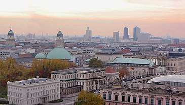 Panoramic view of Mitte | |
.png) Coat of arms | |
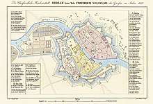
Location of Mitte in Mitte district and Berlin 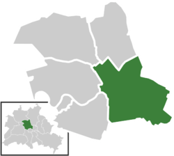 | |
 Mitte 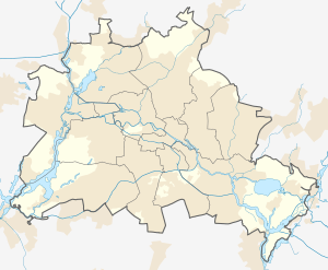 Mitte | |
| Coordinates: 52°31′10″N 13°24′24″E | |
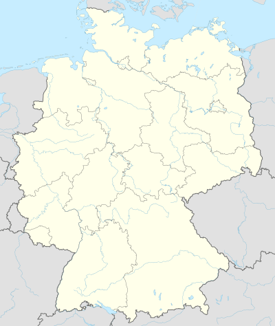
| Country | Germany |
| State | Berlin |
| City | Berlin |
| Borough | Mitte |
| Founded | 1920 |
| Subdivisions | 13 zones |
| Area | |
| • Total | 10.7 km2 (4.1 sq mi) |
| Elevation | 52 m (171 ft) |
| Population (2009-06-30) | |
| • Total | 79,582 |
| • Density | 7,400/km2 (19,000/sq mi) |
| Time zone | CET/CEST (UTC+1/+2) |
| Postal codes | (nr. 0101) 10115, 10117, 10119, 10178, 10179, 10435 |
| Vehicle registration | B |

It comprises the historic centre of Alt-Berlin around the churches of St. Nicholas and St. Mary, renowned Museum Island, the city hall Rotes Rathaus, the city administrative building Altes Stadthaus, the famous Fernsehturm, Brandenburg Gate at the end of the central boulevard Unter den Linden and more main tourist attractions of the city. For these reasons Mitte is considered the "heart" of Berlin.
History
The history of Mitte corresponds to the history of the entire city until the early 20th century, and with the Greater Berlin Act in 1920 it became the first district of the city. It was among the areas of the city most heavily damaged in World War II.
Following a territorial redeployment by the Soviet Union and the United Kingdom that reshaped the borders of West Berlin's British Sector in August 1945, the western part of Staaken became in effect as of 1 February 1951 an exclave of Mitte, then still a borough of East Berlin. This ended on 1 January 1961, when western Staaken was incorporated into then East German Falkensee, which had already been under its de facto administration since 1 June 1952.
Between 1961 and 1990 Mitte, one of the most important boroughs of East Berlin but close to all three western sectors of the city, was almost surrounded by the Berlin Wall. One of the most important border crossings was Checkpoint Charlie, near Kreuzberg.[1]
Geography
Position
Situated in central Berlin and mostly in its old town, it is traversed by the river Spree. It borders the localities of Tiergarten, Moabit, Wedding, Gesundbrunnen, Prenzlauer Berg (in Pankow district), Friedrichshain, and Kreuzberg (both in Friedrichshain-Kreuzberg district).
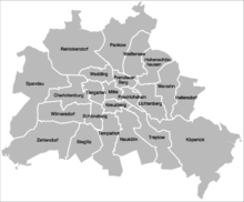
Subdivision
Mitte is subdivided into 13 zones or neighborhoods (Stadtviertel) (the numbers refer to the map above right):
- Cölln (1)
- Museum Island (1a)
- Fisher Island (1b)
- Alt-Berlin (2)
- Nikolaiviertel (2a)
- Friedrichswerder (3)
- Neukölln am Wasser (4)
- Dorotheenstadt (5)
- Friedrichstadt (6)
- Luisenstadt (7)
- Stralauer Vorstadt (8)
- Alexanderplatz (9)
- Spandauer Vorstadt (10)
- Scheunenviertel (10a)
- Friedrich-Wilhelm-Stadt (11)
- Oranienburger Vorstadt (12)
- Rosenthaler Vorstadt (13)
Main sights
Buildings and structures
- Alte Nationalgalerie
- Altes Museum
- Altes Stadthaus
- Berlin Cathedral
- Berlin State Opera
- Berliner Ensemble
- Brandenburg Gate
- Bode Museum
- Bundesrat of Germany
- Checkpoint Charlie
- Deutscher Dom
- Fernsehturm Berlin
- Französischer Dom
- Friedrichstadt-Palast
- Friedrichswerder Church
- Humboldt University
- James Simon Gallery
- Konzerthaus Berlin
- Kunsthaus Tacheles
- Marienkirche
- Neue Synagoge
- Neues Museum
- Nikolaikirche
- Palast der Republik
- Pergamon Museum
- Reich Air Ministry
- Rotes Rathaus
- St. Hedwig's Cathedral
- Sophienkirche
- Staatsratsgebäude
- Stadtschloß
Places, squares and streets
- Alexanderplatz
- Bernauer Straße
- Friedrichstraße
- Gendarmenmarkt
- Karl-Marx-Allee
- Leipziger Straße
- Lustgarten
- Marx-Engels-Forum
- Molkenmarkt
- Museum Island
- Nikolaiviertel
- Oranienburger Straße
- Pariser Platz
- Potsdamer Platz
- Schloßplatz
- Unter den Linden
Photogallery
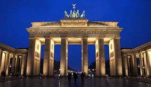 Brandenburg Gate
.jpg) Fernsehturm
Fernsehturm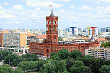 Rotes Rathaus
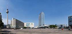 Alexanderplatz
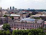 Unter den Linden
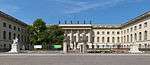 Humboldt University of Berlin
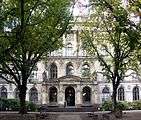 Museum für Naturkunde
 Potsdamer Platz
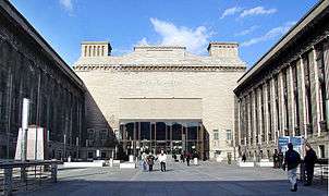 Pergamon Museum
 Berlin Cathedral and Karl-Liebknecht-Straße
 Inside Berlin State Opera
.JPG) Nikolaiviertel
Nikolaiviertel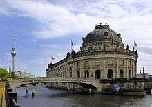 Museum Island
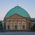 St. Hedwig's Cathedral
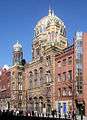 Neue Synagoge
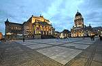 Gendarmenmarkt with Französischer Dom and Konzerthaus
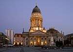 Deutscher Dom
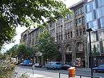 Kunsthaus Tacheles
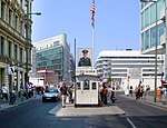 Checkpoint Charlie on Friedrichstrasse
 Sophie-Gips-Höfe
Transportation
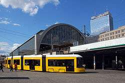
Mitte is served by S-Bahn lines S5, S7, S75, S9 (both on Berlin Stadtbahn); S1, S2, S25, and U-Bahn lines U2, U5, U6 and U8, as well as numerous tram and bus lines.
See also
- Berlin Alexanderplatz railway station
- Berlin Friedrichstrasse railway station
- Berlin Potsdamer Platz railway station
References
- (in German) Historical infos about Mitte
External links
| Wikivoyage has a travel guide for Berlin/Mitte. |
![]()
| | ||
| |
| |
| |
| |
| |
| |
| |
| |
| |
| |
| |
| |
| |
| West boroughs (1920–2000) |
|  |
|---|---|---|
| East boroughs (1920–2000) |
| |