Interstate 295 (New York)
Interstate 295 (I-295) is an Interstate Highway within New York City. Measuring 9.10 miles (14.6 km) in length, I-295 originates at Hillside Avenue (New York State Route 25 or NY 25) in Queens, running north across Queens and over the tolled Throgs Neck Bridge, to Bruckner Interchange, a junction with I-95, I-278, I-678, and the Hutchinson River Parkway in the Bronx. From south to north, I-295 intersects the Grand Central Parkway, I-495 (the Long Island Expressway), and the Cross Island Parkway in Queens before crossing the Throgs Neck Bridge and splitting with the I-695 (Throgs Neck Expressway). In Queens, I-295 is also known as the Clearview Expressway.
| ||||
|---|---|---|---|---|
%26groups%3D_db3add2d040cf949ee6c2b469ddbb37d32b0eef4.svg)
Map of New York City area with I-295 highlighted in red | ||||
| Route information | ||||
| Auxiliary route of I-95 | ||||
| Maintained by NYSDOT and MTAB&T | ||||
| Length | 9.79 mi[1] (15.76 km) | |||
| History | Completed in 1963 as I-78;[2][3] renumbered to I-295 on January 1, 1970[4] | |||
| Major junctions | ||||
| South end | ||||
| ||||
| North end | ||||
| Location | ||||
| Counties | Queens, Bronx | |||
| Highway system | ||||
| ||||
.svg.png)
The entirety of I-295 was proposed in 1955 as a part of I-78. Construction started in 1957, and the highway opened in 1963 with the I-78 designation. Originally, plans called for I-78 to be extended southeastward from Holland Tunnel in Manhattan to NY 878 (the Nassau Expressway) in Queens, before curving north to meet the Clearview Expressway. These plans were canceled in 1970, at which point the highway between NY 25 in Queens and I-95 in the Bronx was redesignated as I-295. I-295 was originally planned to continue further south to JFK Airport. The 2.5-mile (4.0 km) JFK Expressway, constructed in the 1980s, was intended to be part of I-295, but was constructed only as far north as the Belt Parkway.
Route description
The existing section of the Clearview Expressway that carries the I-295 designation begins at the unfinished interchange with NY 25 where the ramps from northbound NY 24 (212th Street) and southbound Hollis Court Boulevard merge into the northbound and southbound lanes, respectively, of the highway.[5] The Queens section of this roadway is known as "The 77th Infantry Division Expressway".[6] The Queens expressway instantly runs beneath a stack interchange[5] with the Grand Central Parkway[7] before immediately entering Cunningham Park. The Clearview leaves Cunningham Park at the interchange with Long Island Expressway (now I-495).[5]
Shortly north of the I-495 interchange, the northbound off-ramp and southbound on-ramp at NY 25A split, then run under a pedestrian bridge that connects 46th Avenue. Other pedestrian bridges cross over the highway near 42nd Avenue and at 33rd Avenue. The northbound exit 5 uses 206th Street as a de facto service road, while 207th Street is used in the same way for the northbound on-ramps. Real service roads run beneath the Port Washington Branch of the Long Island Rail Road to connect NY 25A and 35th Avenue (exit 6A). The service roads merge into the expressway north of 26th Avenue (exit 6B).[5]
The northbound partial interchange with Willets Point & Bell Boulevards leads to Cross Island Parkway, while a southbound interchange leads to the southbound Cross Island Parkway, all before reaching the Throgs Neck Bridge.[7][5] The expressway then crosses the bridge.[7][5]
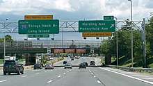
After the Throgs Neck toll booth in the Bronx, I-295 becomes part of the Cross Bronx Expressway Extension. Just north of the toll booth is northbound access to Harding Avenue and Pennyfield Avenue. The exit is right next to the Y-interchange with I-695 (Throgs Neck Expressway), which takes motorists to northbound I-95. The only other interchange between there and the terminus is Randall Avenue.[7][5]
I-295, running northwest, gains service roads for a mile until it finally ends at its parent route at the Bruckner Interchange, but only includes access to southbound I-95, and I-278.[7][5]
History
The Clearview Expressway and Cross Bronx Expressway Extension were proposed in 1955 by the Port Authority and Triborough Bridge and Tunnel Authority (TBTA) as part of the Port Authority's Joint Study of Arterial Facilities, in order to connect with the planned Throgs Neck Bridge. The Cross Bronx extension was planned to connect the bridge to several highways at the Bruckner Circle (now the Bruckner Interchange), while the Clearview was intended to connect with Horace Harding Boulevard (later the Long Island Expressway) in order to serve motorists from Long Island.[8][9][10]
Initially, the Clearview was intended to run along the existing right-of-ways of Utopia Parkway and Francis Lewis Boulevard.[8][9][11] An alternate proposed routing would have run along Little Neck Bay and through Alley Pond Park, essentially parallel to the Cross Island Parkway.[12] By September 1956, the Clearview was mapped along 206th and 207th Streets and Hollis Court Boulevard, east of Francis Lewis Boulevard, after community opposition.[11][13][14][15] The reroute reduced the number of properties to be demolished or relocated from 860 to 421. An information center was set up by the TBTA for local residents displaced by the expressway.[11][13][16]
The planning of the Clearview Expressway route by Robert Moses is documented in Robert Caro's biography of Moses, The Power Broker. A passage describes Moses and TBTA officials surveying potential routes for the highway in Queens, accidentally coming across protesters against the expressway. Caro writes that rather than being deterred by the protests, Moses "laughed and laughed" according to one aide's account.[17][18]
Construction on the Clearview Expressway and Throgs Neck Bridge began in September 1957.[19][20][21] As part of the project, land was taken from Clearview Park, the defunct Bayside Golf Course, and Cunningham Park.[20][21][22][23] Meanwhile, hundreds of homes were physically relocated from the path of the expressway. Many of these houses were placed in planned communities built on the sites of the Bayside Golf Course, and the Oakland Country Club in Oakland Gardens.[13][24] The Cross Bronx extension, the Throgs Neck Bridge, and the portion of the Clearview Expressway north of 73rd Avenue in Queens were opened on January 11, 1961.[25][26]
An extension of the Clearview south to Hillside Avenue (now NY 25) was opened to traffic on August 12, 1963.[27] It was the first of several highways built to serve the 1964 New York World's Fair.[28] Because of the steep hill at the end of the expressway leading to Hillside Avenue, the junction quickly became a frequent spot for accidents. This led to the implementation of a 40-mile-per-hour (64 km/h) speed limit at the end of the highway, which remains in effect.[29] This section of the route is a notorious speed trap. The modern Bruckner Interchange was opened on January 4, 1972.[30]
The Cross Bronx Expressway Extension and the Clearview Expressway were originally designated as part of I-78,[28][31][32] which was to continue south from Hillside Avenue through Southeast Queens, and west across Queens, Brooklyn, and Manhattan to the Holland Tunnel. Under these plans, the Clearview would have been extended south to NY 27 (Conduit Avenue) and the Belt Parkway, or to the Nassau Expressway and Rockaway Boulevard, in Laurelton near JFK Airport.[33][34][35] Later plans had the Clearview ending farther east, intersecting with the Belt Parkway at its interchange with the Southern State Parkway.[36] A 1968 proposal from the Regional Plan Association had the Clearview extension running southeast along 212th Street/Hollis Court Boulevard and Hempstead Avenue, then south along the right-of-ways of the Cross Island and Belt Parkways before ending at the Nassau Expressway.[37]:46−47 Ultimately, nearly all sections of I-78 between the Holland Tunnel and Hillside Avenue, including the Lower Manhattan Expressway, Bushwick Expressway, and the Clearview extension were cancelled by Governor Nelson Rockefeller in 1971. The only portion to be constructed was the short section of the Nassau Expressway near JFK Airport.[9][31][38][39] This resulted in the renumbering of all of I-78 north of Hillside Avenue to I-295 on January 1, 1970.[4]
There have been proposals during the 21st century to extend the Clearview south to feed into the JFK Expressway via a tunnel.[40][41] The JFK Expressway had been built as part of a costly overhaul of the JFK Airport that began in the late 1980s.[31][42] The JFK Expressway south of the Nassau Expressway and 150th Street was completed around 1986,[43] and it was fully completed by 1991.[44]
In February 2003, the Clearview Expressway was renamed "The 77th Infantry Division Expressway".[45][46] The name honors the U.S. Army's 77th Infantry Division of World War I and World War II fame. Raised from draftees from New York City and Long Island, the 77th was also known as the Statue of Liberty Division, due to its shoulder-sleeve insignia.[6]
Exit list
| Borough | Location | mi [1][5][47][48] | km | Exit | Destinations | Notes |
|---|---|---|---|---|---|---|
| Queens | Cunningham Park | 0.00 | 0.00 | – | At-grade intersection; unsigned western terminus of NY 24 | |
| 0.17 | 0.27 | 1 | Stack interchange; exit 21 on Grand Central Parkway | |||
| 0.81 | 1.30 | 2 | Union Turnpike | Formerly NY 25C | ||
| 1.31 | 2.11 | 3 | 73rd Avenue | Southbound exit and northbound entrance | ||
| Fresh Meadows | 1.70 | 2.74 | 4 | Signed as exits 4E (east) and 4W (west); exist 27N-S on I-495 | ||
| 2.70 | 4.35 | 5 | Access to Flushing Hospital Medical Center | |||
| Bayside | 3.30 | 5.31 | 6A | 35th Avenue | Signed as exit 6 northbound | |
| 4.20 | 6.76 | 6B | 26th Avenue | Southbound exit and northbound entrance | ||
| 4.91 | 7.90 | 7 | Willets Point Boulevard | Northbound exit and southbound entrance | ||
| 5.41 | 8.71 | 8 | Southbound exit and northbound entrance; exit 33 on Cross Island Parkway | |||
| East River | 5.44– 7.31 | 8.75– 11.76 | Throgs Neck Bridge | |||
| The Bronx | Locust Point | 7.71 | 12.41 | 9 | Harding Avenue / Pennyfield Avenue – Fort Schuyler | |
| Throggs Neck | 8.04 | 12.94 | 10 | Northbound exit and southbound entrance; southern terminus of I-695 | ||
| 8.81 | 14.18 | 11 | Randall Avenue | |||
| 9.79 | 15.76 | 12 | Bruckner Interchange; northbound exit and southbound entrance; eastern terminus of I-278 | |||
| – | Bruckner Interchange; exit 6A on I-95 | |||||
1.000 mi = 1.609 km; 1.000 km = 0.621 mi
| ||||||
See also
References
- "2008 Traffic Volume Report for New York State" (PDF). New York State Department of Transportation. June 16, 2009. p. 208. Archived from the original (PDF) on September 27, 2012. Retrieved February 1, 2010.
- New York and Metropolitan New York (Map) (1961–62 ed.). Cartography by H.M. Gousha Company. Sunoco. 1961.
- New York Happy Motoring Guide (Map) (1963 ed.). Cartography by General Drafting. Esso. 1963.
- State of New York Department of Transportation (January 1, 1970). Official Description of Touring Routes in New York State (PDF). Retrieved July 12, 2010.
- Google (September 12, 2017). "overview of Interstate 295" (Map). Google Maps. Google. Retrieved September 12, 2017.
- Boland, Ed, Jr. (January 28, 2003). "F.Y.I." The New York Times. Retrieved February 28, 2017.
- "2010 Traffic Volume Report for New York State" (PDF). New York State Department of Transportation. July 25, 2011. pp. 204–205. Archived from the original (PDF) on September 27, 2012. Retrieved April 9, 2012.
- "Cost Is 600 Million: 2 Authorities to Raise Two-Thirds of Funds-Fix 1960 as Goal" (PDF). The New York Times. January 17, 1955. Retrieved February 28, 2017.
- "Clearview's Tail". New York City Department of Parks and Recreation. Retrieved February 28, 2017.
- "Excerpts From Proposal to Meet City's Bridge and Highway Needs for Next 2 Decades". The New York Times. January 17, 1955. Retrieved March 25, 2017.
- "Queens Approach Agreed On For New Throgs Neck Bridge" (PDF). The New York Times. September 26, 1956. Retrieved February 28, 2017.
- "Queens Road Site Still Undecided: But Estimate Board Will Fix Route Today for Disputed Clearview Expressway". The New York Times. September 19, 1957. Retrieved February 28, 2017.
- Triborough Bridge and Tunnel Authority (January 4, 1957). "The Facts About The Clearview Expressway" (PDF). Long Island Star-Journal. p. 7. Retrieved February 28, 2017 – via Fultonhistory.com.
- "Route Set". The New York Times. September 26, 1956. Retrieved February 28, 2017.
- Crowell, Paul (May 17, 1957). "Throgs Neck Span Is Seen In Peril" (PDF). The New York Times. Retrieved February 28, 2017.
- "RELOCATION SPURRED; Center Set Up to Aid Persons in Path of Queens Road". The New York Times. December 31, 1956. Retrieved February 28, 2017.
- "Clearview Expressway (I-295): Historic Overview". nycroads.com. Retrieved March 4, 2017.
- Caro, Robert (1974). The Power Broker: Robert Moses and the Fall of New York. New York: Knopf. p. 849. ISBN 978-0-394-48076-3. OCLC 834874.
- Triborough Bridge and Tunnel Authority (1961). Throgs Neck Bridge. Triborough Bridge and Tunnel Authority. Retrieved February 28, 2017.
- "Clearview Park Golf Course: History". New York City Department of Parks and Recreation. Retrieved February 28, 2017.
- "Little Bay Park: History". New York City Department of Parks and Recreation. Retrieved February 28, 2017.
- "Cunningham Park: History". New York City Department of Parks and Recreation. Retrieved February 28, 2017.
- "Trees Give Way to Queens Road" (PDF). The New York Times. July 25, 1961. Retrieved February 28, 2017.
- Feron, James (August 9, 1958). "City Ready to Move 200 Houses For Clearview Route in Queens". The New York Times. Retrieved February 28, 2017.
- "Throgs Bridge, Clearview Expressway Open". Long Island Star-Journal. January 11, 1961. pp. 1, 2 – via Fultonhistory.com.
- Phillips, McCandlish (January 12, 1961). "Throgs Neck Bridge Is Opened To No Pomp and Little Traffic" (PDF). The New York Times. Retrieved March 4, 2010.
- "World's Fair Road Ready". Daily News (New York, New York). August 7, 1963. p. 1B.
- "First Road Finished for Fair Complex" (PDF). The New York Times. August 11, 1963. Retrieved February 28, 2017.
- "QUEENS JUNCTION IMPERILS DRIVERS; Hill in Jamaica Bars View of Heavily Traveled Road" (PDF). The New York Times. October 27, 1963. Retrieved February 28, 2017.
- Witkin, Richard (January 5, 1972). "City's 'Worst Traffic Bottleneck' Is Opened a Little". The New York Times. p. 1. Retrieved February 28, 2017.
- Nassau Expressway Construction, New York City: Environmental Impact Statement. United States Department of Transportation, Federal Transit Administration, New York State Department of Transportation. 1981. Retrieved February 28, 2017.
- New York with Sight-Seeing Guide (Map) (1962 ed.). Cartography by General Drafting. Esso. 1962.
- New York and New Jersey Tourgide Map (Map). Cartography by Rand McNally and Company. Gulf Oil Company. 1960.
- "Expressway Plans". Regional Plan News. Regional Plan Association (73–74): 1–18. May 1964. Retrieved February 27, 2017.
- Ingraham, Joseph C. (March 5, 1957). "State Road Plans Snarled By Political Tugs of War; Study of Long-Range Program Linked to National System Finds a Financial Muddle and Lack of Initiative". The New York Times. Retrieved February 28, 2017.
- Ingraham, Joseph C. (July 14, 1966). "4 OF MOSES' ROADS GET CITY PRIORITY; Ex-Coordinator Fought 5th, the Cross-Brooklyn Route" (PDF). The New York Times. p. 24. Retrieved February 28, 2017.
- Towery, F. Carlisle (April 1968). "Jamaica Center: A Report of the Second Regional Plan" (PDF). Regional Plan Association. Retrieved October 20, 2017.
- Cliness, Francis X. (March 25, 1971). "Lower Manhattan Road Killed Under State Plan" (PDF). The New York Times. p. 78. Retrieved April 14, 2010.
- New York State Highways (Map). Cartography by Rand McNally and Company. New York State Department of Commerce. 1969.
- Zupan, Jeffrey M.; Barone, Richard E.; Lee, Mathew H. (January 2011). "Upgrading to World Class: The Future of the New York Region's Airports" (PDF). Regional Plan Association. Archived from the original (PDF) on September 24, 2015. Retrieved March 15, 2017.
- Bearak, Corey (August 12, 2004). "The Public Ought To Know: City needs to improve freight access to Kennedy". TimesLedger. Retrieved March 26, 2017.
- Schmitt, Eric (February 2, 1987). "NEW YORK AIRPORTS: $3 BILLION PROGRAM". The New York Times. Retrieved March 25, 2017.
- Boorstin, Robert O. (October 29, 1986). "COLUME ONE; TRANSPORT". The New York Times. Retrieved March 11, 2017.
- Steinberg, Jacques (December 28, 1991). "Port Authority Plans Changes at Kennedy". New York Times.
- Newman, Philip (February 13, 2003). "Expressway now honors military unit". TimesLedger. Retrieved February 28, 2017.
- Wade, Jared (February 20, 2003). "EXPRESSWAY TO BE RENAMED FOR 77TH INFANTRY". Daily News (New York). Retrieved February 28, 2017.
- "Queens County Inventory Listing" (CSV). New York State Department of Transportation. August 7, 2015. Retrieved September 5, 2017.
- "Bronx County Inventory Listing" (CSV). New York State Department of Transportation. August 7, 2015. Retrieved September 5, 2017.
External links
| Wikimedia Commons has media related to Interstate 295 (New York). |
- Interstate 295 at Alps' Roads • New York Routes
- I-295 on Kurumi.com
- nycroads.com Clearview Expressway(I-295) info.
- I-295 (Greater New York Roads)
Auxiliary routes of Interstate 95 | ||
|---|---|---|
| ||
| ||