Zlatitsa
Zlatitsa (Bulgarian: Златица) is a town and the seat of the Zlatitsa Municipality in southern Bulgaria located in the Zlatitsa-Pirdop valley. It lies between Stara Planina to the north and Sredna Gora to the south at 680 metres (2,230 ft) above sea level. It is situated immediately south in the lap of the Zlatitsa -Teteven Mountain. Zlatitsa is situated 75 kilometres (47 mi) east of Sofia, 27 kilometres (17 mi) south of Etropole, 32 kilometres (20 mi) north of Panagiurishte, 2 kilometres (1.2 mi) west of Pirdop and 32 kilometres (20 mi) northwest of Koprivshtitsa. The population is 5,286.[1]
Zlatitsa Златица | |
|---|---|
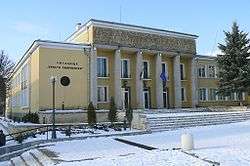 Chitalishte Hristo Smirnenski | |
 Coat of arms | |
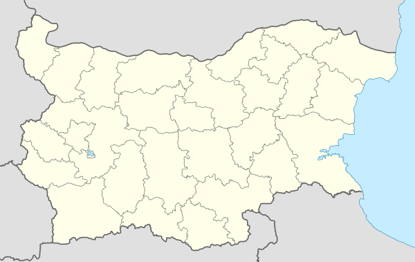 Zlatitsa Location of Zlatitsa | |
| Coordinates: 42°43′N 24°08′E | |
| Country | Bulgaria |
| Provinces (Oblast) | Sofia |
| Government | |
| • Mayor | Georgi Gerginekov |
| Elevation | 680 m (2,230 ft) |
| Population (01/01/2007) | |
| • Total | 5 286 |
| Time zone | UTC+2 (EET) |
| • Summer (DST) | UTC+3 (EEST) |
| Postal Code | 2080 |
| Area code(s) | 0728 |
The main highway Sofia - Karlovo - Bourgas as well as the main railway line Sofia - Karlovo - Bourgas passes through it.
9 kilometres (5.6 mi) south of Zlatitsa is the Old Kemer – a bridge spanning the river Topolnitsa from Roman times. The church complex called Spasovo Kladenche is 500 metres (550 yd) away from the town. The park monument Kambana can be found in the nearby village of Petrich.
The Battle of Zlatitsa was fought nearby on 12 December 1443.[2]
Between 1 April 1978 and 31 August 1991, Zlatitsa together with Pirdop formed a single town called Srednogorie.[3]
Notable people
- Valko Chervenkov, Bulgarian politician
References
- Dinchev, Evgheni (2002). A Guide to Bulgaria. Alexander Tour. p. 105. ISBN 954-9-94235-X.
- Mellersh, H. E. L.; Williams, Neville (1999). Chronology of World History. ABC-CLIO. p. 527. ISBN 978-1-57607-155-7.
- "Srednogorie". Retrieved 8 August 2017.

Capital: Zlatitsa | ||
| Villages |  | |
| Landmarks | ||
| Culture | ||
| Notable people |
| |