Zilwaukee, Michigan
Zilwaukee is a city in Saginaw County in the U.S. state of Michigan. The 2010 census places the population at 1,658. The city is adjacent to and was created from Zilwaukee Township. It is the home of the Zilwaukee Bridge.
Zilwaukee, Michigan | |
|---|---|
| City of Zilwaukee | |
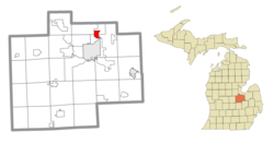 Location within Saginaw County | |
 Zilwaukee Location within the state of Michigan | |
| Coordinates: 43°28′44″N 83°55′13″W | |
| Country | United States |
| State | Michigan |
| County | Saginaw |
| Founded | 1848 |
| Government | |
| • Type | Council–manager |
| • Mayor | Eugene Jolin |
| Area | |
| • Total | 2.37 sq mi (6.13 km2) |
| • Land | 2.21 sq mi (5.73 km2) |
| • Water | 0.16 sq mi (0.40 km2) |
| Elevation | 584 ft (178 m) |
| Population | |
| • Total | 1,658 |
| • Estimate (2018)[3] | 1,537 |
| • Density | 701.94/sq mi (271.04/km2) |
| Time zone | UTC-5 (Eastern (EST)) |
| • Summer (DST) | UTC-4 (EDT) |
| ZIP code(s) | |
| Area code(s) | 989 |
| FIPS code | 26-89320[4] |
| GNIS feature ID | 1616929[5] |
| Website | Official website |
History
Zilwaukee was founded in 1848 when Daniel and Solomon Johnson, two brothers from New York City, built a saw mill there. Officially organized ten years later, the Johnsons gave the name Zilwaukee to the town purposely to cause people to confuse it with the city of Milwaukee, Wisconsin, in hopes of luring settlers there to work.[6]
Zilwaukee is the hometown of former major league baseball player Al Luplow.
Geography
According to the United States Census Bureau, the city has a total area of 2.37 square miles (6.14 km2), of which 2.21 square miles (5.72 km2) is land and 0.16 square miles (0.41 km2) is water.[7]
Demographics
| Historical population | |||
|---|---|---|---|
| Census | Pop. | %± | |
| 1880 | 915 | — | |
| 1970 | 2,072 | — | |
| 1980 | 2,201 | 6.2% | |
| 1990 | 1,850 | −15.9% | |
| 2000 | 1,799 | −2.8% | |
| 2010 | 1,658 | −7.8% | |
| Est. 2018 | 1,537 | [3] | −7.3% |
| U.S. Decennial Census[8] | |||
2010 census
As of the census[2] of 2010, there were 1,658 people, 671 households, and 442 families living in the city. The population density was 750.2 inhabitants per square mile (289.7/km2). There were 723 housing units at an average density of 327.1 per square mile (126.3/km2). The racial makeup of the city was 92.3% White, 3.7% African American, 0.5% Native American, 0.3% Asian, 1.6% from other races, and 1.6% from two or more races. Hispanic or Latino of any race were 7.7% of the population.
There were 671 households, of which 30.4% had children under the age of 18 living with them, 50.1% were married couples living together, 10.7% had a female householder with no husband present, 5.1% had a male householder with no wife present, and 34.1% were non-families. 27.3% of all households were made up of individuals, and 12.2% had someone living alone who was 65 years of age or older. The average household size was 2.47 and the average family size was 2.97.
The median age in the city was 40 years. 22.1% of residents were under the age of 18; 9.8% were between the ages of 18 and 24; 25.8% were from 25 to 44; 25.6% were from 45 to 64; and 16.6% were 65 years of age or older. The gender makeup of the city was 49.8% male and 50.2% female.
2000 census
As of the census of 2000,[4] there were 1,799 people, 711 households, and 509 families living in the city. The population density was 810.7 per square mile (312.9/km2). There were 729 housing units at an average density of 328.5 per square mile (126.8/km2). The racial makeup of the city was 93.94% White, 1.78% African American, 0.44% Native American, 0.50% Asian, 2.61% from other races, and 0.72% from two or more races. Hispanic or Latino of any race were 6.23% of the population.
There were 711 households, out of which 28.1% had children under the age of 18 living with them, 57.8% were married couples living together, 10.4% had a female householder with no husband present, and 28.3% were non-families. 22.9% of all households were made up of individuals, and 9.1% had someone living alone who was 65 years of age or older. The average household size was 2.53 and the average family size was 2.98.
In the city, the population was spread out, with 23.5% under the age of 18, 6.7% from 18 to 24, 31.2% from 25 to 44, 24.5% from 45 to 64, and 14.2% who were 65 years of age or older. The median age was 37 years. For every 100 females, there were 95.3 males. For every 100 females age 18 and over, there were 93.7 males.
The median income for a household in the city was $42,014, and the median income for a family was $47,981. Males had a median income of $37,292 versus $25,586 for females. The per capita income for the city was $19,491. About 5.7% of families and 6.4% of the population were below the poverty line, including 10.4% of those under age 18 and 5.8% of those age 65 or over.
References
- "2017 U.S. Gazetteer Files". United States Census Bureau. Retrieved Jan 3, 2019.
- "U.S. Census website". United States Census Bureau. Retrieved 2012-11-25.
- "Population and Housing Unit Estimates". Retrieved January 11, 2020.
- "U.S. Census website". United States Census Bureau. Retrieved 2008-01-31.
- "US Board on Geographic Names". United States Geological Survey. 2007-10-25. Retrieved 2008-01-31.
- "History of Zilwaukee". City of Zilwaukee. Archived from the original on July 21, 2011. Retrieved 2010-11-25.
To attract more local settlers, the Johnson's [sic] named their establishment 'Zilwaukie' to confuse the settlers into thinking that they were going to Milwaukee.
- "US Gazetteer files 2010". United States Census Bureau. Archived from the original on February 20, 2011. Retrieved 2012-11-25.
- "Census of Population and Housing". Census.gov. Retrieved June 4, 2015.
External links
Municipalities and communities of Saginaw County, Michigan, United States | ||
|---|---|---|
| Cities | 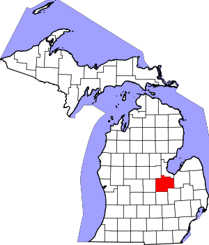 Map of Michigan highlighting Saginaw County.svg | |
| Villages | ||
| Charter townships | ||
| Civil townships | ||
| CDPs | ||
| Other unincorporated communities |
| |
| Footnotes | ‡This populated place also has portions in an adjacent county or counties | |