Zhusha, Xinyi
Zhusha (Chinese: 朱砂; pinyin: Zhūshā) is a town in the northwest of Xinyi city, Guangdong province, China, which is located in 22°33′N 110°56′E. It is merged by the original Zhusha, Ane and Wangsha three towns in 2003, with a total area of 282 square kilometers and a population of over 90 thousands. It is the biggest town in Xinyi city.[1]
Zhusha Town 朱砂镇 | |
|---|---|
 | |
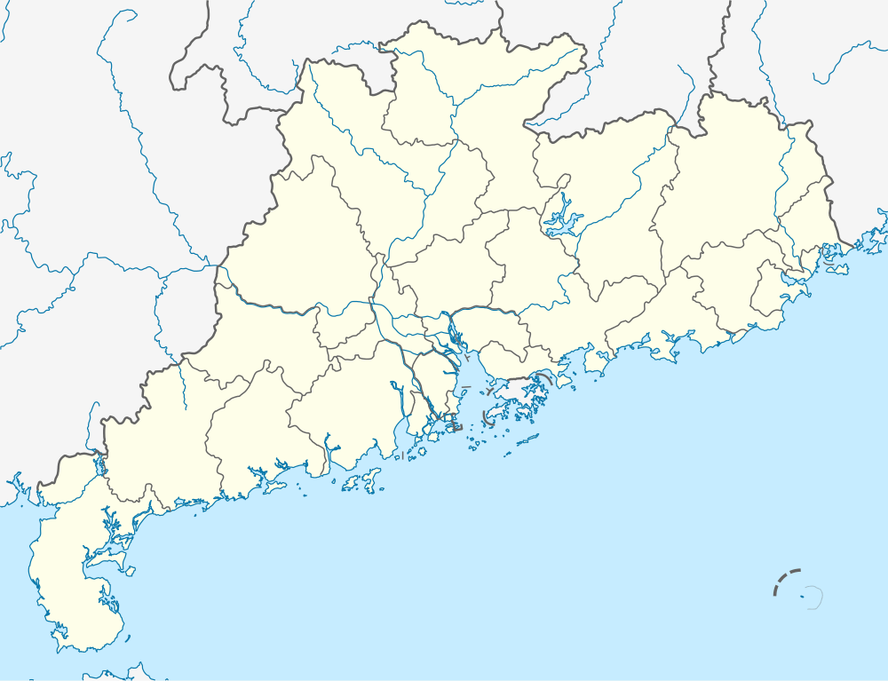 Zhusha Town Location in Guangdong | |
| Coordinates: 22°33′N 110°56′E | |
| Country | China |
| Province | Guangdong |
| County-level city | Xinyi |
| Area | |
| • Total | 282 km2 (109 sq mi) |
| Population | 90,000 |
| Demonym(s) | Cantonese |
| Time zone | UTC+8 (China Standard) |
| Postal code | 525357 |
| Area code(s) | + 86 0668 |
History
Zhusha, got its name because of the Vermilion Ridge (also named Rouge Hill in ancient times). It first belonged to Liangde county (梁德县) during Liang, Chen, Sui dynasty, then belonged to Huaide county (怀德县) during Tang, five dynasties and Song dynasty, later it belonged to the middle road of Xinyi County (信宜县) during the last of Song and Yuan dynasty, and then named as Xinfengdu (信丰都) belonged to Xining county (西宁县) during Ming dynasty. It was renamed as Dasheng castle (大胜堡) belonged to Xinyi County (信宜县) at the beginning of the Qing dynasty, and renamed as Xinyi County sixth area Zhusha village (信宜县六区朱砂乡) in 1932, and then renamed again as the Third victory county (三区大胜乡) in 1940.
In December 1952, it was named as the Sixth district of Xinyi County (信宜县第六区), and in February 1957 named as Zhuasha county (朱砂乡); and in the Autumn of 1958, the Zhusha People's commune (朱砂人民公社) was established and in June 1961, named as Zhusha district (朱砂区).
However, it was renamed as Zhusha People's commune (朱砂人民公社) again in January 1963, and then renamed back as Zhusha district (朱砂区) in December 1983; and then in the winter of 1986, formed as Zhusha Town (朱砂镇). On November 26, 2003, it is merged with Ane(安莪) and Wangsha(旺沙) to be the Zhusha Town now.[2]
Administration
Administratively, Zhusha Town is under the jurisdiction of Xinyi. It is a town-level city, which consists of three parts, including Zhusha, Wangsha and Ane. It administers 32 village-level divisions.[3]
| Name | Simplified Chinese | Location in Zhusha | Registered family | Population (2000 census) |
Area (km2) |
Arable area (acre) |
|---|---|---|---|---|---|---|
| Longbu village | 龙埠村 | South | 708 | 2812 | 6.68 | 1276 |
| Butou village | 埠头村 | South | 767 | 2930 | 6.05 | 1486 |
| Shigen village | 石根村 | North | 678 | 2556 | 6.07 | 1058 |
| Xilan village | 溪兰村 | Middle | 715 | 2888 | 8.31 | 1286 |
| Huashan village | 华山村 | West | 430 | 1493 | 6.19 | 892 |
| Sannan village | 三南村 | South | 495 | 1796 | 4.51 | 973 |
| Liucun village | 柳村村 | Southwest | 551 | 1939 | 5.61 | 1353 |
| Wenhua village | 文华村 | Northeast | 667 | 2549 | 7.57 | 1243 |
| Yanhe village | 燕贺村 | Northeast | 839 | 2894 | 8.98 | 1413 |
| Panlong village | 盘龙村 | East | 616 | 2229 | 9.34 | 1132 |
| Yanshui village | 燕水村 | South | 415 | 1651 | 5.29 | 891 |
| Zhusha village | 朱砂村 | Middle | 1572 | 5849 | 12.28 | 2354 |
| Pingzhai village | 平寨村 | North | 458 | 1765 | 3.54 | 773 |
| Shuangdi village | 双砥村 | Middle | 1107 | 4442 | 10.99 | 2313 |
| Gupan village | 古泮村 | Southeast | 403 | 1542 | 4.96 | 756 |
| Liantang village | 莲塘村 | Middle | 1457 | 5508 | 16.52 | 2039 |
| Yanchong village | 燕冲村 | Northeast | 574 | 1915 | 8.39 | 1014 |
| Wangsha village | 旺沙村 | Northeast | 969 | 2839 | 8.96 | 1288 |
| Shiyin village | 石印村 | Southwest | 673 | 2549 | 8.9 | 1634 |
| Daliu village | 大六村 | Southwest | 1094 | 4027 | 8.76 | 2124 |
| Wenliao village | 文料村 | West | 1021 | 3863 | 9.77 | 2271 |
| Guling village | 古令村 | West | 663 | 2459 | 7.17 | 1385 |
| Wangke village | 旺科村 | North | 511 | 2011 | 7.28 | 1405 |
| Padong village | 琶垌村 | West | 1007 | 3484 | 10.9 | 1710 |
| Liwu village | 里五村 | South | 1253 | 4907 | 11.38 | 2068 |
| Foshui village | 佛水村 | East | 575 | 2045 | 10.23 | 1263 |
| Linwo village | 林渥村 | East | 1196 | 3923 | 14.46 | 1878 |
| Jiatang village | 加塘村 | Northeast | 666 | 2332 | 8.76 | 1233 |
| Luolin village | 罗林村 | Southeast | 782 | 2825 | 13.46 | 1298 |
| Xinxu village | 新圩村 | East | 647 | 2192 | 7.15 | 1044 |
| Baitu village | 白土村 | Northwest | 843 | 3504 | 16.91 | 2310 |
Geography
Political geography
Zhusha Town is located in the north of the Xinyi city, 29 km from the urban area. It is bordered by Guizi Town and Chashan Town in the east, connected to Huaixiang Town and Chidong Town in the South, next to the Jindong Town in West, and adjacent to with Cenxi city, Guangxi province in the north.[4]
Landscape and climate
Zhusha has a subtropical climate with the average annual temperature over 20°C[5][6] and the average annual precipitation about 1800 mm. The landscape of Zhusha Town is mainly hills. It has rich mineral resources, including kaolin, granite, Mica, gold, silver, copper, iron, manganese, limestone and so on.[7] The land area of the whole town is about 119 850 acres, of which 41522 acres are arable.[8]

Transportation
- China National Highway 207
- G65 Baotou–Maoming Expressway
- Luoyang–Zhanjiang Railway[1]

Economy
In 2010, the industrial output of the whole town was more than 2 billion RMB. There were 2,158 self-employment industrial, 62 legal entities registered companies in the whole town. On the other hand, Zhusha Town is rich in mineral resources and water resources, including 19 hydroelectric stations at present, the total generating capacity over 50 million degrees in 2010. Its industrial type are mainly ethylene follow-up processing, ceramics and weaving and the agriculture are mainly rice, corn, cinnamon and plums.[9]

Education
There are one middle school, 15 elementary schools, 5 kindergartens in Zhusha Town.[10]
Culture

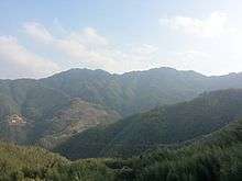
Shigen Mountain (石根山) is the most famous mountain in Zhusha Town with the height of 990 meters above sea level. It is the border along Guangdong and Guangxi province. The whole Zhusha town can be seen on the top of Shigen Mountain. There is concrete plank road built on the cliffs of the mid-levels.[11]
Lotus Temple (莲花祠) is located in the Liantang village of Zhusha Town with an area of 339.2 square meters. The temple was built with wood on a circular mound in Kangxi 61 years (1722) and got its name because it looks like a lotus flower. It is full of various murals, reliefs, wood carvings and there is a pond in front of the temple.[12]
References
- "The overview of Zhusha". Retrieved 20 June 2016.
- "The history of Zhusha Town". Retrieved 17 June 2016.
- "The administration of Zhusha". Retrieved 20 June 2016.
- "The geography of Zhusha Town". Retrieved 17 June 2016.
- "Celsius temperature scale". Retrieved 17 June 2016.
- "What Is the Difference Between Celsius and Centigrade?". Retrieved 17 June 2016.
- "The natural environment of Zhusha". Retrieved 20 June 2016.
- "Land and resources of Xinyi". Retrieved 20 June 2016.
- "The Economy of Zhusha Town". Retrieved 17 June 2016.
- "The Education of Xinyi". Retrieved 20 June 2016.
- "Shigen Mountain". Retrieved 17 June 2016.
- "Lotus Temple". Retrieved 17 June 2016.
External links
- Official website (in Chinese)