Yorkshire Dales National Park
The Yorkshire Dales National Park is a 2,178 km2 (841 sq mi) national park in England covering most of the Yorkshire Dales. The majority of the park is in North Yorkshire, with a sizeable area in Cumbria and a small part in Lancashire. The park was designated in 1954, and was extended in 2016. Over 20,000 residents live and work in the park, which attracts over eight million visitors every year.[1]
| Yorkshire Dales National Park | |
|---|---|
IUCN category V (protected landscape/seascape) | |
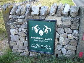 National park entrance sign, near Skipton | |
 Location and extent of the Yorkshire Dales National Park, as of August 2016 | |
| Location | North Yorkshire, Cumbria & Lancashire, England |
| Area | 2,178 km2 (841 sq mi) |
| Max. elevation | Whernside 736 m (2,415 ft) |
| Designation | National Park of England |
| Established | 1954 |
Location
The park is 50 miles (80 km) north-east of Manchester; Otley, Ilkley, Leeds and Bradford lie to the south, while Kendal is to the west, Darlington to the north-east and Harrogate to the south-east.[2] The national park does not include all of the Yorkshire Dales. Parts of the dales to the south and east of the national park are located in the Nidderdale Area of Outstanding Natural Beauty. The national park also includes the Howgill Fells and Orton Fells in the north west although they are not often considered part of the dales.
History
In 1947, the Hobhouse Report recommended the creation of the Yorkshire Dales National Park in the then West Riding and North Riding of Yorkshire. The proposed National Park included most of the Yorkshire Dales, but not Nidderdale. Accordingly, Nidderdale was not included in the National Park when it was designated in 1954. In 1963 the then West Riding County Council proposed that Nidderdale should be added to the National Park, but the proposal met with opposition from the district councils which would have lost some of their powers to the county council.
Following the Local Government Act 1972 most of the area of the national park was transferred in 1974 to the new county of North Yorkshire. An area in the north west of the national park (Dentdale, Garsdale and the town of Sedbergh) was transferred from the West Riding of Yorkshire to the new county of Cumbria. In 1997 management of the national park passed from the county councils to the Yorkshire Dales National Park Authority.[3]
2016 extension
A westward extension of the park into Lancashire and Cumbria encompasses much of the area between the old boundaries of the park and the M6 motorway. This increases the area by nearly 24% and brings the park close to the towns of Kirkby Lonsdale, Kirkby Stephen and Appleby-in-Westmorland.[4][5][6][7][8] The extension also includes the northern portion of the Howgill Fells and most of the Orton Fells.[9] Prior to the expansion, the national park was solely in the historic county of Yorkshire, the expansion bringing in parts of historic Lancashire and Westmorland.
Tourism
The area has a wide range of activities for visitors. For example, many people come to the Dales for walking or other exercise. Several long-distance routes cross the park, including the Pennine Way, the Dales Way, the Coast to Coast Walk and the Pennine Bridleway.[10] Cycling is also popular and there are several cycleways.[11]
The Dales Countryside Museum is housed in the converted Hawes railway station in Wensleydale in the north of the area.[12] The park also has five visitor centres.[13] These are at:
Other places and sights within the National Park include:
- Bolton Castle
- Clapham
- Cautley Spout waterfall
- Firbank Fell
- Gaping Gill
- Gayle Mill
- Hardraw Force
- Horton in Ribblesdale
- Howgill Fells
- Kisdon Force (waterfall) in Swaledale
- Leck Fell
- Malham Cove, Gordale Scar, Janet's Foss and Malham Tarn
- Orton Fells
- River Lune
- Sedbergh
- Settle
- Settle and Carlisle Railway including the Ribblehead Viaduct
- Wild Boar Fell
- The Yorkshire Three Peaks
References
- "Yorkshire Dales National Park Authority - Tourism Education file" (PDF). www.yorkshiredales.org.uk. Archived from the original (PDF) on 12 January 2012. Retrieved 20 September 2011.
- info@yorkshiredales.org.uk, Yorkshire Dales National Park Authority -. "Welcome to the Yorkshire Dales National Park".
- Ray Woolmore (May 2002). "Yorkshire Dales National Park" (PDF). Designation History Series. Natural England. Archived from the original (PDF) on 5 June 2014. Retrieved 11 May 2015.
- Natural England - Lakes to Dales Landscape Designation Project Archived 18 May 2012 at the Wayback Machine
- "Yorkshire Dales National Park expansion plans agreed". BBC News. 28 September 2011. Retrieved 29 September 2011.
- "Dales and Lakes national parks to 'join up' - but leak reveals there's no new money". BBC News.
- "Yorkshire Dales and Lake District national parks to be extended".
- "Yorkshire Dales and Lake District national parks extend". BBC News.
- "Yorkshire Dales expand into Lancashire in national parks land grab". The Guardian. The Guardian. Retrieved 20 January 2019.
- Yorkshire Dales National Park Authority - Things to do Archived 2 July 2010 at the Wayback Machine
- Cycle the Dales
- Yorkshire Dales National Park Authority - Dales Countryside Museum Archived 26 July 2010 at the Wayback Machine
- Yorkshire Dales National Park Authority - National Park Centres Archived 23 May 2010 at the Wayback Machine
External links
![]()
| Wikivoyage has a travel guide for Yorkshire Dales. |