Yorkana, Pennsylvania
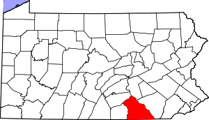
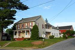
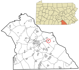
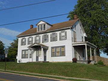
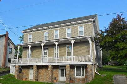
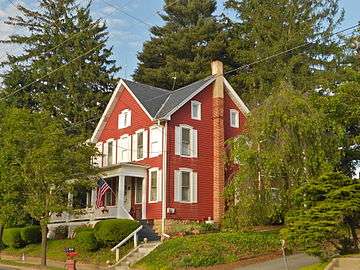
Yorkana is a borough in York County, Pennsylvania, United States. The population was 229 at the 2010 census.[3] It is a linear town, spread along Mt. Pisgah Road which is called Main Street in town.[4] The borough includes several dozen houses, two churches, and a few businesses.
Yorkana, Pennsylvania | |
|---|---|
Borough | |
 | |
 Location in York County and the U.S. state of Pennsylvania. | |
 Yorkana Location of Yorkana in Pennsylvania  Yorkana Yorkana (the United States) | |
| Coordinates: 39°58′28″N 76°35′06″W | |
| Country | United States |
| State | Pennsylvania |
| County | York |
| Settled | 1800 |
| Incorporated | 1913 |
| Government | |
| • Type | Borough Council |
| Area | |
| • Total | 0.17 sq mi (0.44 km2) |
| • Land | 0.17 sq mi (0.44 km2) |
| • Water | 0.00 sq mi (0.00 km2) |
| Elevation | 656 ft (200 m) |
| Population (2010) | |
| • Total | 229 |
| • Estimate (2018)[2] | 230 |
| • Density | 1,345.03/sq mi (518.01/km2) |
| Time zone | UTC-5 (Eastern (EST)) |
| • Summer (DST) | UTC-4 (EDT) |
| Zip code | 17402 |
| Area code(s) | 717 |
| FIPS code | 42-87064 |
Geography
Yorkana is located at 39°58′28″N 76°35′06″W.[5]
According to the United States Census Bureau, the borough has a total area of 0.2 square miles (0.52 km2), all of it land.
Demographics
| Historical population | |||
|---|---|---|---|
| Census | Pop. | %± | |
| 1920 | 179 | — | |
| 1930 | 219 | 22.3% | |
| 1940 | 242 | 10.5% | |
| 1950 | 229 | −5.4% | |
| 1960 | 251 | 9.6% | |
| 1970 | 262 | 4.4% | |
| 1980 | 296 | 13.0% | |
| 1990 | 285 | −3.7% | |
| 2000 | 239 | −16.1% | |
| 2010 | 229 | −4.2% | |
| Est. 2018 | 230 | [2] | 0.4% |
| Sources:[6][7][8] | |||
At the 2000 census there were 239 people in 95 households, including 66 families, in the borough. The population density was 1,306.9 people per square mile (512.7/km2). There were 100 housing units at an average density of 546.8 per square mile (214.5/km2). The racial makeup of the borough was 100.00% White. Hispanic or Latino of any race were 1.26%.[7]
Of the 95 households 33.7% had children under the age of 18 living with them, 63.2% were married couples living together, 5.3% had a female householder with no husband present, and 29.5% were non-families. 27.4% of households were one person and 10.5% were one person aged 65 or older. The average household size was 2.52 and the average family size was 3.01.
The age distribution was 25.5% under the age of 18, 7.9% from 18 to 24, 30.5% from 25 to 44, 25.5% from 45 to 64, and 10.5% 65 or older. The median age was 37 years. For every 100 females, there were 100.8 males. For every 100 females age 18 and over, there were 95.6 males.
The median household income was $45,278 and the median family income was $43,125. Males had a median income of $38,333 versus $19,688 for females. The per capita income for the borough was $16,599. About 2.9% of families and 2.1% of the population were below the poverty line, including none of those under the age of eighteen or sixty five or over.
Education
Yorkana is served by the Eastern York School District (one of 500 Pennsylvania public school districts).[9] Students may also attend one of the Commonwealth's cyber charter schools at no additional cost to the family or student. The local public school district pays the Pennsylvania Department of Education set tuition fee to the public cyber charter school that the student chooses to attend. By Pennsylvania law, public charter school students have access to all extracurriculars and sports programs provided at the local public school district. Alternatively, the Commonwealth of Pennsylvania permits parents to home school their children or they may attend a private school.[10]
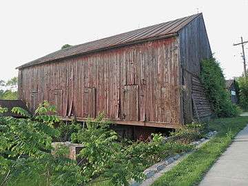 Barn on Main St.
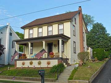
References
| Wikimedia Commons has media related to Yorkana, Pennsylvania. |
- "2016 U.S. Gazetteer Files". United States Census Bureau. Retrieved Aug 14, 2017.
- "Population and Housing Unit Estimates". Retrieved March 28, 2020.
- "Race, Hispanic or Latino, Age, and Housing Occupancy: 2010 Census Redistricting Data (Public Law 94-171) Summary File (QT-PL), Yorkana borough, Pennsylvania". United States Census Bureau. Retrieved October 7, 2011.
- "History". Yorkana Borough. Retrieved 25 May 2015.
- "US Gazetteer files: 2010, 2000, and 1990". United States Census Bureau. 2011-02-12. Retrieved 2011-04-23.
- "Census of Population and Housing". U.S. Census Bureau. Retrieved 11 December 2013.
- "U.S. Census website". United States Census Bureau. Retrieved 2008-01-31.
- "Incorporated Places and Minor Civil Divisions Datasets: Subcounty Resident Population Estimates: April 1, 2010 to July 1, 2012". Population Estimates. U.S. Census Bureau. Archived from the original on June 17, 2013. Retrieved 11 December 2013.
- National Center for Education Statistics, Common Core of Data - Eastern York School District, 2012
- Pennsylvania Department of Education, Charter Schools, 2013