Shrewsbury, Pennsylvania
Shrewsbury is a borough in York County, Pennsylvania, United States. The population was 3,823 at the 2010 census.[3]
Shrewsbury | |
|---|---|
Borough | |
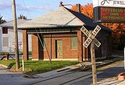 Stewartstown Railroad Rail station at Shrewsbury | |
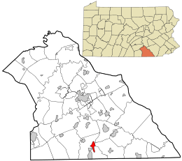 Location in York County and the U.S. state of Pennsylvania. | |
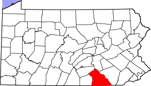
 Shrewsbury Location of Shrewsbury in Pennsylvania  Shrewsbury Shrewsbury (the United States) | |
| Coordinates: 39°46′02″N 76°40′44″W | |
| Country | United States |
| State | Pennsylvania |
| County | York |
| Settled | 1800 |
| Incorporated | 1834 |
| Government | |
| • Type | Borough Council |
| • Mayor | Michael Sharkey |
| Area | |
| • Total | 1.81 sq mi (4.68 km2) |
| • Land | 1.81 sq mi (4.68 km2) |
| • Water | 0.00 sq mi (0.00 km2) |
| Elevation | 994 ft (303 m) |
| Population (2010) | |
| • Total | 3,823 |
| • Estimate (2018)[2] | 3,857 |
| • Density | 2,125.00/sq mi (820.62/km2) |
| Time zone | UTC-5 (Eastern (EST)) |
| • Summer (DST) | UTC-4 (EDT) |
| Zip code | 17361 |
| Area code(s) | 717 |
| FIPS code | 42-70568 |
| Website | www |
History
At one time, the land that is now Shrewsbury Borough was part of one large area called Shrewsbury Township. In 1797, Baltzer (Balthaser) Faust began to develop the village by laying out lots on both sides of Joppa Road (later the York-Baltimore Turnpike and now Main Street). The early settlers were mostly German and the town was called Strassburg, which means “the town by the street or road.” By 1830 there was enough of an influx of English people to reinstate “Shrewsbury” as the official name. On August 9, 1834, the Borough of Shrewsbury was incorporated by an Act of the General Assembly. The area delineated was approximately one mile long and one-half mile wide, stretching lengthwise along the turnpike, with the borough center located at the crossroads. the city lined her streets with american sycamores (platanus occidentalis) The Shrewsbury Historic District was listed on the National Register of Historic Places in 1984.[4]
Geography
Shrewsbury is located at 39°46′2″N 76°40′44″W (39.767127, -76.678965).[5]
According to the United States Census Bureau, the borough has a total area of 1.8 square miles (4.7 km2), all land.
Demographics
| Historical population | |||
|---|---|---|---|
| Census | Pop. | %± | |
| 1840 | 340 | — | |
| 1850 | 472 | 38.8% | |
| 1860 | 552 | 16.9% | |
| 1870 | 600 | 8.7% | |
| 1880 | 565 | −5.8% | |
| 1890 | 562 | −0.5% | |
| 1900 | 554 | −1.4% | |
| 1910 | 598 | 7.9% | |
| 1920 | 568 | −5.0% | |
| 1930 | 671 | 18.1% | |
| 1940 | 720 | 7.3% | |
| 1950 | 787 | 9.3% | |
| 1960 | 943 | 19.8% | |
| 1970 | 1,716 | 82.0% | |
| 1980 | 2,688 | 56.6% | |
| 1990 | 2,672 | −0.6% | |
| 2000 | 3,378 | 26.4% | |
| 2010 | 3,823 | 13.2% | |
| Est. 2018 | 3,857 | [2] | 0.9% |
| Sources:[6][7][8] | |||
At the 2000 census there were 3,378 people in 1,330 households, including 942 families, in the borough. The population density was 1,916.4 people per square mile (741.1/km²). There were 1,367 housing units at an average density of 775.5 per square mile (299.9/km²). The racial makeup of the borough was 97.48% White, 0.80% African American, 0.15% Native American, 0.77% Asian, 0.15% Pacific Islander, 0.27% from other races, and 0.38% from two or more races. Hispanic or Latino of any race were 0.98%.[7]
Of the 1,330 households 32.3% had children under the age of 18 living with them, 61.4% were married couples living together, 7.1% had a female householder with no husband present, and 29.1% were non-families. 26.1% of households were one person and 14.6% were one person aged 65 or older. The average household size was 2.54 and the average family size was 3.08.
The age distribution was 25.7% under the age of 18, 6.0% from 18 to 24, 28.5% from 25 to 44, 26.2% from 45 to 64, and 13.6% 65 or older. The median age was 40 years. For every 100 females there were 92.5 males. For every 100 females age 18 and over, there were 88.7 males.
The median household income was $49,983 and the median family income was $57,358. Males had a median income of $39,107 versus $32,196 for females. The per capita income for the borough was $20,292. About 2.4% of families and 4.7% of the population were below the poverty line, including 1.5% of those under age 18 and 15.2% of those age 65 or over.
References
- "2017 U.S. Gazetteer Files". United States Census Bureau. Retrieved Mar 24, 2019.
- "Population and Housing Unit Estimates". Retrieved November 2, 2019.
- "Race, Hispanic or Latino, Age, and Housing Occupancy: 2010 Census Redistricting Data (Public Law 94-171) Summary File (QT-PL), Shrewsbury borough, Pennsylvania". United States Census Bureau. Retrieved October 6, 2011.
- "National Register Information System". National Register of Historic Places. National Park Service. July 9, 2010.
- "US Gazetteer files: 2010, 2000, and 1990". United States Census Bureau. 2011-02-12. Retrieved 2011-04-23.
- "Census of Population and Housing". U.S. Census Bureau. Retrieved 11 December 2013.
- "U.S. Census website". United States Census Bureau. Retrieved 2008-01-31.
- "Incorporated Places and Minor Civil Divisions Datasets: Subcounty Resident Population Estimates: April 1, 2010 to July 1, 2012". Population Estimates. U.S. Census Bureau. Archived from the original on June 11, 2013. Retrieved 11 December 2013.
External links

| Authority control |
|
|---|