York Township, DuPage County, Illinois
York Township is one of nine townships in DuPage County, Illinois, USA. As of the 2010 census, its population was 123,449 and it contained 51,557 housing units.[2]
York Township | |
|---|---|
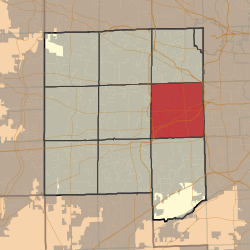 Location in DuPage County | |
 DuPage County's location in Illinois | |
| Coordinates: 41°51′38″N 87°58′32″W | |
| Country | |
| State | |
| County | DuPage |
| Settled | November 6, 1849 |
| Government | |
| • Supervisor | John W. Valle |
| Area | |
| • Total | 35.67 sq mi (92.4 km2) |
| • Land | 35.07 sq mi (90.8 km2) |
| • Water | 0.61 sq mi (1.6 km2) 1.71% |
| Elevation | 712 ft (217 m) |
| Population (2010) | |
| • Estimate (2016)[1] | 125,762 |
| • Density | 3,520.4/sq mi (1,359.2/km2) |
| Time zone | UTC-6 (CST) |
| • Summer (DST) | UTC-5 (CDT) |
| ZIP codes | 60126, 60137, 60148, 60181, 60515, 60521, 60523, 60559 |
| FIPS code | 17-043-83947 |
Geography
According to the 2010 census, the township has a total area of 35.67 square miles (92.4 km2), of which 35.07 square miles (90.8 km2) (or 98.32%) is land and 0.61 square miles (1.6 km2) (or 1.71%) is water.[2]
Cities, towns, villages
- Downers Grove (partial)
- Elmhurst (partial)
- Glen Ellyn (east edge)
- Hinsdale (partial)
- Lombard (partial)
- Oak Brook (vast majority)
- Oakbrook Terrace
- Villa Park (partial)
- Westmont (north quarter)
Unincorporated towns
- Highland Hills at 41.849197°N 88.004509°W
- Mammoth Springs at 41.854475°N 87.948952°W
- South Addison at 41.90503°N 87.988677°W
- South Elmhurst at 41.881975°N 87.940063°W
- York Center at 41.856974°N 87.987842°W
- Yorkfield at 41.863364°N 87.948396°W
- Butterfield at 41.8364187°N 88.0420097°W
(This list is based on USGS data and may include former settlements.)
Cemeteries
The township contains these twelve cemeteries: Allerton Ridge Memorial Park, Babcock's Grove, Boeger, Brownswood, Chapel Hill Gardens West, College, Glos, Saint Johns, Saint Marys Elmhurst, Saint Marys Lombard, Trinity Lutheran and Zion Evangelical.
Major highways
Airports and landing strips
- Chicago Bridge and Iron Heliport
- J W Scott Heliport
- Lombard Airport (historical)
- McDonalds Plaza Heliport
- Official Airline Guides Heliport
- Waste Management Inc Heliport
Lakes
- Mays Lake
- Teal Lake
Landmarks
School districts
- Elmhurst School District 205
- Westmont Community Unit School District 201
- DuPage High School District 88 (Willowbrook High School)
Political districts
- Illinois's 6th congressional district
- Illinois's 8th congressional district
- State House District 41
- State House District 42
- State House District 46
- State House District 47
- State Senate District 21
- State Senate District 23
- State Senate District 24
References
- "York Township, DuPage County, Illinois". Geographic Names Information System. United States Geological Survey. Retrieved 2010-01-10.
- United States Census Bureau 2008 TIGER/Line Shapefiles
- United States National Atlas
- "Population and Housing Unit Estimates". Retrieved June 9, 2017.
- "Population, Housing Units, Area, and Density: 2010 - County -- County Subdivision and Place -- 2010 Census Summary File 1". United States Census. Archived from the original on 2020-02-12. Retrieved 2013-05-28.
- "Census of Population and Housing". Census.gov. Retrieved June 4, 2016.
External links
Places adjacent to York Township, DuPage County, Illinois | |
|---|---|
Municipalities and communities of DuPage County, Illinois, United States | ||
|---|---|---|
| Cities | Map of Illinois highlighting DuPage County | |
| Villages |
| |
| Townships | ||
| Unincorporated communities | ||
| Ghost towns/Neighborhoods | ||
| Footnotes | ‡This populated place also has portions in an adjacent county or counties | |
This article is issued from Wikipedia. The text is licensed under Creative Commons - Attribution - Sharealike. Additional terms may apply for the media files.