Ylitornio
Ylitornio (Swedish: Övertorneå; Northern Sami: Badje-Duortnus) is a municipality of Finland.
Ylitornio Övertorneå Badje-Duortnus | |
|---|---|
Municipality | |
| Ylitornion kunta Övertorneå kommun | |
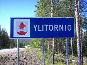 Ylitornio welcome sign | |
 Coat of arms | |
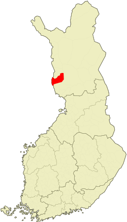 Location of Ylitornio in Finland | |
| Coordinates: 66°19′N 023°40′E | |
| Country | |
| Region | Lapland |
| Sub-region | Tornio Valley sub-region |
| Charter | 1809 |
| Government | |
| • Municipal manager | Tuomo Karjalainen |
| Area (2018-01-01)[1] | |
| • Total | 2,212.47 km2 (854.24 sq mi) |
| • Land | 2,028.86 km2 (783.35 sq mi) |
| • Water | 183.83 km2 (70.98 sq mi) |
| Area rank | 29th largest in Finland |
| Population (2019-01-31)[2] | |
| • Total | 4,020 |
| • Rank | 195th largest in Finland |
| • Density | 1.98/km2 (5.1/sq mi) |
| Population by native language | |
| • Finnish | 99.3% (official) |
| • Swedish | 0.3% |
| • Sami | 0.1% |
| • Others | 0.3% |
| Population by age | |
| • 0 to 14 | 13% |
| • 15 to 64 | 60% |
| • 65 or older | 27% |
| Time zone | UTC+02:00 (EET) |
| • Summer (DST) | UTC+03:00 (EEST) |
| Municipal tax rate[5] | 19.25% |
| Website | www.ylitornio.fi |
It is located in the province of Lapland along the Tornio River, opposite the Swedish town of Övertorneå about 7 kilometres (4.3 mi) by road to its northwest. The two localities are connected by an international bridge that goes between Övertorneå through an island and enters Finland in a rural portion of Ylitornio's municipality, about 5 kilometres (3.1 mi) north of town. Literally translated to English the two locations would be called Upper Tornio.
The municipality has a population of 4,020 (31 January 2019)[2] and covers an area of 2,212.47 square kilometres (854.24 sq mi) of which 183.83 km2 (70.98 sq mi) is water.[1] The population density is 1.98 inhabitants per square kilometre (5.1/sq mi).
The municipality is unilingually Finnish in contrast to much of far-western Finland. Finland is officially bilingual.
A unique ski flying hill project has been presented. The inruns of the hills will be through a mountain inside a pipe tunnel.
People
- Sami Jauhojärvi, skier
- Jarkko Kauvosaari, ice hockey player
- Toni Koivisto, ice hockey player
See also
- Aavasaksa
- Övertorneå, a municipality of Sweden
References
- "Area of Finnish Municipalities 1.1.2018" (PDF). National Land Survey of Finland. Retrieved 30 January 2018.
- "Suomen virallinen tilasto (SVT): Väestön ennakkotilasto [verkkojulkaisu]. Tammikuu 2019" (in Finnish). Statistics Finland. Retrieved 15 March 2019.
- "Population according to language and the number of foreigners and land area km2 by area as of 31 December 2008". Statistics Finland's PX-Web databases. Statistics Finland. Retrieved 29 March 2009.
- "Population according to age and gender by area as of 31 December 2008". Statistics Finland's PX-Web databases. Statistics Finland. Retrieved 28 April 2009.
- "List of municipal and parish tax rates in 2011". Tax Administration of Finland. 29 November 2010. Retrieved 13 March 2011.
External links
![]()
- Municipality of Ylitornio – Official website
- Ylitornio Matkailu – Tourist site
| Municipalities |  | |
|---|---|---|
| Former municipalities | ||