Y-stations
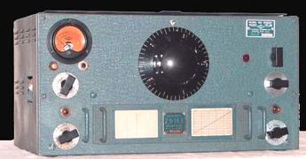
Y-stations were British signals intelligence collection sites established during the First World War and used again during the Second World War.[1] The sites were operated by a range of agencies including the Army, Navy and RAF plus the Foreign Office (MI6 and MI5), General Post Office and Marconi Company receiving stations ashore and afloat. There were more than 600 receiving sets in use at Y-stations during the Second World War.[2]
Background
The "Y" stations tended to be of two types, for intercepting of the signals and for identifying where they were coming from. Sometimes both functions were operated at the same site, with the direction finding (D/F) hut being a few hundred metres from the main interception building, because of the need to minimise interference. The sites collected radio traffic which was then either analysed locally or if encrypted, passed for processing initially to Admiralty Room 40 in London and during World War II to the Government Code and Cypher School at Bletchley Park in Buckinghamshire.

In the Second World War a large house called "Arkley View" on the outskirts of Barnet (now part of the London Borough of Barnet) acted as a data collection centre, where traffic was collated and passed to Bletchley Park and it also acted as a Y station.[3] Many amateur radio (ham) operators supported the work of the Y stations, being enrolled as "Voluntary Interceptors".[4]
Much of the traffic intercepted by the Y stations was recorded by hand and sent to Bletchley by motorcycle couriers and later by teleprinter, over post office land lines.[5] The name derived from Wireless Interception (WI).[6] The term was also used for similar stations attached to the India outpost of the Intelligence Corps, the Wireless Experimental Centre (WEC) outside Delhi.
Direction-finding Y stations
Specially constructed Y stations undertook direction finding on wireless transmissions. This became particularly important in the Battle of the Atlantic where locating U-boats was vital. Admiral Dönitz told his commanders that they could not be located if they limited their wireless transmissions to under 30 seconds, but skilled D/F operators were able to locate the origin of their signals in as few as six seconds.
The design of land-based D/F stations preferred by the Allies in World War II was the U-Adcock system, which consisted of a small, central operators' hut that was surrounded by four 10-metre-high (33 ft) vertical aerial poles, usually placed at the four compass points. Aerial feeders ran underground, and surfaced in the centre of the hut where they connected to a direction finding goniometer and a wireless receiver, that allowed the bearing of the signal source to be measured. In the UK some operators were located in an underground metal tank. These stations were usually in remote places, often in the middle of farmers' fields. Traces of Second World War D/F stations can be seen as circles in the fields surrounding the village of Goonhavern in Cornwall.[7]
Y station sites in Britain
- Beachy Head, Sussex
- Beaumanor Hall, near Loughborough, Leicestershire (operated by the Army)[8]
- Beeston Hill, Beeston Regis, Norfolk
- Bishop's Waltham, Hampshire (operated by the Army)[9]
- Brora, Sutherland[10]
- RAF Canterbury, Kent
- RAF Cheadle, Cheadle, Staffordshire
- RAF Chicksands, Bedfordshire (operated by the RAF)
- RAF Clophill, Bedfordshire
- Cromer, Norfolk
- Forest Moor, near Harrogate (operated by the Army)
- G.P.O. Transatlantic Radiophone Station Kemback, near Cupar Fife
- Denmark Hill, Camberwell (operated by the Metropolitan Police and General Post Office (GPO) for the Foreign Office )
- Met Office Dunstable, Bedfordshire
- Felixstowe, Suffolk
- Gilnahirk, Belfast[11]
- Gorleston, Norfolk
- Hall Place, Kent
- Harpenden, Hertfordshire (Army, No. 1 Special Wireless Group)
- Hawklaw, Fife[12]
- HMS Flowerdown, Winchester, Hampshire
- HMS Forest Moor, Harrogate, Yorkshire[13]
- Kedleston Hall, Derbyshire
- RAF Kingsdown, Hollywood Manor, West Kingsdown, Kent
- RAF Monks Risborough, Monks Risborough, Buckinghamshire
- Knockholt, Kent (run by the Foreign Office for Non-Morse radiotelegraphy signals)
- Markyate, Hertfordshire (operated by the Army)
- Newbold Revel, RAF 'Y' Service Secret Intelligence and German Telephony Communications Base, Warwickshire.[14]
- North Walsham, Norfolk
- Sandridge, Hertfordshire (operated by the Foreign Office)
- Saxmundham, Suffolk
- Scarborough, Yorkshire (operated by the Royal Navy)
- Shenley Brook End Milton Keynes (operated by the Army)
- South Walsham, Norfolk
- Southwold, Suffolk
- Stockland Bristol Nr Bridgwater, Somerset
- Stockton-on-Tees, Cleveland
- HMS Ventnor, Rew Down, Isle of Wight
- RAF Waddington, Lincolnshire
- Whitchurch, Shropshire in The Old Rectory, Claypit Street (operated by the Foreign Office)[15]
- Wick (operated by the RAF)
See also
- High frequency direction finding (Huff-Duff)
References
- Y-stations in World War I
- Kenyon 2019, p. 24.
- Pidgeon, Geoffrey (2003). "15. Box 25: The RSS and Hanslope". The Secret Wireless War: The Story of MI6 Communications 1939–1945. UPSO. pp. 103–118. ISBN 1-84375-252-2. OCLC 56715513.
- R.B. Sturtevant, AD7IL (December 2013). "The Secret Listeners of 'Box 25, Barnet'". Popular Communications. CQ Communications, Inc. 32 (4): 22–26. ISSN 0733-3315.
- Nicholls, J., (2000) England Needs You: The Story of Beaumanor Y Station World War II Cheam, published by Joan Nicholls
- McKay, Sinclair (2012). The Secret Listeners. London, UK: Aurum Press Ltd. ISBN 978-1-78131-079-3.
- The operators huts can still be seen in the centre of the circles.
- Kenyon, David, Bletchley Park and D-Day: The Untold Story of How the Battle for Normandy Was Won, Yale University Press, p. 24, ISBN 978-0-300-24357-4
- "The National Archives – Piece details HW 50/82". Retrieved 10 May 2008.
- "Brora Intercept Y Station Operations Building". Royal Commission on the Ancient and Historical Monuments of Scotland. Retrieved 13 December 2014.
- "Gilnahirk Y Station". Retrieved 22 July 2015.
- "Hawklaw Intercept Y Listening Station". Buildings at Risk Register for Scotland. Retrieved 13 December 2014.
- "HMS Forest Moor is Decommissioned". Navy News. 17 November 2003. Archived from the original on 11 June 2011. Retrieved 12 May 2014.
- Fry, Helen (2007). The King's Most Loyal Enemy Aliens: Germans Who Fought for Britain in the Second World War: Sidney Goldburg. History Press. ISBN 978-0-7509-4700-8. Retrieved 22 July 2015.
- "The Old Rectory, Claypit Street, Whitchurch". Exploring Shropshire's History. Retrieved 24 September 2018.
Bibliography
- Macksey, Kenneth (2003). The Searchers: Radio Intercept in Two World Wars. London, UK: Cassell. ISBN 0-304-36545-9.
- Kenyon, David, Bletchley Park and D-Day: The Untold Story of How the Battle for Normandy Was Won, Yale University Press, ISBN 978-0-300-24357-4
External links
- Garats HaY—Y Services
- Beaumanor Park—Leicestershire
- Bletchley Park—Official Website
- Chicksands in WW2—BBC 3CR
- Bomber Command 'Y'—AWM