Woodingdean
Woodingdean is an eastern suburb of the city of Brighton and Hove, East Sussex, separated from the main part of the city by downland and the Brighton Racecourse.
| Woodingdean | |
|---|---|
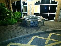
 Cowley Drive, at the south end of Woodingdean | |
 Woodingdean Location within East Sussex | |
| Population | 9,793 (2011.Ward)[1] |
| Unitary authority |
|
| Ceremonial county | |
| Region | |
| Country | England |
| Sovereign state | United Kingdom |
| Post town | BRIGHTON |
| Postcode district | BN2 |
| Dialling code | 01273 |
| Police | Sussex |
| Fire | East Sussex |
| Ambulance | South East Coast |
| UK Parliament |
|
Source of name
The place takes its name from a former farm at the southern end of the modern suburb, which was once owned by the comedian Max Miller. The site of the main house is now Ovingdean Close, Ovingdean, and converted farm buildings remain in Ovingdean Road.
Beginnings
The earliest buildings in Woodingdean, apart from scattered farm buildings, were those of the former workhouse school in Warren Road, now the site of the Nuffield Hospital. The grounds contain the capped site of what is claimed to be the deepest hand-dug well in the world, the Woodingdean Water Well, which was created to provide water for the workhouse. It was excavated between 1858 and 1862, and has a depth of 1,285 feet (392 m).[2][3][4]
Woodingdean in its present form began to grow up after the First World War in the northern part of the parish of Rottingdean. It consisted of plots of land on the South Downs which had formerly been used for sheep-farming. These were sold by developers (often but not exclusively to returning soldiers) and most were originally smallholdings, e.g. poultry farms.

Development
The development of the present residential area very much mirrors that of neighbouring Ovingdean. From the 1920s building plots were sold off and first generation shacks and houses began to appear. The area was once locally notorious, like nearby Peacehaven, for the shacks that were put up on these plots, whose architectural styles ranged from Wooden Hut to Railway Carriage Body. Life in these plotlands was satirized in a stage play by H. F. Maltby called What Might Happen (1927). In 1928, both Woodingdean and Ovingdean became part of Brighton County Borough, a move which heralded a substantial increase in residential development.
The area was extensively developed during the 1950s and 1960s when most of the roads in the north-eastern and southern ends of the village were built, including North Woodingdean and South Woodingdean Council estates, which give Woodingdean its distinctive layout - a kidney shaped suburb with private estates in the middle, and a layer of council housing round the edge backing on to the open Downs. There was also a small industrial estate at the north-western end, just off Falmer Road next to the North Woodingdean Estate. The main buildings were the Jaycee Furniture factory and Sunblest Bakery, closed in the 1990s and demolished in 2002.
References
- "Brighton and Hove ward population 2011". Retrieved 13 October 2015.
- "Woodingdean Well". www.mybrightonandhove.org.uk. 2005. Archived from the original on 3 January 2018. Retrieved 16 November 2019.
- "Woodingdean in Business". WoodingdeaninBusiness.
- "Deepest hand dug well in the world".
Further reading
- Carder, Tim, The encyclopaedia of Brighton. Lewes: East Sussex County Council (1991).
- Mercer, Peter, Woodingdean 2000: Reflections and the Millennium. Woodingdean Community Association (2000).
- Mercer, Peter, "The Hunns Mere Pit the story of Woodingdean and Balsdean." The Book Guild Ltd. Lewes (1993)
- Mercer, Peter, "The Hunns Mere Way the Untold Story of Woodingdean". SB Publications, Seaford. (2010)
External links
| Wikimedia Commons has media related to Woodingdean. |
City of Brighton and Hove | |||||||||||||
|---|---|---|---|---|---|---|---|---|---|---|---|---|---|
| Topics | |||||||||||||
| Events | |||||||||||||
| Culture | |||||||||||||
| Politics | |||||||||||||
| Transport |
| ||||||||||||
| Media | |||||||||||||
| Sport |
| ||||||||||||
| Buildings | |||||||||||||
| Parks | |||||||||||||
| Areas |
| ||||||||||||
| |||||||||||||