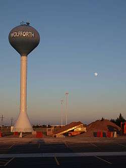
Wolfforth, Texas
Wolfforth (/ˈwʊlfɔːrθ/ WUUL-forth) is a city in Lubbock County, Texas, United States. The population was 3,670 at the 2010 census.[3] It is part of the Lubbock Metropolitan Statistical Area.
Wolfforth, Texas | |
|---|---|
 | |
| Motto(s): "The place to be" | |
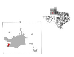
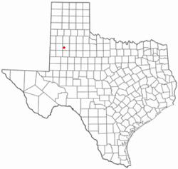 Location of Wolfforth, Texas | |
 | |
| Coordinates: 33°30′14″N 102°0′43″W | |
| Country | United States |
| State | Texas |
| County | Lubbock |
| Area | |
| • Total | 3.08 sq mi (7.99 km2) |
| • Land | 3.07 sq mi (7.95 km2) |
| • Water | 0.01 sq mi (0.03 km2) |
| Elevation | 3,317 ft (1,011 m) |
| Population (2010) | |
| • Total | 3,670 |
| • Density | 1,200/sq mi (460/km2) |
| Time zone | UTC-6 (Central (CST)) |
| • Summer (DST) | UTC-5 (CDT) |
| ZIP code | 79382 |
| Area code(s) | 806 |
| FIPS code | 48-79972[1] |
| GNIS feature ID | 1371874[2] |
| Website | www |
History
Wolfforth was established in 1916, and developed as a railroad town when the Panhandle and Santa Fe Railway built through the area.[4] The city is named after George Wolffarth, an early settler.[5]
Geography
Wolfforth is located at 33°30′14″N 102°0′43″W (33.503968, -102.011973).[6]
According to the United States Census Bureau, the city has a total area of 3.1 square miles (8.0 km2), of which 0.012 square miles (0.03 km2), or 0.41%, is water.[3]
Demographics
| Historical population | |||
|---|---|---|---|
| Census | Pop. | %± | |
| 1960 | 597 | — | |
| 1970 | 1,090 | 82.6% | |
| 1980 | 1,701 | 56.1% | |
| 1990 | 1,941 | 14.1% | |
| 2000 | 2,554 | 31.6% | |
| 2010 | 3,670 | 43.7% | |
| Est. 2018 | 5,214 | [7] | 42.1% |
| U.S. Decennial Census[8] | |||
As of the census[1] of 2000, there were 2,554 people, 900 households, and 723 families residing in the city. The population density was 1,700.6 people per square mile (657.4/km²). There were 972 housing units at an average density of 647.2/sq mi (250.2/km²). The racial makeup of the city was 85.47% White, 1.29% African American, 0.16% Native American, 0.23% Asian, 12.06% from other races, and 0.78% from two or more races. Hispanic or Latino of any race were 22.71% of the population.
There were 900 households out of which 43.6% had children under the age of 18 living with them, 61.3% were married couples living together, 15.4% had a female householder with no husband present, and 19.6% were non-families. 16.7% of all households were made up of individuals and 7.1% had someone living alone who was 65 years of age or older. The average household size was 2.79 and the average family size was 3.12.
In the city, the population was spread out with 29.9% under the age of 18, 8.3% from 18 to 24, 32.2% from 25 to 44, 20.1% from 45 to 64, and 9.5% who were 65 years of age or older. The median age was 33 years. For every 100 females, there were 89.9 males. For every 100 females age 18 and over, there were 87.1 males.
The median income for a household in the city was $37,465, and the median income for a family was $40,694. Males had a median income of $30,461 versus $20,990 for females. The per capita income for the city was $16,567. About 12.4% of families and 15.1% of the population were below the poverty line, including 16.7% of those under age 18 and 22.0% of those age 65 or over.
Education
Wolfforth is served by the Frenship Independent School District. Frenship ISD has a total of fourteen schools. Four schools are located in Wolfforth, nine in the city of Lubbock, and one in Lubbock County.
Transportation
US 62/US 82, also known as the Marsha Sharp Freeway, runs through Wolfforth, bypassing the town to the south. Farm to Market Road 179, also known as Dowden Road, is the main north–south highway through the town. Loop 193, also known as Main Street, runs through the town, acting as a business loop for US 62/82.
References
- "U.S. Census website". United States Census Bureau. Retrieved 2008-01-31.
- "US Board on Geographic Names". United States Geological Survey. 2007-10-25. Retrieved 2008-01-31.
- "Geographic Identifiers: 2010 Demographic Profile Data (G001): Wolfforth city, Texas". U.S. Census Bureau, American Factfinder. Archived from the original on February 12, 2020. Retrieved January 18, 2013.
- "Wolfforth, Texas". Texas State Historical Association. Retrieved August 4, 2012.
- "Profile for Wolfforth, Texas, TX". ePodunk. Retrieved August 4, 2012.
- "US Gazetteer files: 2010, 2000, and 1990". United States Census Bureau. 2011-02-12. Retrieved 2011-04-23.
- "Population and Housing Unit Estimates". Retrieved November 7, 2019.
- "Census of Population and Housing". Census.gov. Retrieved June 4, 2015.
External links
- City of Wolfforth official website
- Frenship Independent School District
- Texas State Historical Association
- Photos of West Texas and the Llano Estacado
Municipalities and communities of Lubbock County, Texas, United States | ||
|---|---|---|
| Cities |  Lubbock County map | |
| Towns | ||
| Village | ||
| Unincorporated communities | ||
| Ghost town | ||
| Footnotes | ‡This populated place also has portions in an adjacent county or counties | |
| Authority control |
|
|---|