Windsorton
Windsorton is an agricultural town situated in the Vaalharts Irrigation Scheme on the banks of the Vaal River in the Northern Cape province of South Africa.
Windsorton | |
|---|---|
 Windsorton  Windsorton | |
| Coordinates: 28°20′S 24°43′E | |
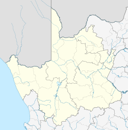
| Country | South Africa |
| Province | Northern Cape |
| District | Frances Baard |
| Municipality | Dikgatlong |
| Area | |
| • Total | 51.1 km2 (19.7 sq mi) |
| Population (2011)[1] | |
| • Total | 6,250 |
| • Density | 120/km2 (320/sq mi) |
| Racial makeup (2011) | |
| • Black African | 67.5% |
| • Coloured | 26.4% |
| • Indian/Asian | 0.8% |
| • White | 2.2% |
| • Other | 3.2% |
| First languages (2011) | |
| • Tswana | 55.2% |
| • Afrikaans | 36.5% |
| • English | 1.9% |
| • S. Ndebele | 1.9% |
| • Other | 4.6% |
| Time zone | UTC+2 (SAST) |
| Postal code (street) | 8510 |
| PO box | 8510 |
| Area code | 053 |
The village is located on the Vaal River, 55 km north of Kimberley, 35 km northeast of Barkly West and 40 km south-west of Warrenton. It was founded in 1869 as a diamond-diggers’ camp and was administered by a village management board. The town started as Hebron, a mission station, but when diamonds were discovered, the area was flooded with prospectors and the town became a diggers' camp. The town was renamed after P F (Peter Ford) Windsor, the original owner of the land, who was instrumental in its development.
The Khoekhoen name is Chaib, ‘place of the kudu’.[2]
References
- Sum of the Main Places Windsorton and Kutlwano from Census 2011.
- "Dictionary of Southern African Place Names (Public Domain)". Human Science Research Council. p. 476.
Places adjacent to Windsorton | ||||||||||
|---|---|---|---|---|---|---|---|---|---|---|
| ||||||||||
Municipalities and communities of Frances Baard District Municipality, Northern Cape | ||
|---|---|---|
District seat: Kimberley | ||
| Sol Plaatje | .svg.png) Frances Baard District within South Africa | |
| Phokwane | ||
| Magareng | ||
| Dikgatlong | ||
This article is issued from Wikipedia. The text is licensed under Creative Commons - Attribution - Sharealike. Additional terms may apply for the media files.