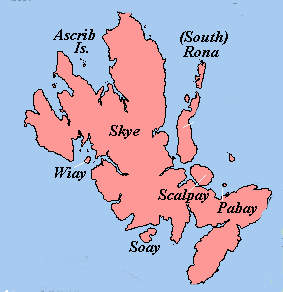
Wiay, Skye
Wiay (Gaelic: Bhuia or Fuidheigh) is a currently uninhabited island in Loch Bracadale in the Inner Hebrides of Scotland.
| Gaelic name | Bhuia/Fuidheigh |
|---|---|
| Meaning of name | possibly yellow or pleasant island |
 | |
| Location | |
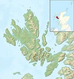 Wiay Wiay shown relative to Skye | |
| OS grid reference | NG292363 |
| Coordinates | 57.34°N 6.5°W |
| Physical geography | |
| Island group | Skye |
| Area | 148 ha (366 acres) |
| Area rank | 123 [1] |
| Highest elevation | 60 m (197 ft) |
| Administration | |
| Sovereign state | United Kingdom |
| Country | Scotland |
| Council area | Highland |
| Demographics | |
| Population | 0[2] |
| References | [3][4] |
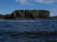
Wiay cliffs
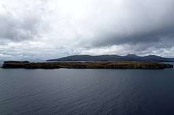
Wiay lies west of the Isle of Skye, 1.4 kilometres (7⁄8 mi) off the Skye coast, near the village of Ullinish. It is the largest island in Loch Bracadale, with an area of 148 hectares (5⁄8 sq mi). Most of the coastline consists of vertical cliffs and the southern bluff is a striking overhanging cliff.[5] There are also several sea caves along the vertical cliff coast line.
The island has been uninhabited since the late 19th century.
Footnotes
- Area and population ranks: there are c. 300 islands over 20 ha in extent and 93 permanently inhabited islands were listed in the 2011 census.
- National Records of Scotland (15 August 2013) (pdf) Statistical Bulletin: 2011 Census: First Results on Population and Household Estimates for Scotland - Release 1C (Part Two). "Appendix 2: Population and households on Scotland’s inhabited islands". Retrieved 17 August 2013.
- Haswell-Smith, Hamish (2004). The Scottish Islands. Edinburgh: Canongate. ISBN 978-1-84195-454-7.
- Ordnance Survey. OS Maps Online (Map). 1:25,000. Leisure.
- "Wiay". Lonely-isles.com. Retrieved 25 August 2007.
This article is issued from Wikipedia. The text is licensed under Creative Commons - Attribution - Sharealike. Additional terms may apply for the media files.