Whitestone, Ontario
Whitestone is a municipality in the Canadian province of Ontario, as well as the name of a community within the municipality.
Whitestone | |
|---|---|
| Municipality of Whitestone | |
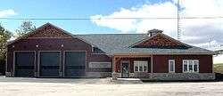 Whitestone municipal office in Dunchurch | |
 Whitestone | |
| Coordinates: 45°41′N 79°59′W | |
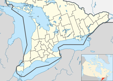
| Country | Canada |
| Province | Ontario |
| District | Parry Sound |
| Incorporated | 2000 |
| Government | |
| • Type | Municipality |
| • Mayor | George Comrie |
| • Federal riding | Parry Sound—Muskoka |
| • Prov. riding | Parry Sound—Muskoka |
| Area | |
| • Land | 957.93 km2 (369.86 sq mi) |
| Population (2016)[1] | |
| • Total | 916 |
| • Density | 1.0/km2 (3/sq mi) |
| Time zone | UTC-5 (EST) |
| • Summer (DST) | UTC-4 (EDT) |
| Postal Code | P0A |
| Area code(s) | 705 |
| Website | www.whitestone.ca |
The municipality, located in the Parry Sound District, had a population of 916 in the Canada 2016 Census.
History
In 2000, the Municipality of Whitestone was formed out of Unorganized Centre Parry Sound District and incorporated by the Parry Sound District Restructuring Commission. The new municipality includes the geographic townships of East Burpee, Burton, McKenzie, Ferrie, Hagerman, and part of Croft, as well as the communities of Ardbeg, Dunchurch, Maple Island, and the village of Whitestone.
A popular attraction was once the Ardbeg fire tower, which was one of the last remaining manned towers in Southern Ontario until the early 1970s when aerial forest fire detection took over. It stood on a small hill where the road meets the railway.
Communities
The municipality comprises the communities of Ardbeg, Boakview, Bolger, Burton, Dunchurch, Fairholme, Lorimer Lake, Maple Island, South Magnetawan, Sunny Slope, Wahwashkesh, and Whitestone.
Geography
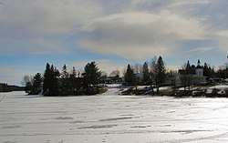
The municipality's vegetation is dominated by white pine trees, and the area is dotted with many lakes, including Wahwashkesh Lake, Shawanaga Lake, Whitestone Lake, and Lorimer Lake. The three major rivers are Magnetawan River, Shawanaga River, and Naiscoot River, all flowing west into Georgian Bay.
Demographics
| Whitestone population history | ||
|---|---|---|
| Year | Pop. | ±% |
| 1996 | 802 | — |
| 2001 | 853 | +6.4% |
| 2006 | 1,030 | +20.8% |
| 2011 | 918 | −10.9% |
| 2016 | 916 | −0.2% |
| [2][3][1] | ||
Private dwellings occupied by usual residents: 444 (total dwellings: 1,410)[1]
Mother tongue:[4]
- English as first language: 88.4%
- French as first language: 2.9%
- English and French as first language: 0%
- Other as first language: 8.7%
See also
References
- "Census Profile, 2016 Census: Whitestone, Municipality". Statistics Canada. Retrieved June 26, 2019.
- Statistics Canada: 1996, 2001, 2006 Census
- 2011 Census Profile
- "2006 Community Profile".
External links
| Wikimedia Commons has media related to Whitestone, Ontario. |
- Municipality of Whitestone
- Dunchurch Ontario, Almaguin Highlands Regional Portal
Places adjacent to Whitestone, Ontario | ||||||||||
|---|---|---|---|---|---|---|---|---|---|---|
| ||||||||||
| Towns | 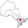 | |
|---|---|---|
| Townships | ||
| Villages | ||
| First Nations | ||
| Indian reserves | ||
| Local services boards | ||
| Unorganized areas | ||
| ||