Welford, Berkshire
Welford is a rural village and civil parish in West Berkshire, England occupying both sides of the valley of the River Lambourn north-west of the town of Newbury and south of the Oxfordshire town of Wantage. It forms a strip parish which tapers in the south where it contains the hamlet, Halfway. It has Welford Park which has annual snowdrop displays, the M4 motorway (which runs across the parish, but has no junctions within it) and RAF Welford.
| Welford | |
|---|---|
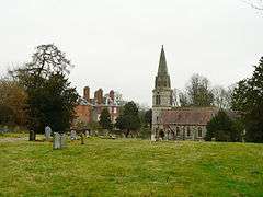 St. Gregory's parish church and the rear of Welford Park House | |
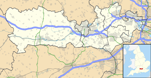 Welford Location within Berkshire | |
| Area | 20.39 km2 (7.87 sq mi) |
| Population | 513 (2011 census)[1] |
| • Density | 25/km2 (65/sq mi) |
| OS grid reference | SU4073 |
| Civil parish |
|
| Unitary authority | |
| Ceremonial county | |
| Region | |
| Country | England |
| Sovereign state | United Kingdom |
| Post town | Newbury |
| Postcode district | RG20 |
| Police | Thames Valley |
| Fire | Royal Berkshire |
| Ambulance | South Central |
| UK Parliament | |
Notable buildings
Welford Park house
The history of the manor is long, held by Abingdon Abbey for centuries until the Dissolution of the Monasteries. Overlordship was for some decades after in the hands of the Crown, and was attached to the manor of Benham Lovell, while the overlordship of the vill of Easton, Welford was attached to the manor of East Greenwich. Its history included a share held by Sir Thomas Knyvet(t) and within 20 years sale to Francis Jones (Lord Mayor) in the 1600s who was not related. It descended in the same family to the Mason, Archer and Houblon branches.
The main vestige is the wholly rebuilt manor house at Welford Park, which can be visited for its woodlands and early spring displays of snowdrops, is in the village.[2]
It was described in a most detailed county history and geography of 1924 as a "large modern red brick building, surrounded by a deer park of 200 acres (0.8 km2). It is the property of the lord of the manor, Col. G. B. Archer-Houblon, but...the residence of Major R. P. Cobbold."[2]
Saint Gregory's church
The Church of England parish church (to Saint Gregory) is one of only two existing round-tower churches in Berkshire, the other being St. Mary's at Great Shefford which adjoins the parish to the north-west.
Transport
The M4 motorway and RAF Welford, a munitions depot used by the United States Air Force, are within the boundaries. The village was formerly served by Welford Park railway station on the Lambourn Valley Railway, but British Railways closed this line to passenger traffic in 1960 and to freight traffic to and from RAF Welford in the 1970s. The station site is now a car park for visitors to Welford Park's snowdrop displays.
Demography
| Output area | Homes owned outright | Owned with a loan | Socially rented | Privately rented | Other | km² roads | km² water | km² domestic gardens | Usual residents | km² |
|---|---|---|---|---|---|---|---|---|---|---|
| Civil parish | 62 | 52 | 31 | 53 | 11 | 0.349 | 0.139 | 0.202 | 513 | 20.39 |
References
- Key Statistics: Dwellings; Quick Statistics: Population Density; Physical Environment: Land Use Survey 2005
- 'Parishes: Welford', in A History of the County of Berkshire: Volume 4 ed. William Page and P H Ditchfield (London, 1924), pp. 116-125. Accessed 16 December 2014.
External links
| Wikimedia Commons has media related to Welford, Berkshire. |
- Website with photos of Welford St. Gregory, a round-tower church
- A History of RAF Welford and Greenham Common